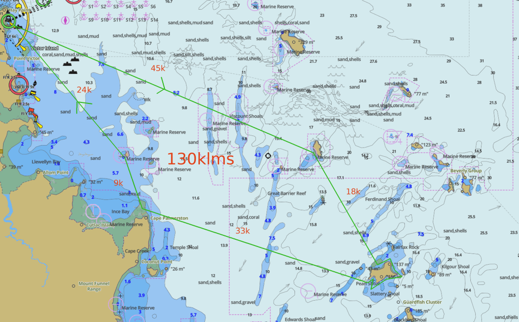
Route below is a general Idea with rough enough distances. The 130klms is the distance between islands does not allow for exploring but would think 20k added would cover ?
Hay pt ramp should be good for launching plenty of water.

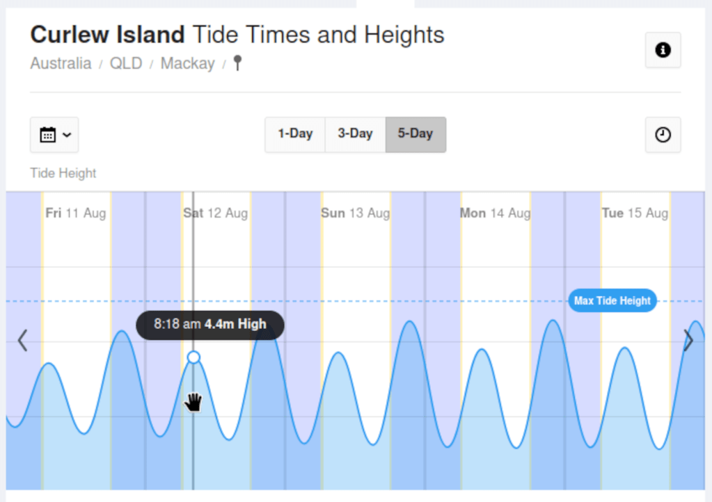
Rising water for a couple of hours high at 818 on Curlew. Not sure it matters to much which direction we do the circuit clock wise or anti clock ? Would it be better to visit Cape Palmerston on rising water ? Curlew looks to have a couple of accessible bays on any tide regardless we should be there before the to top of tide 8.18.
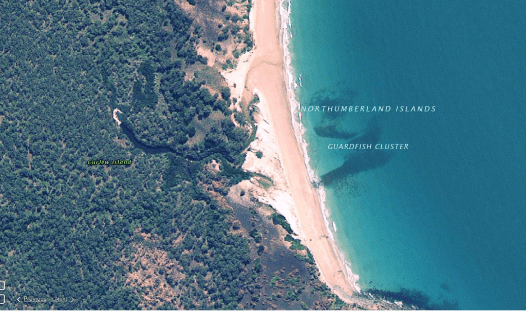
I have spotted a couple of points of interest especially the water way on that eastern side
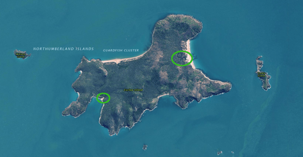
Descent waterway by the look
This may be worth a look ?https://qldglobe.information.qld.gov.au/

Should conditions be great we could check out the other Islands in this Guardfish Cluster. There is a possible cave ?
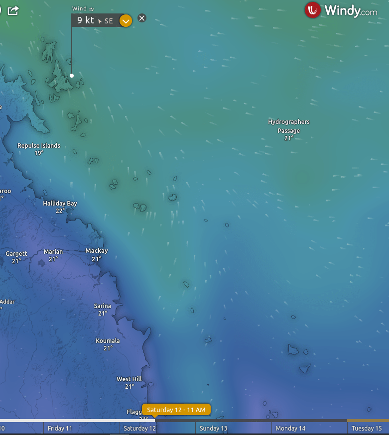
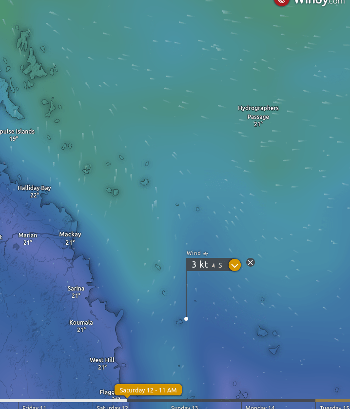
UPDATED Wednesday 9th
Below the 2 images taken Wednesday 9th is my reasoning of Sth on Saturday
Below is reasoning for Nth on Sunday taken Wednesday 9th.
Both days are good south and probably marginally better overall (7am – 1pm) south on the Sunday than Saturday. Not certain its worth considering just highlighting it.

Monday is shaping up to be the ducks nuts.
UPDATE Friday 11th
Base Plan Hay Pt boat ramp 630am Duane and friend, Morne, (Sondra ? ) and me. Probably head down coast to Irving Islet 25k then about Cape Palmerston 9k cut across to Curlew Island 32k. Give Curlew a bit of explore (maybe have some sort of foot ware). Run home north to Waratah Island 18k, Knight Island 15k Hay Pt 38k . That totals 137k allow 15k run around is 152K. This is basically that run route at the top of page. NOTE a couple of small errors in that map the distance between Curlew – Knight is NOT 18k closer to 33k and distance Knight – Hay Pt is NOT 45k it is 38k. Plus Waratah deviation is not marked on that map. See you in the morning. The above distances aren’t spot on.
