Interpret Weather Forecast
This is what I use and only my interpretation only. NOTE I am NOT meteorologist. Mainly for beginners and sharing of tools and my understanding or employ of them.
In my opinion most weather apps are crap. They all calculate from the BOM but they are convenient and widely used. The wind speed at Mackay Harbour is not necessarily the same 15-20klms offshore.
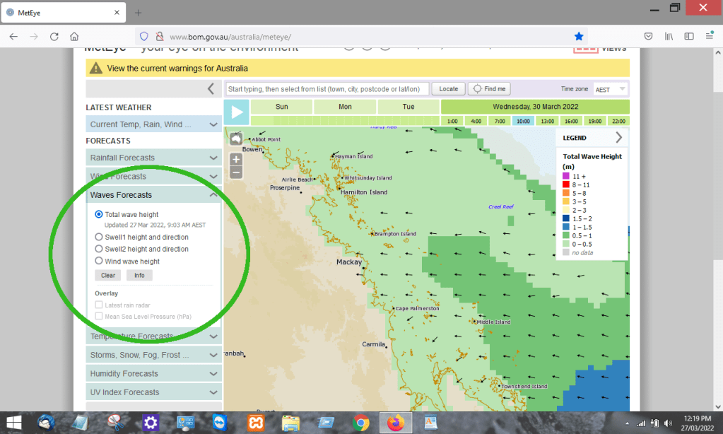
https://www.bom.gov.au/australia/meteye

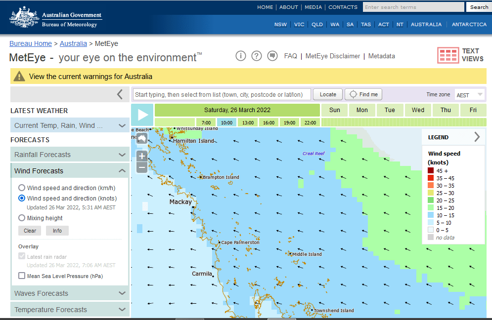
Day and times in 3 hour blocks. Legend of wind speed. Types of Forecast. Wind is chosen. The arrows = wind direction. You will need to zoom and drag to the intended area.
Scenario, I want to do run out to Brampton Island NE off Mackay. Looking for the right forecast.
First factor is WIND speed. Under 10 knots should be OK But if it has been blowing dogs off chains in previous days don’t expect the sea to settle immediately. Generally I would normally allow 24hrs of softer winds. I will click on each day at 10.00 and go through hoping to find light winds.
This first example Saturday is a NO go, 10-15knots surrounding the Brampton Island area and worse 15-20knots further out in the same direction wind is coming from. ( Search Wind Fetch)
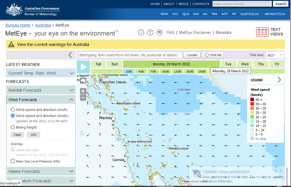
Sunday much like Saturday

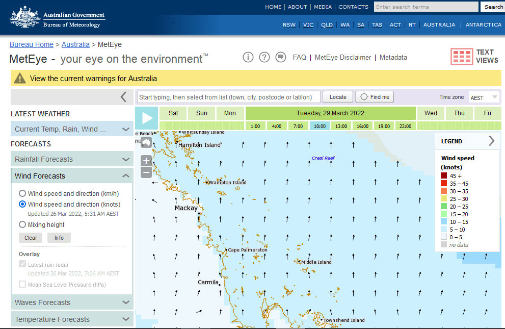
Monday starting to look up but later in the morning it was up 10-15knots again.
Tuesday now were looking promising. Now I have good look around at each 3 hr block forwards and backwards. I find 10-15knots closing in around mid morning doable at pinch unsure ?
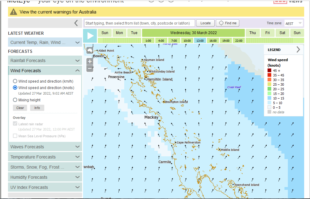
Wednesday deserves a closer look at this point and now happy with the wind forecast.
2ND Factor have a look at is Wave forecast under a meter good enough.
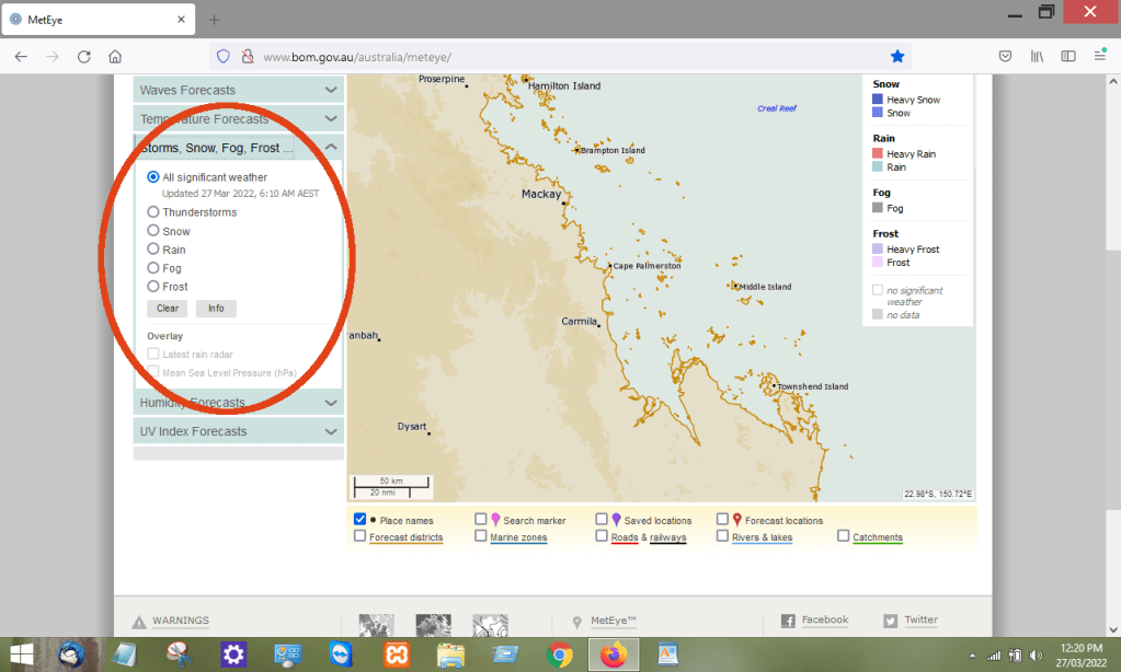
3RD Factor Storm and Fog Forecast looking for Storms in the summer and Fog more so in winter both best avoided. Fog without GPS is scary. All clear in this forecast.
I reckon Wednesday is a goer at this stage based on this information.
Tide Factor: Wednesday 947am 6.03M. Some might argue this is a high factor and I would not argue. This element is considerable. Wind against tide will make waves stand up steep. The larger the tide the faster the current. Faster the wind against a current the steeper the stand. So staying in wind under 10knots should keep you in good stead for avoiding.
More importantly knowing the tide times is very essential when exploring in Bays and Creeks. Avoid these areas on a outgoing tide or specially aware of whats going on around you. Might find your exit has dried up and you will be sitting there until the higher water returns that probably will be at night. It is much more comfy to know the water under you is only going to rise rather than fall. 947am isn’t perfect but doable will, want be in too shallow a water after that time.
Wind Direction: Apart from the Wind Against Tide it is a lot more comfortable to ride with the wind than against. Should you decide to push past the 10knots you might want to consider if direction is in favor. Wind Fetch basically is the further wind blows over water in consistent direction the lager the wave. The values or formula i have no idea. To say a westerly at 5knots blowing off the land will have a small wave at 10klms compared to 50klms off the land.
Wave Monitoring Mackay: Has a bouy at Bailey Islet 35klms east of Harbour and worth checking before you head out. https://www.qld.gov.au/environment/coasts-waterways/beach/monitoring/waves-sites/mackay
Hay Point: https://www.qld.gov.au/environment/coasts-waterways/beach/monitoring/waves-sites/hay-point
Weather Stations in Mackay region for marine are sparse. Consist of the Harbour, Hay Point, Percy Island, Creal Reef and Hamilton Island. Observations are taken at these points Measurements are recorded as they happen so not much use in forecasting. You may want to try and decipher what you had experienced. http://www.bom.gov.au/qld/observations/qldall.shtml
There will be a lot I have missed but its a start, please reinforce this with your own research. Any corrections are welcome.
