Whitehaven / Edward Group

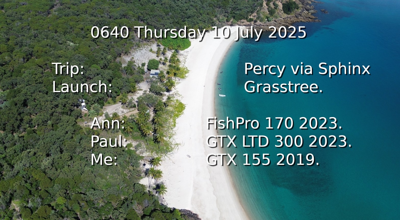
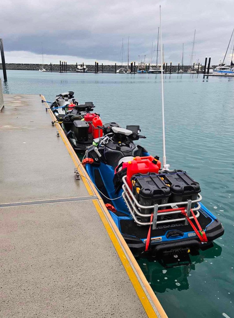
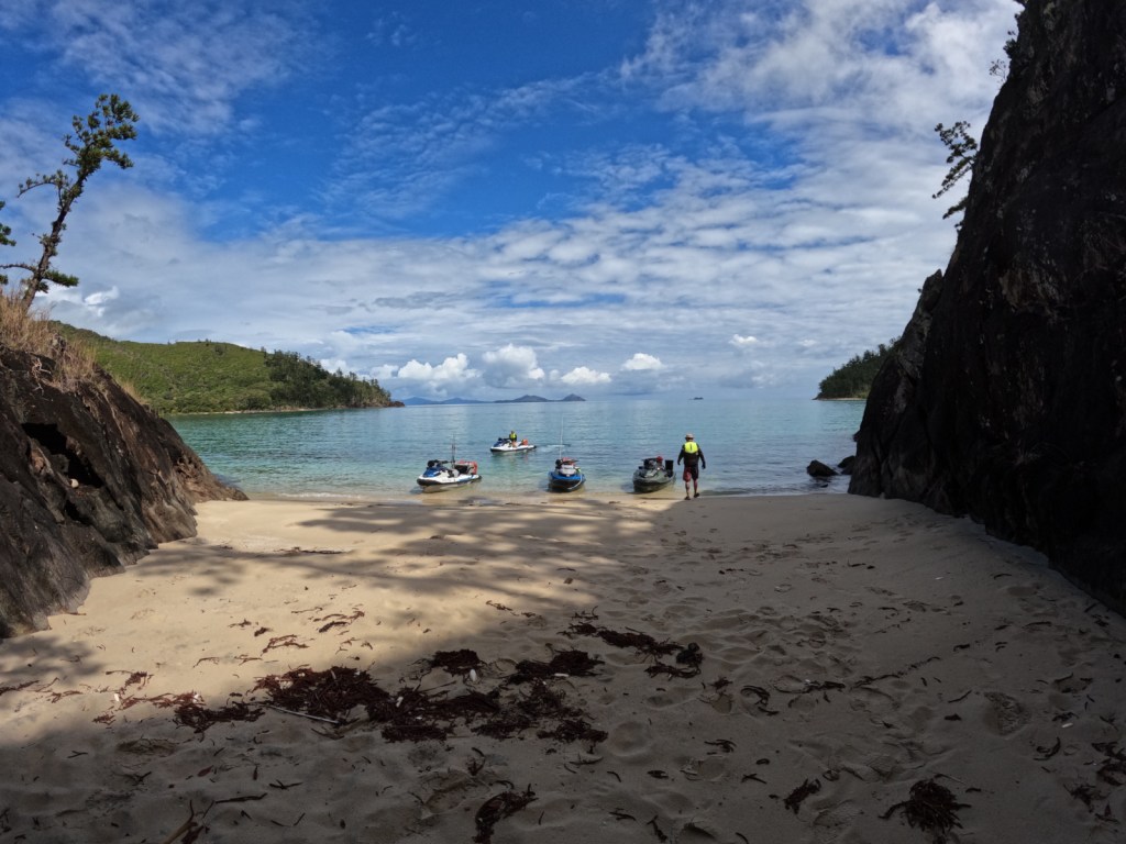
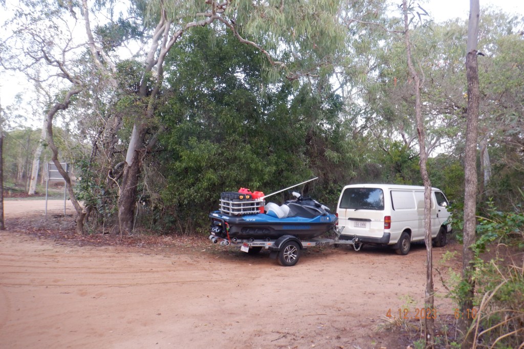
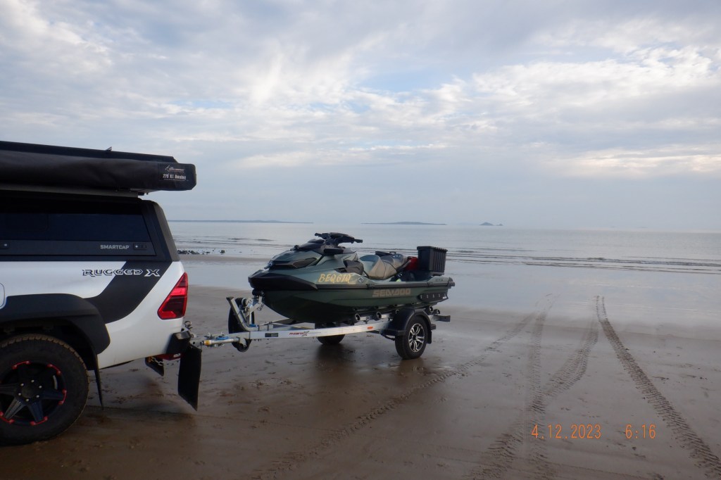
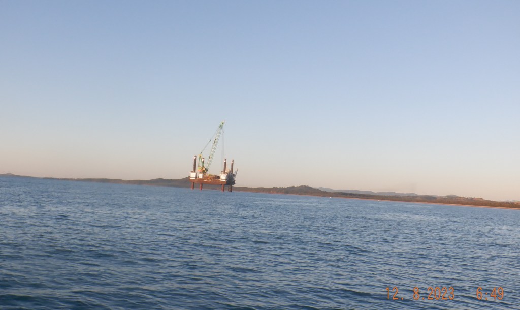
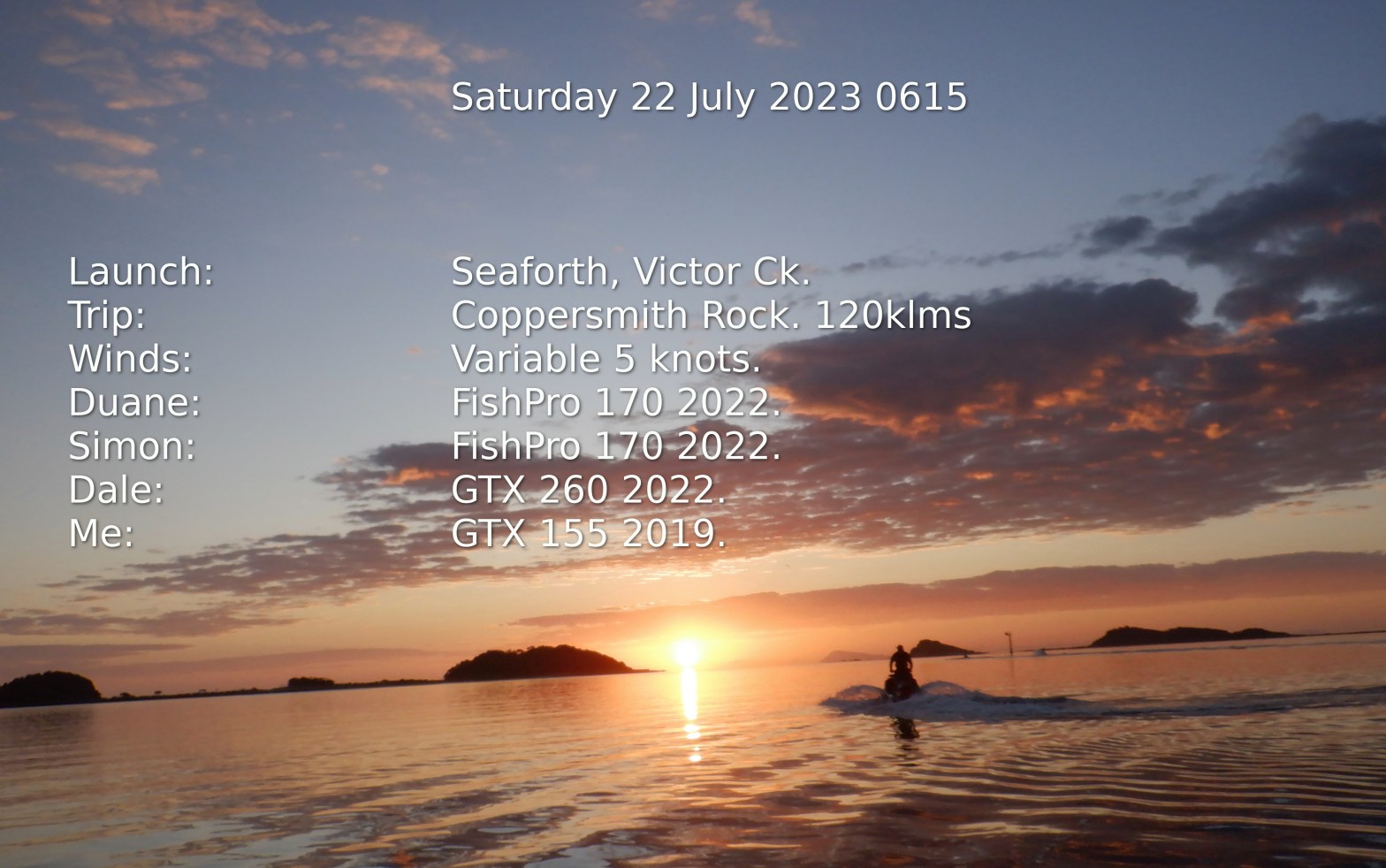
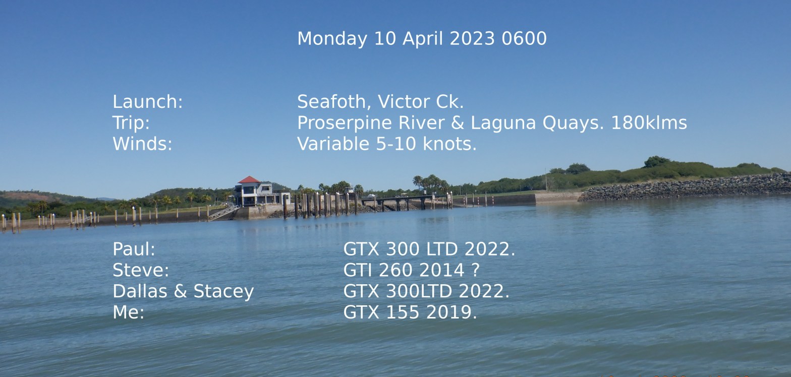
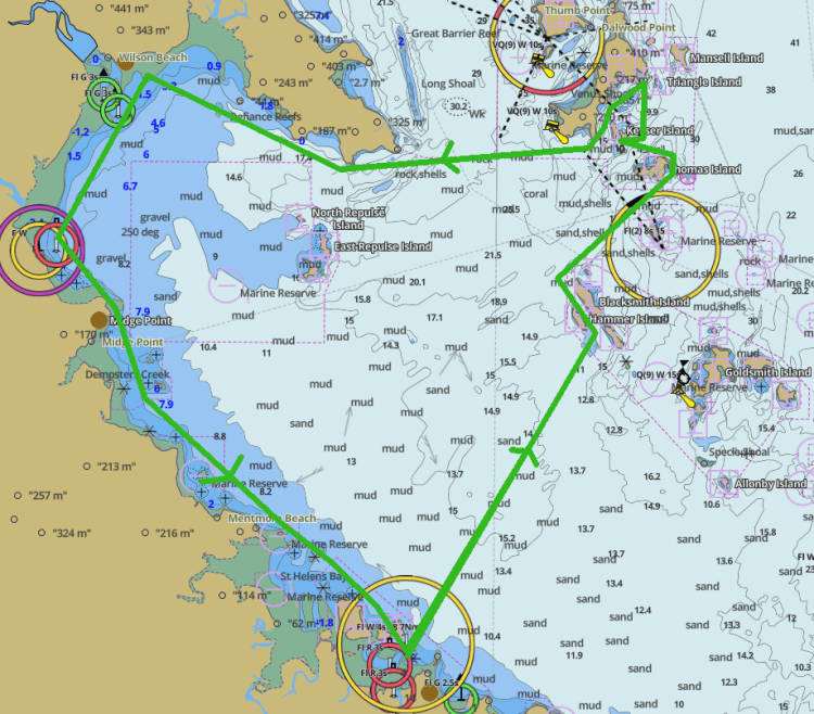
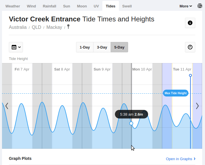
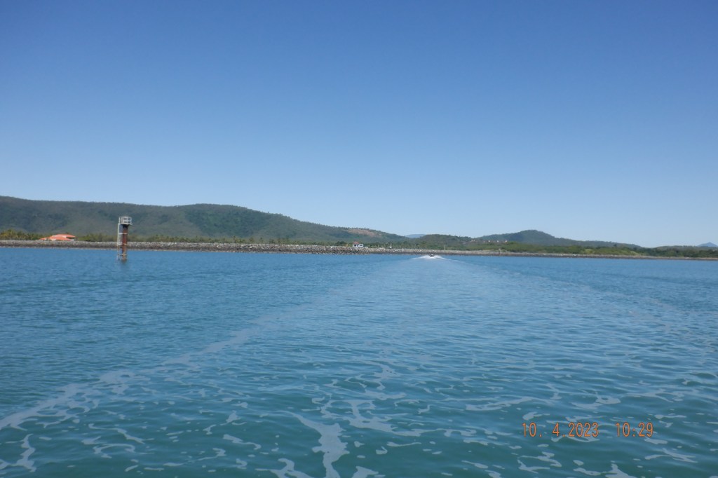
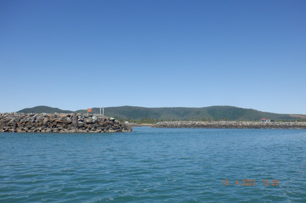
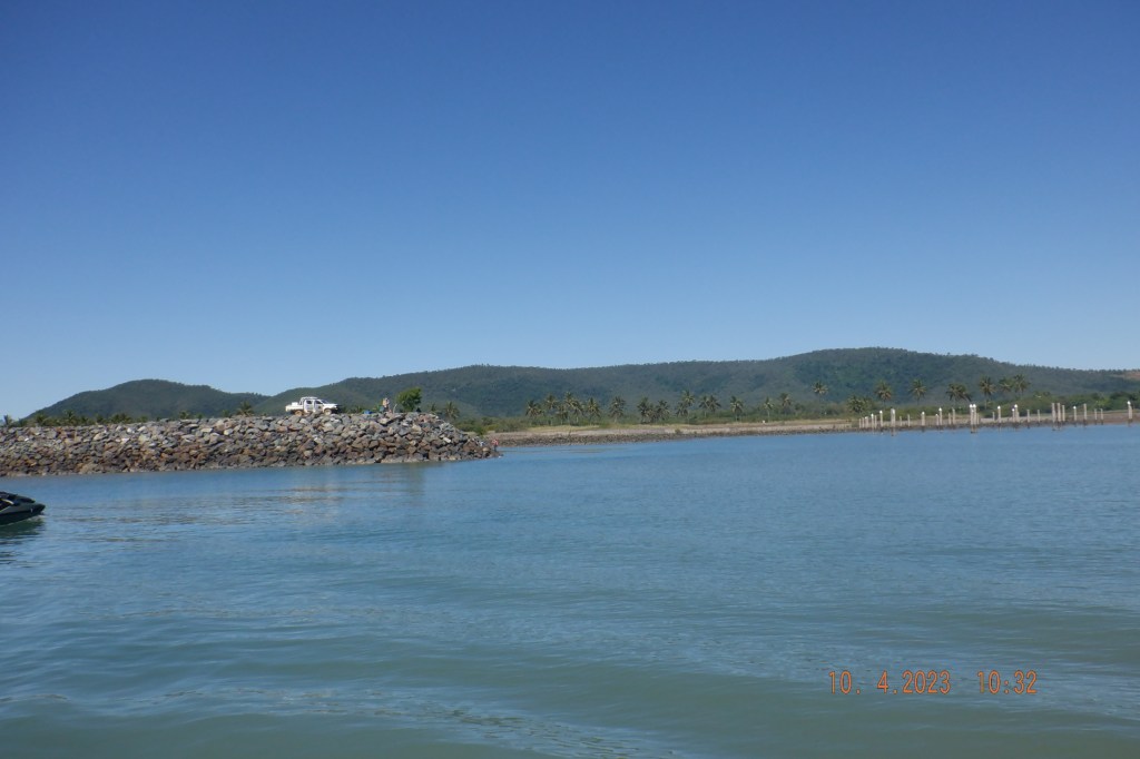
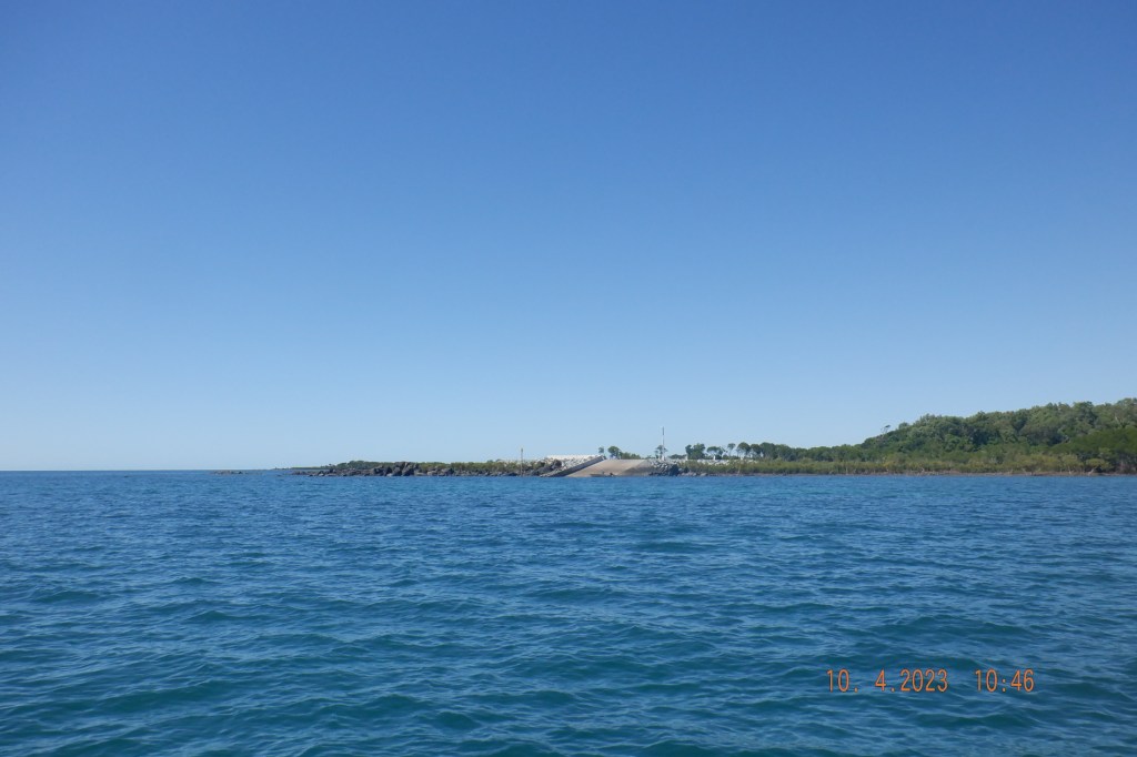
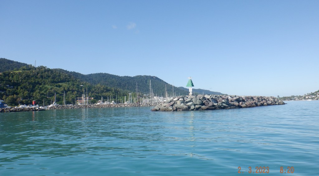
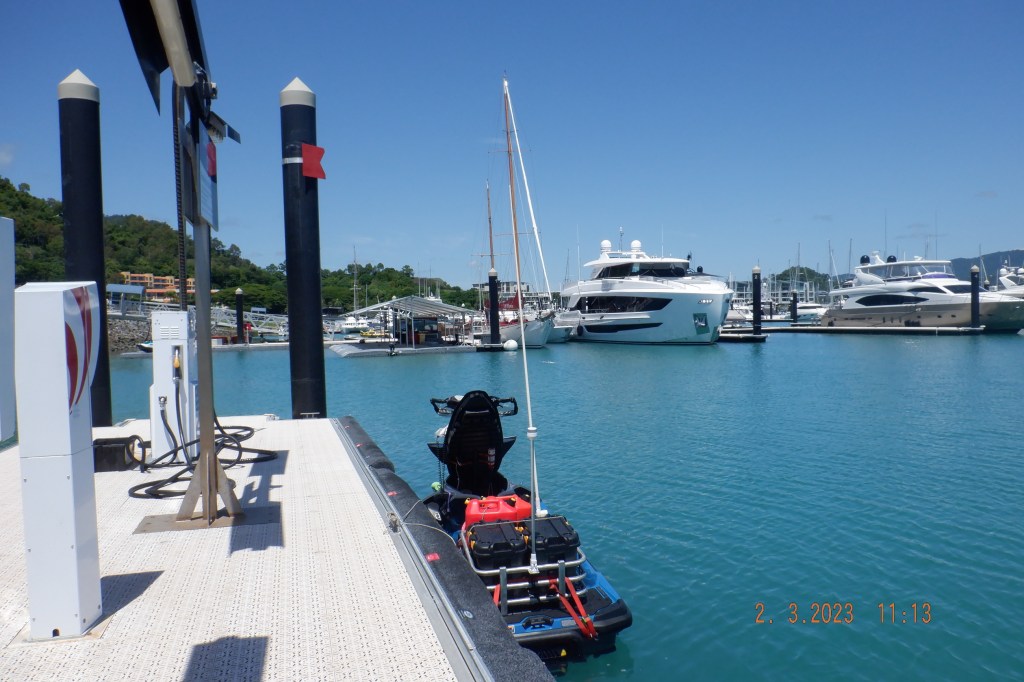
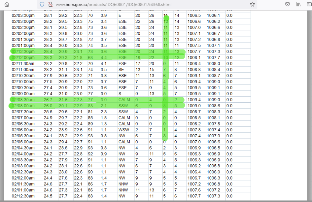
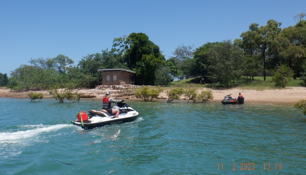
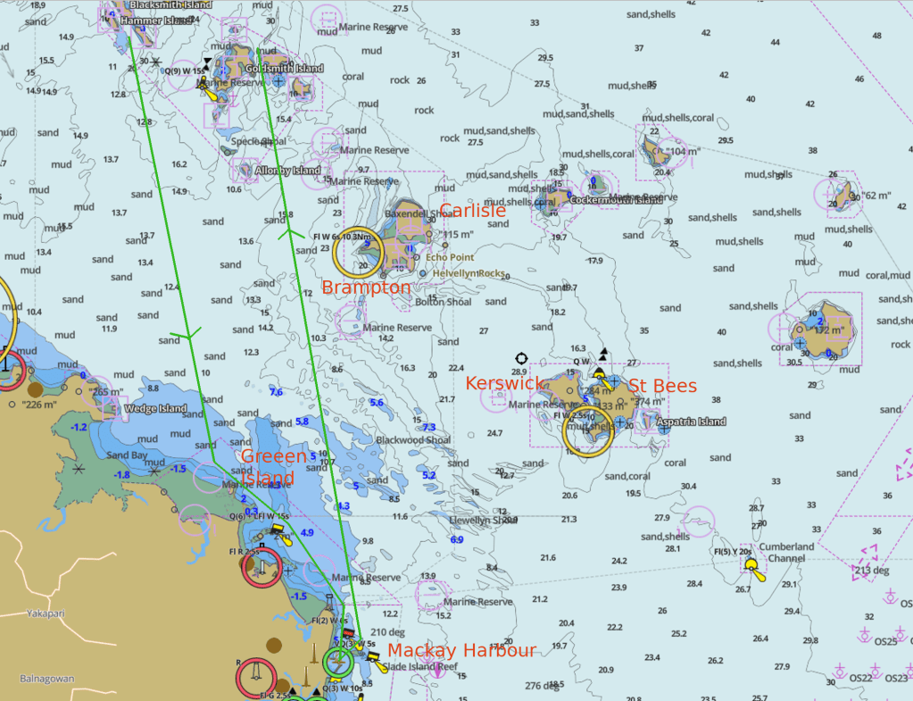
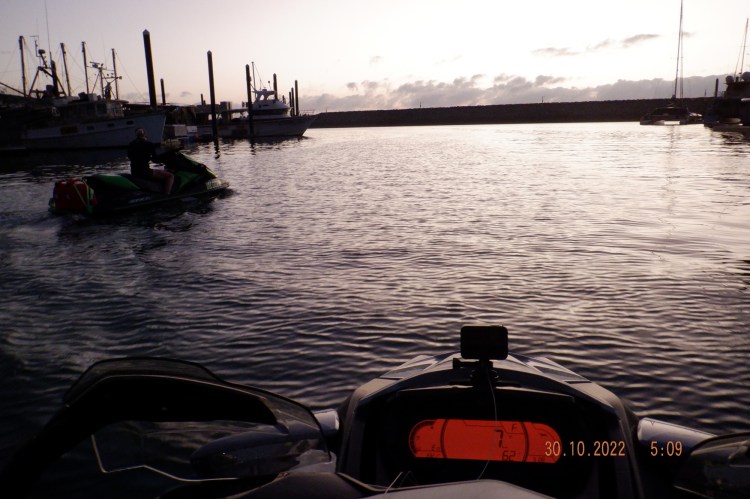
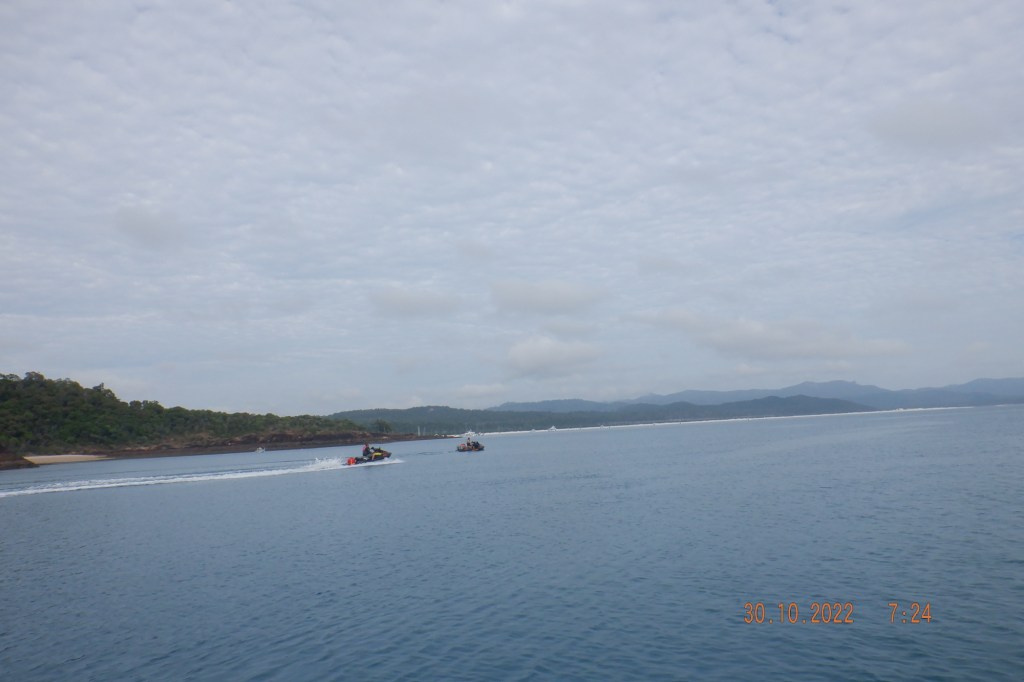
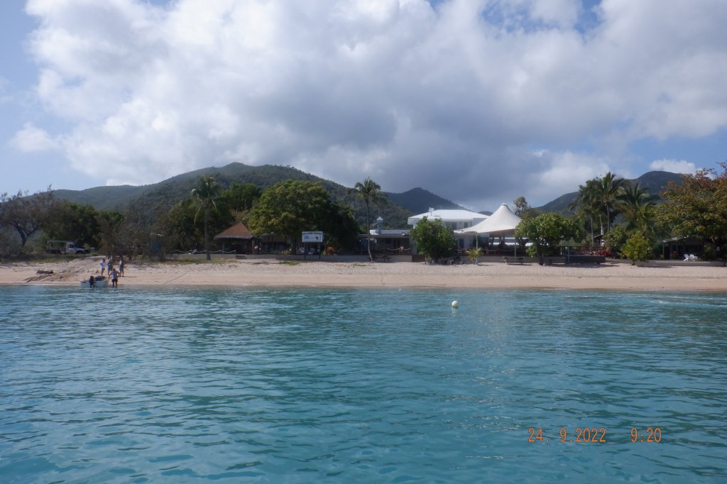
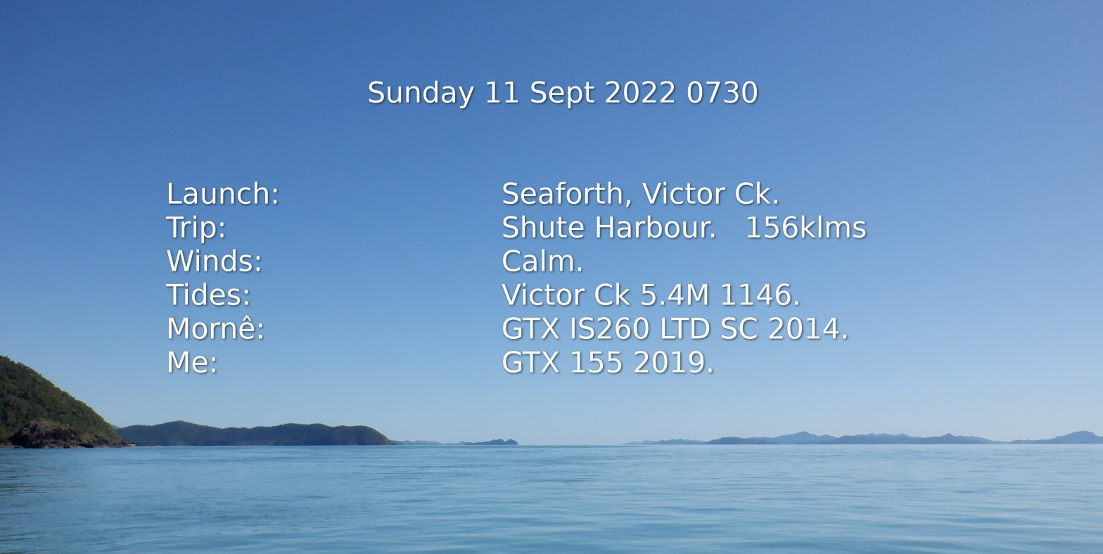
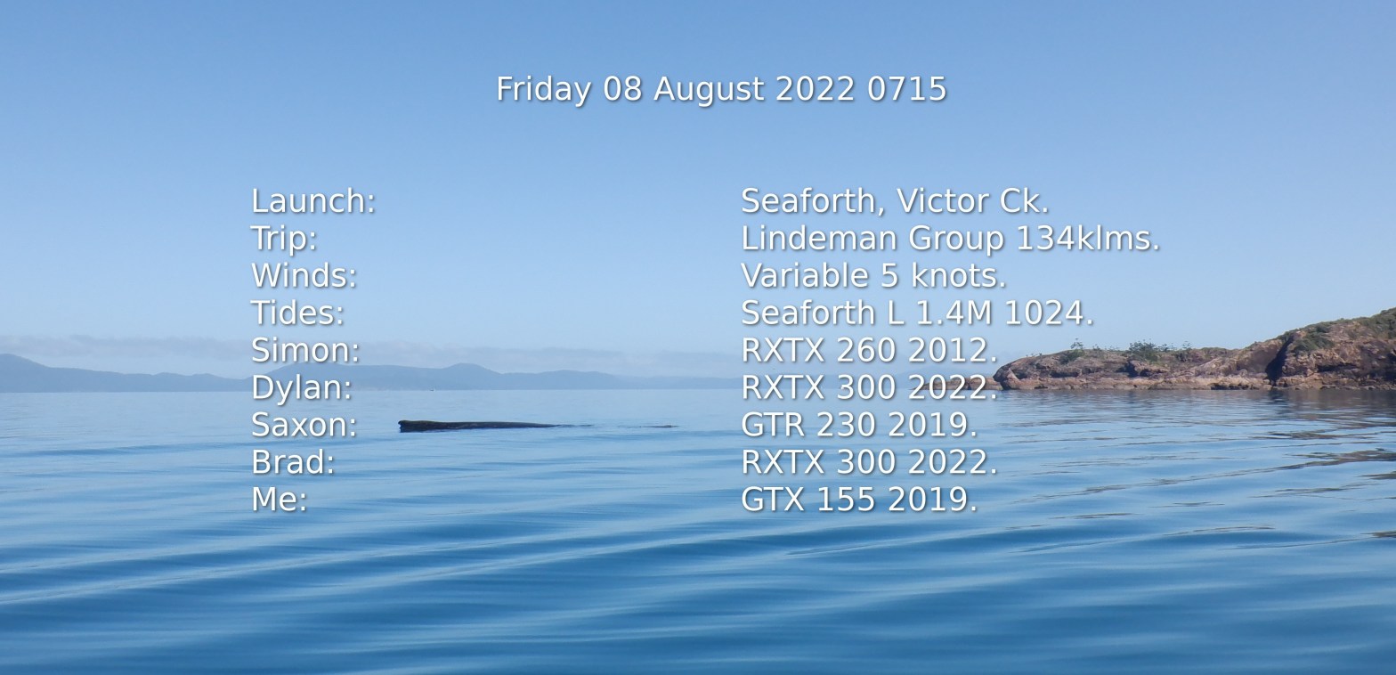
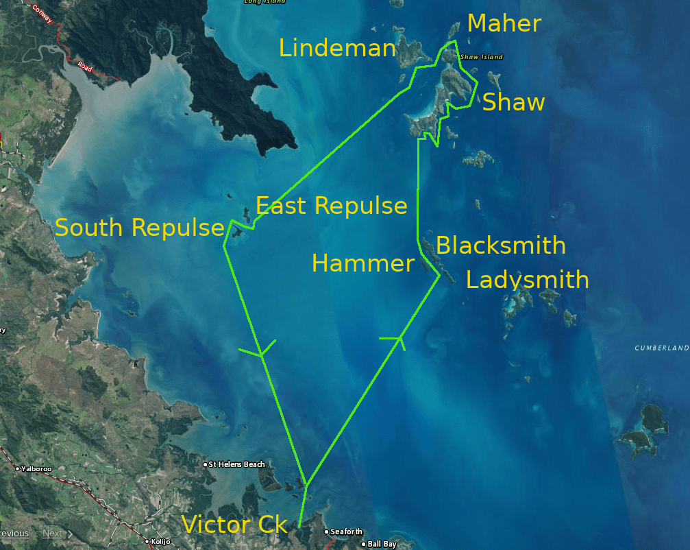
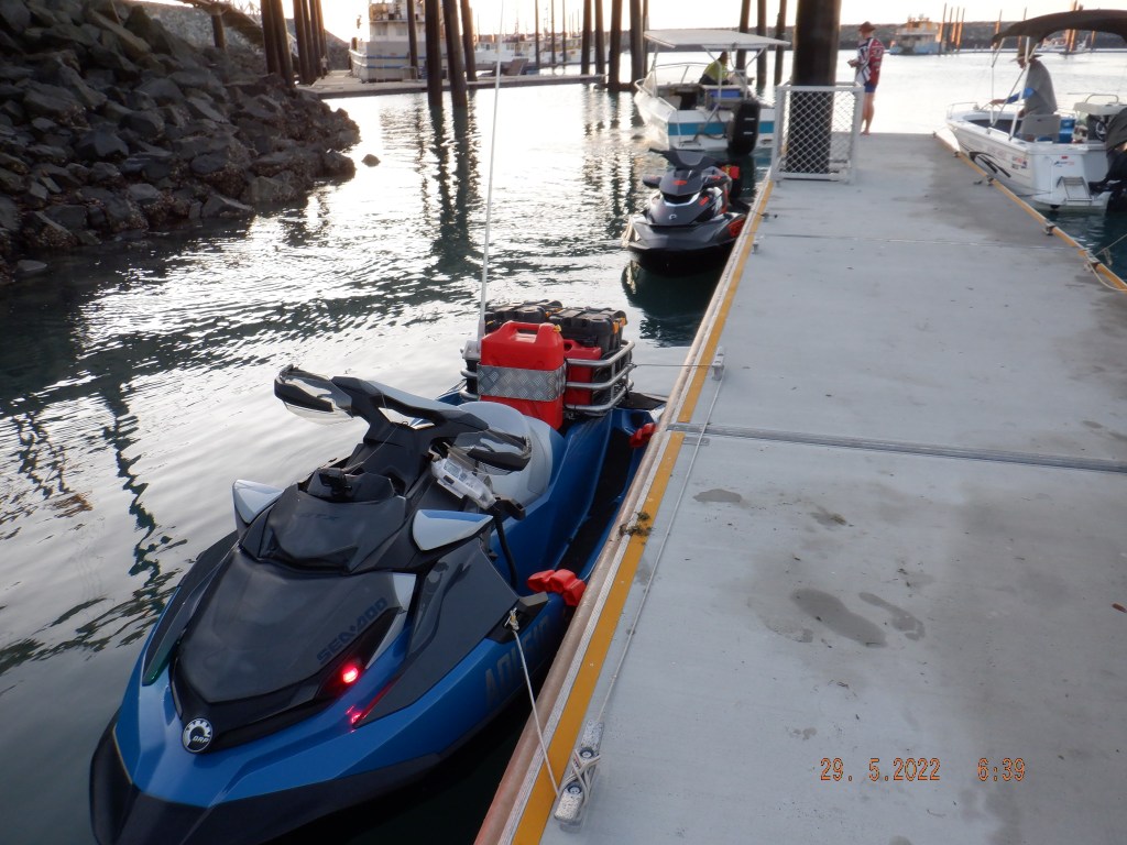
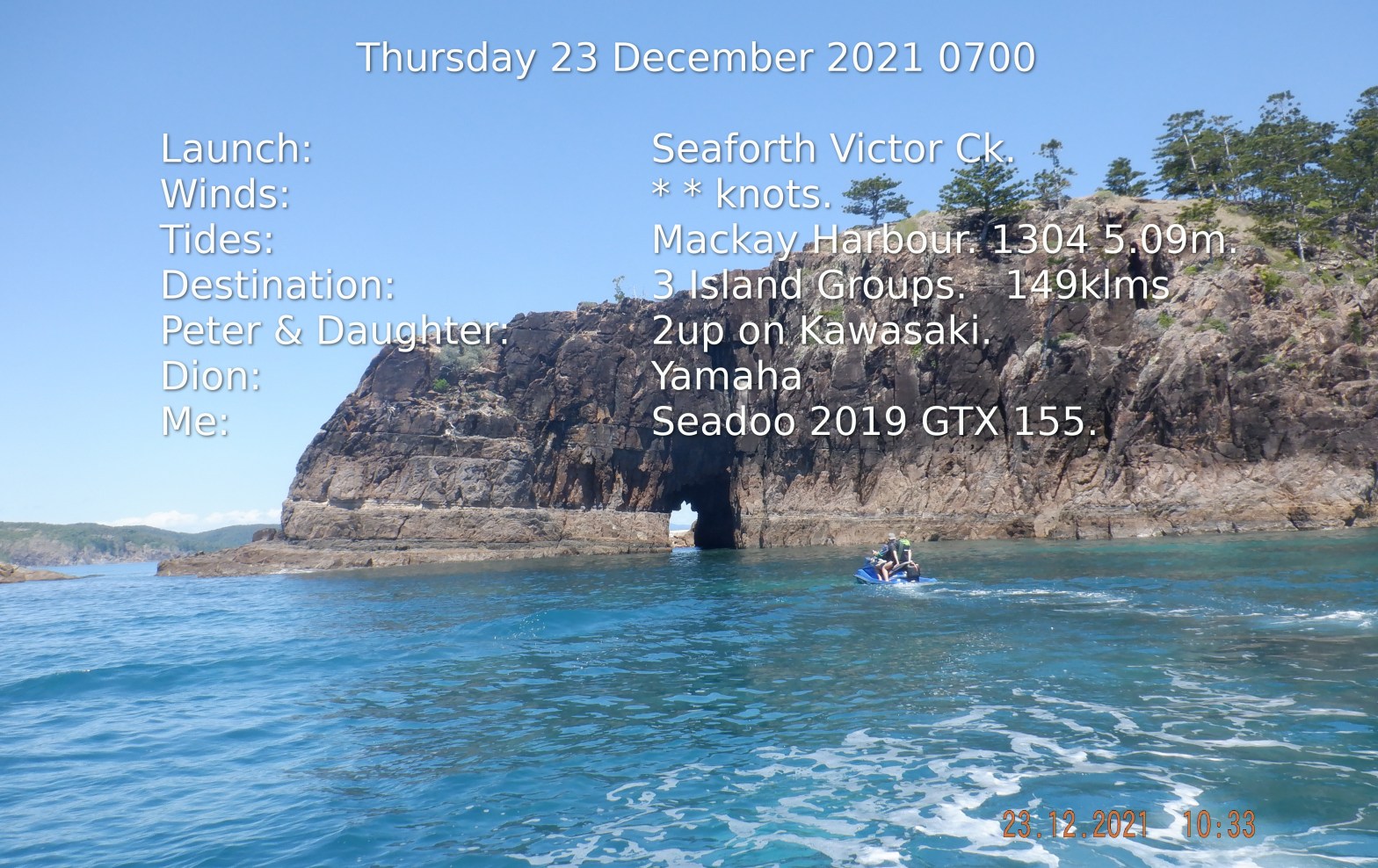
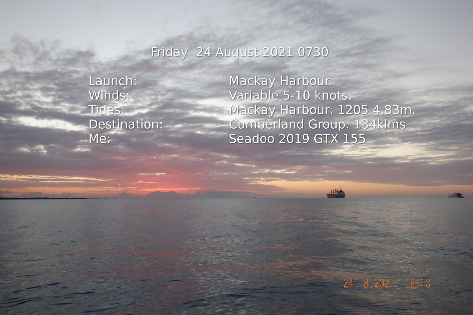
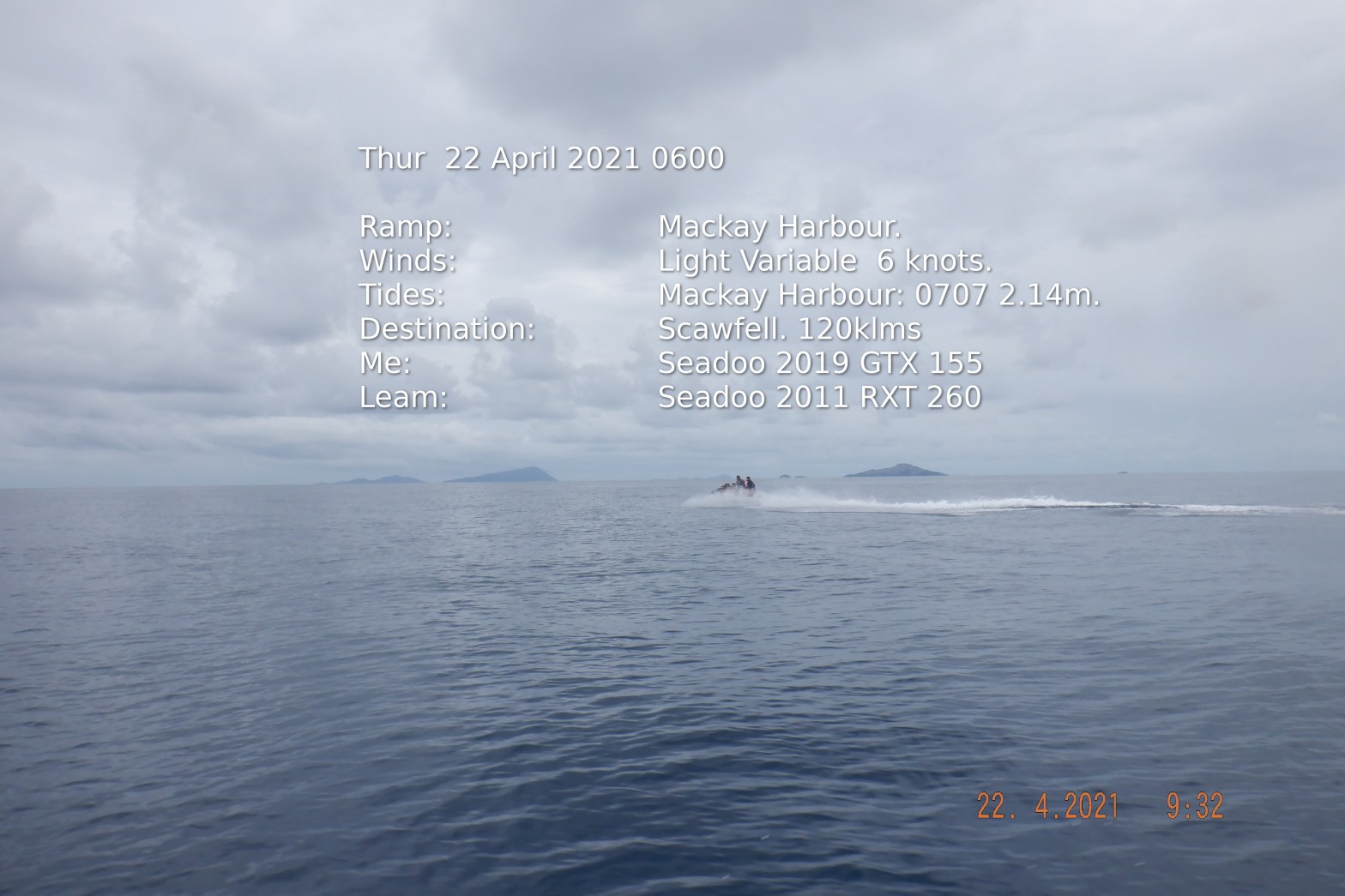
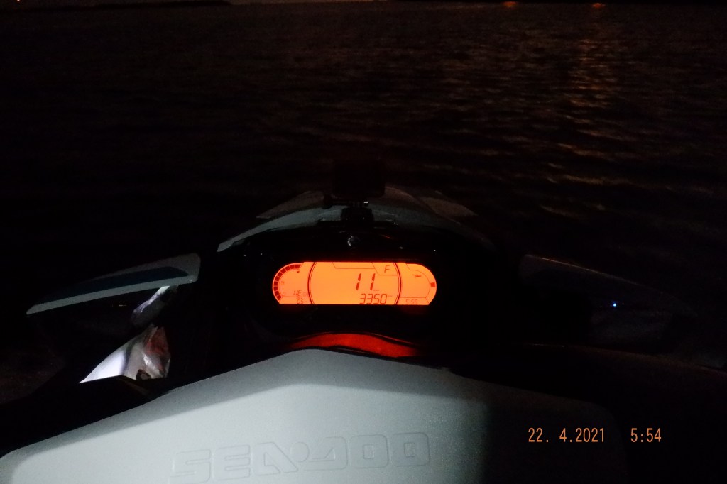
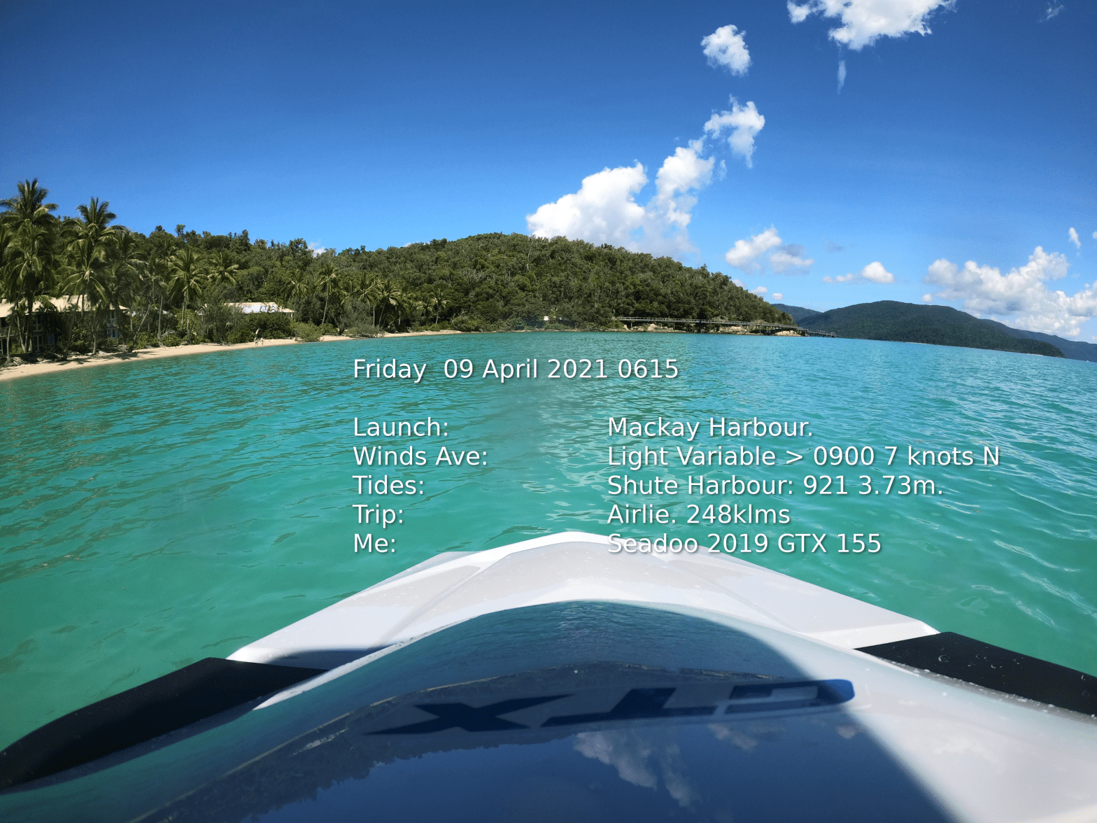
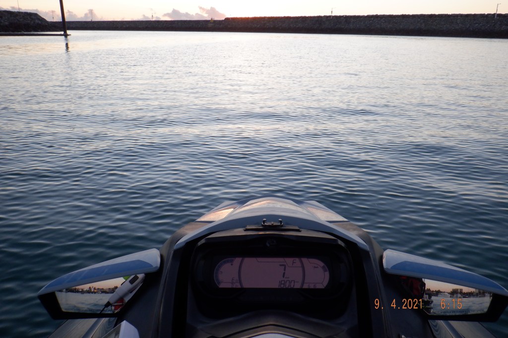
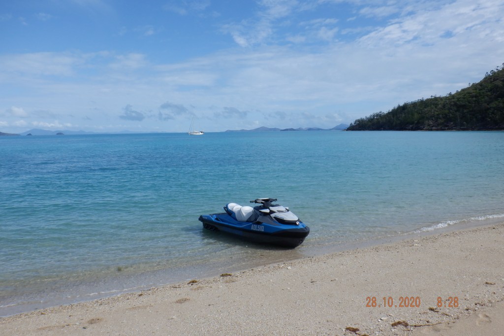
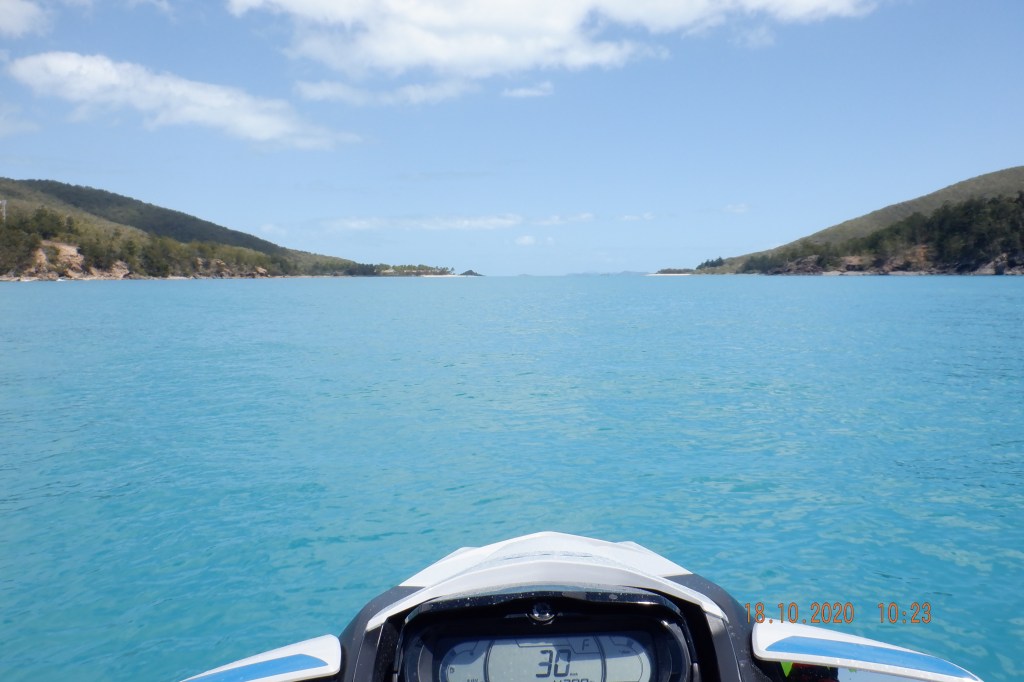
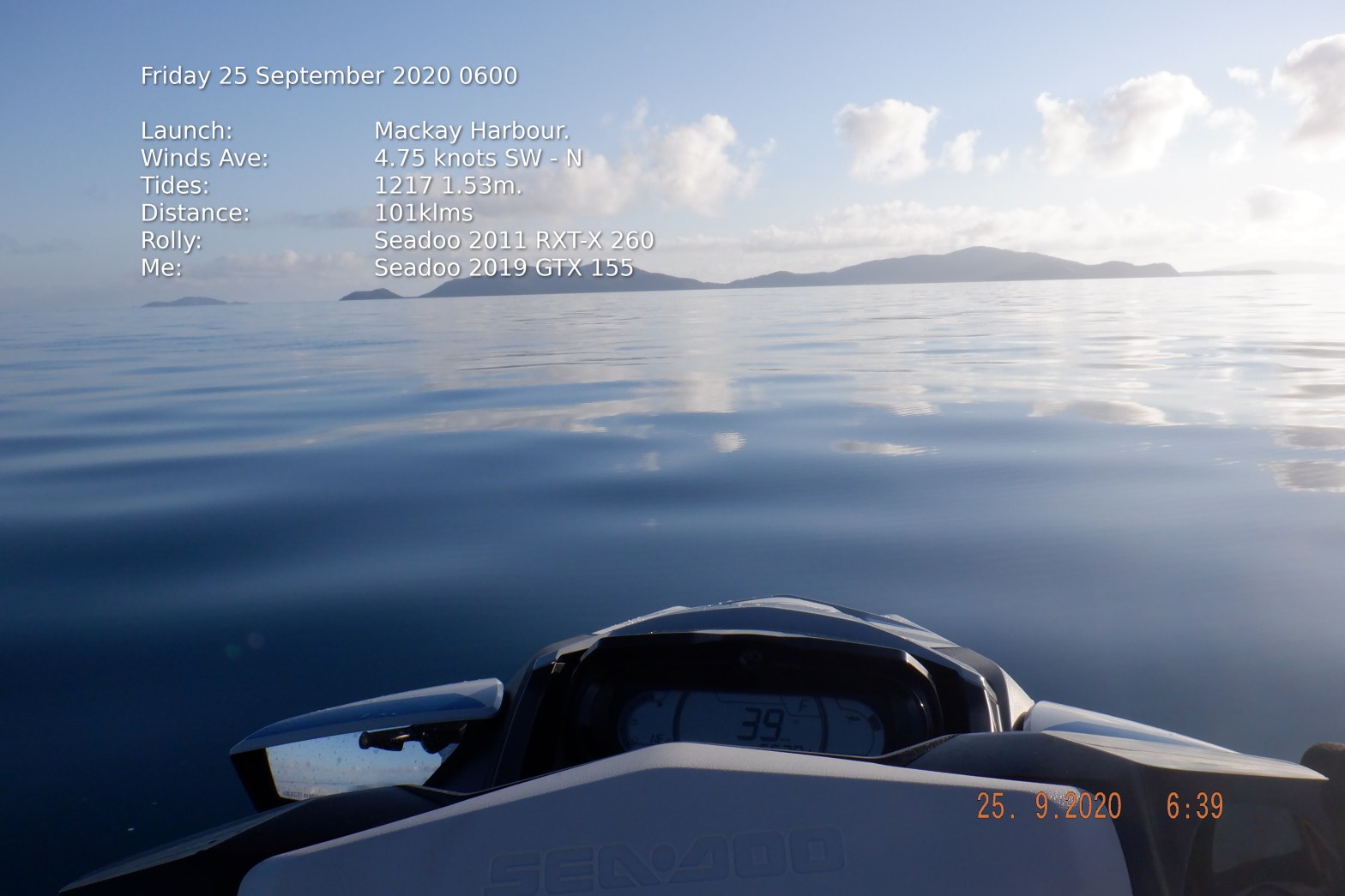
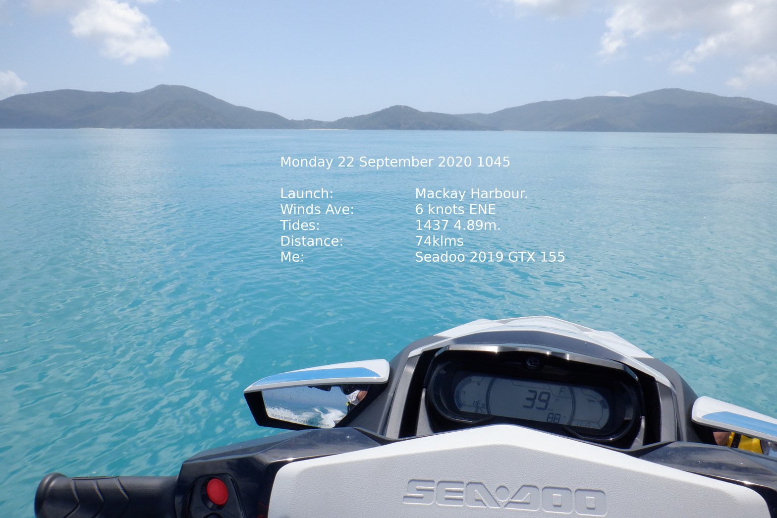
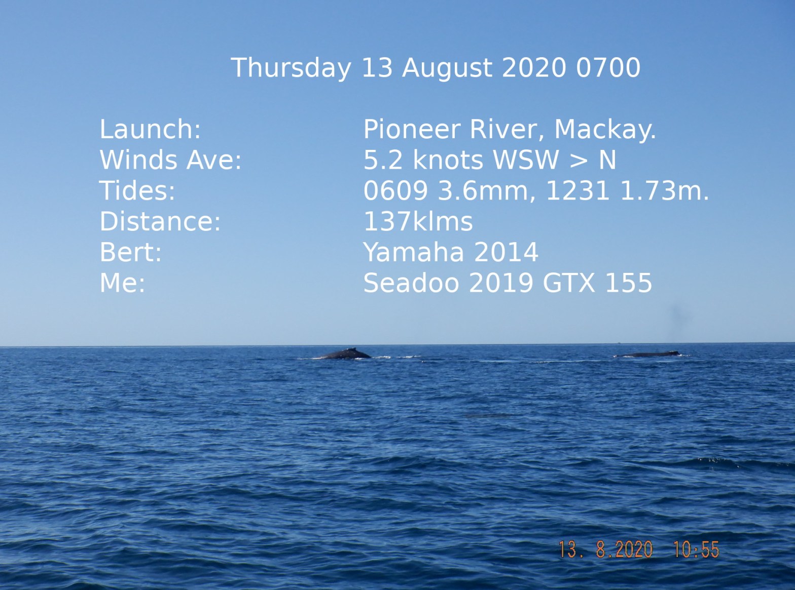
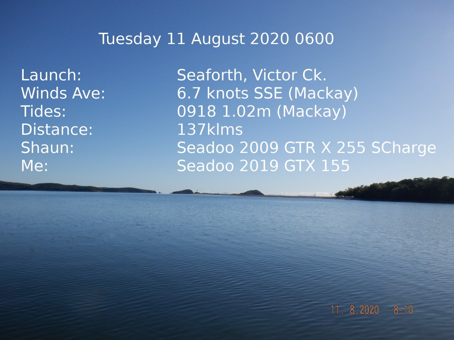
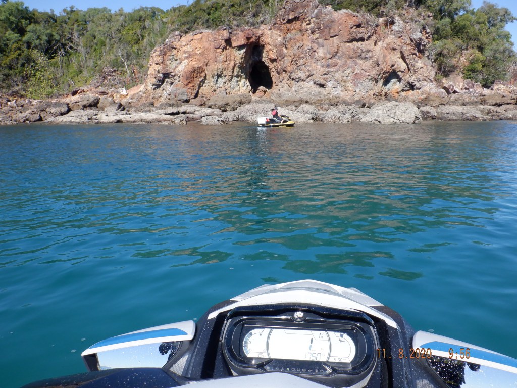
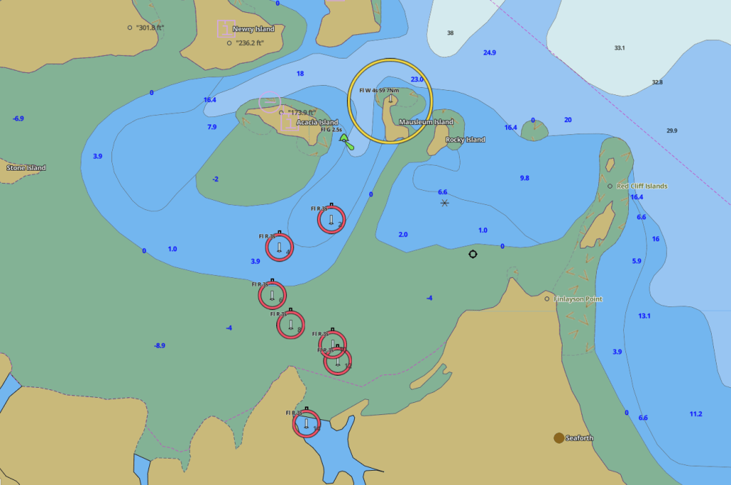
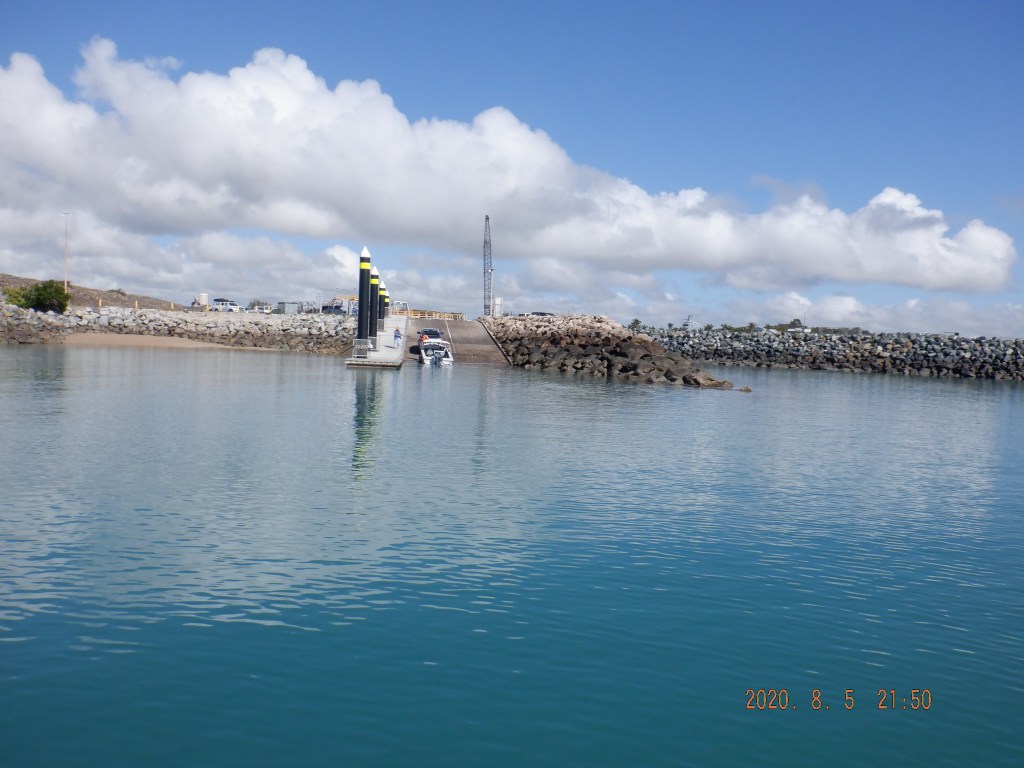
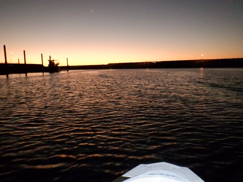
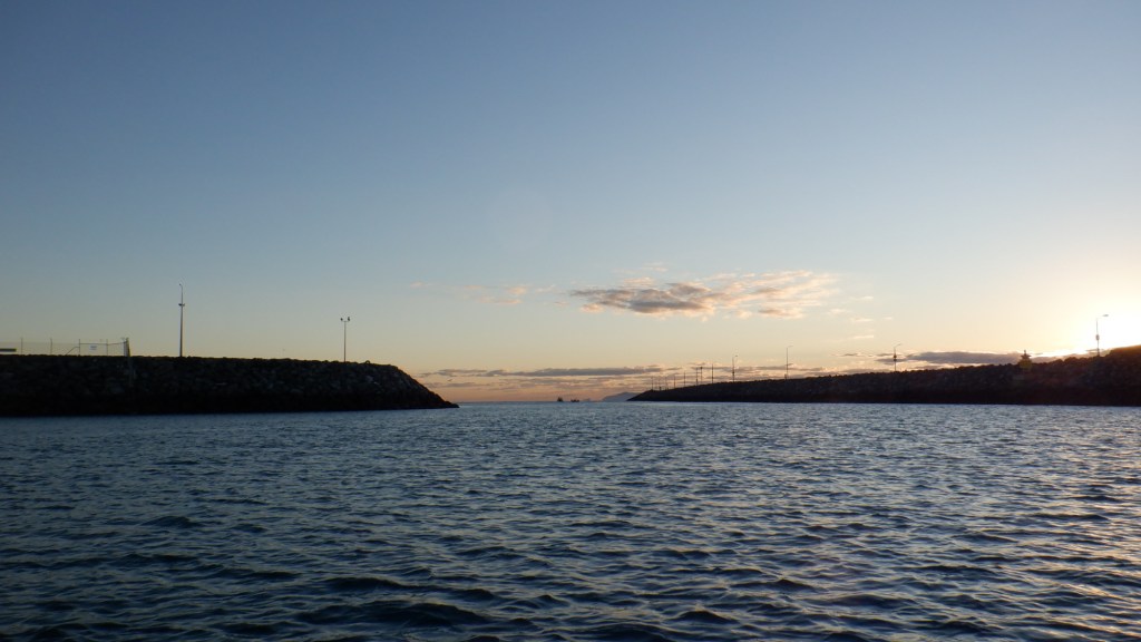
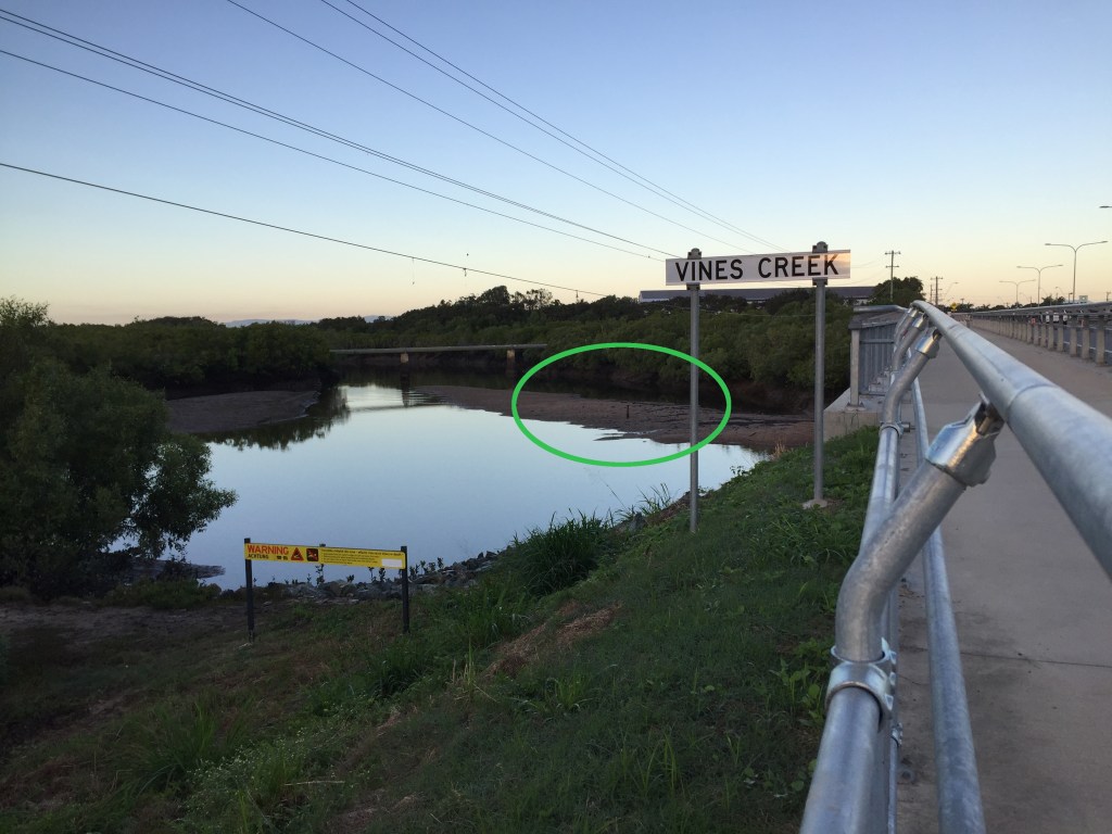
Plan is out of Victor Ck, Seaforth. Midges were terrible at the ramp. We were putting in just before 7 when Anns Ski dug it heels in and refused to start. She jump started off Jump Pack. Made our way out at 7am through the lateral markers then between Inner Newry & Rabbit Islands. Before clearing Rabbit Anns Ski died dead stop no life at all. She tried a Relay that i carry that solved problem. This is a part you should carry its tiny and not expensive to have sitting there.


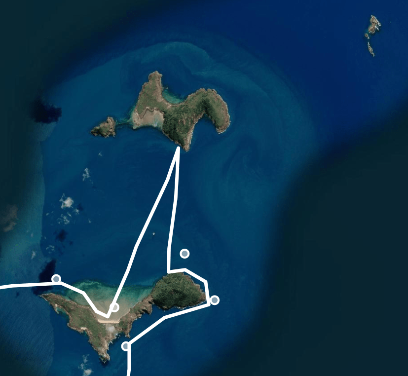
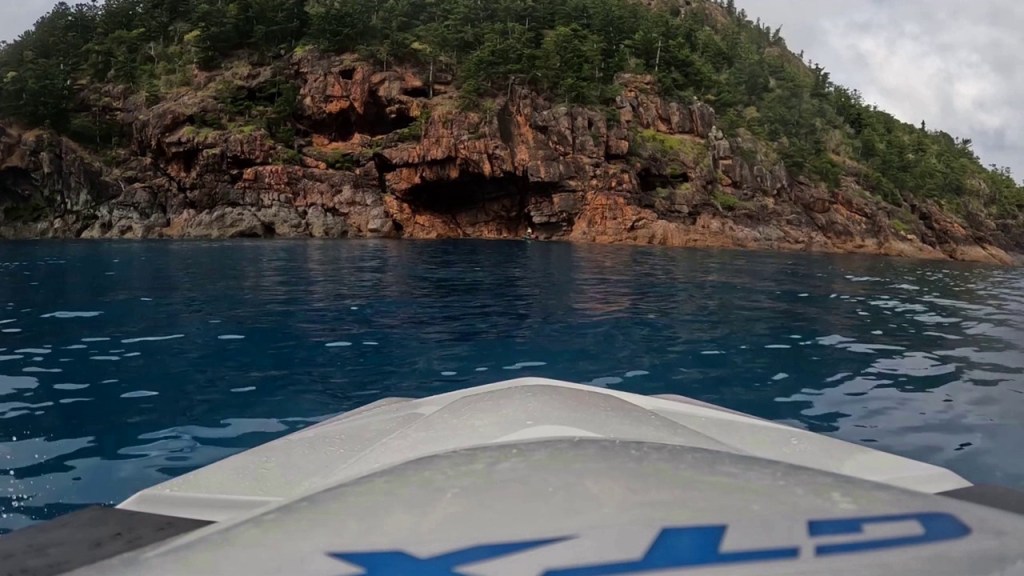
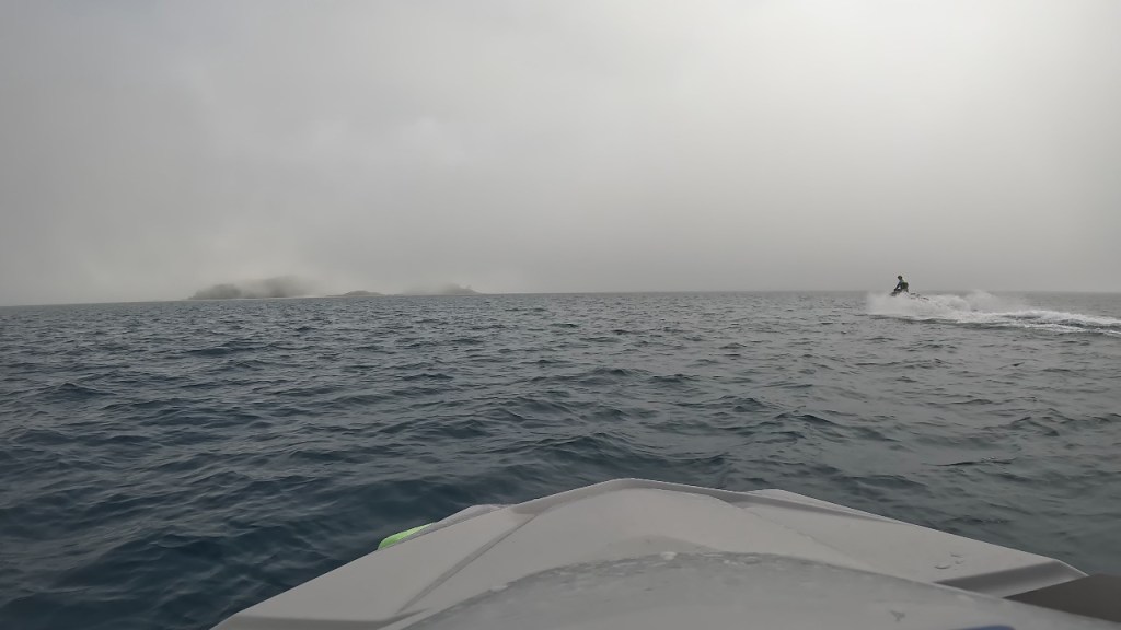
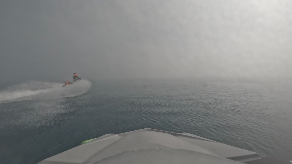
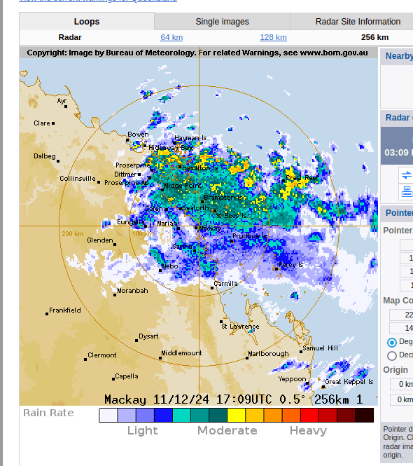
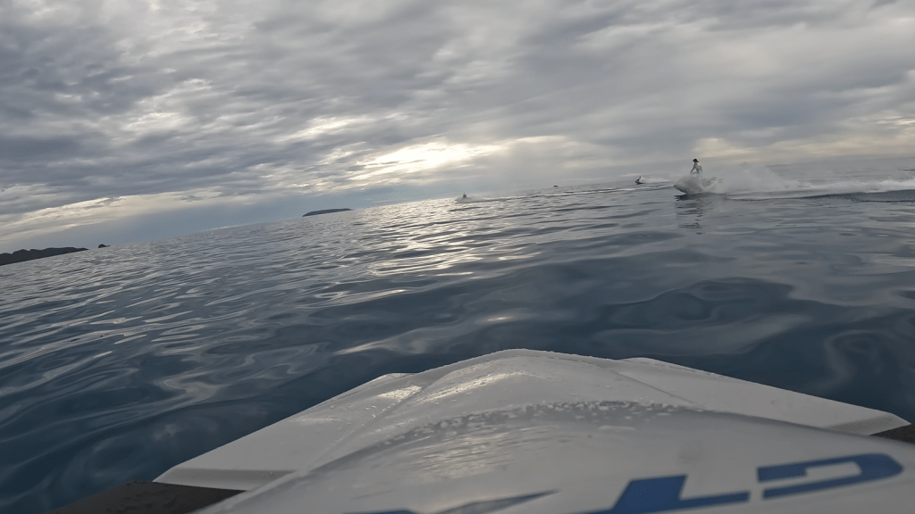
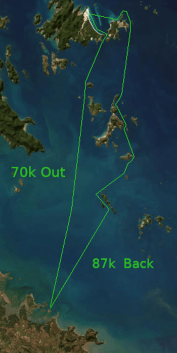
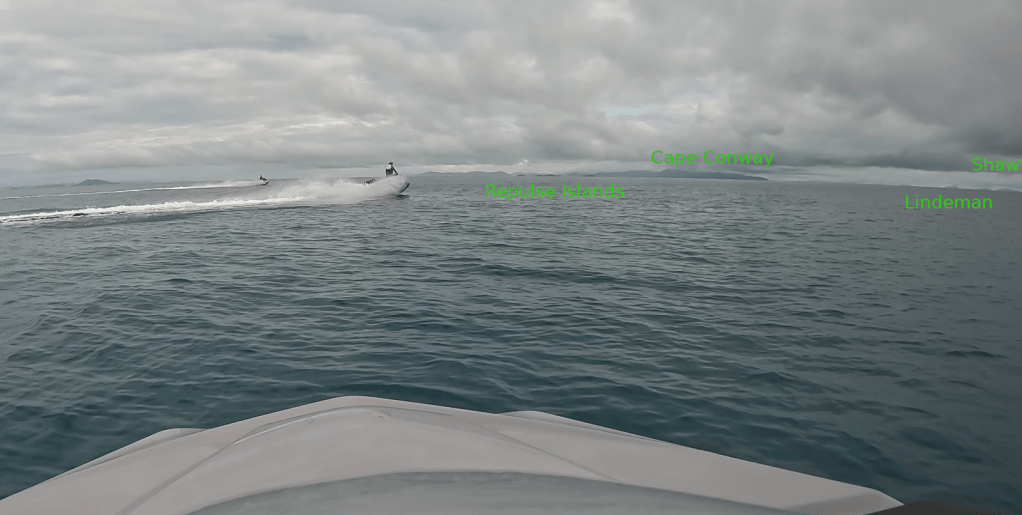
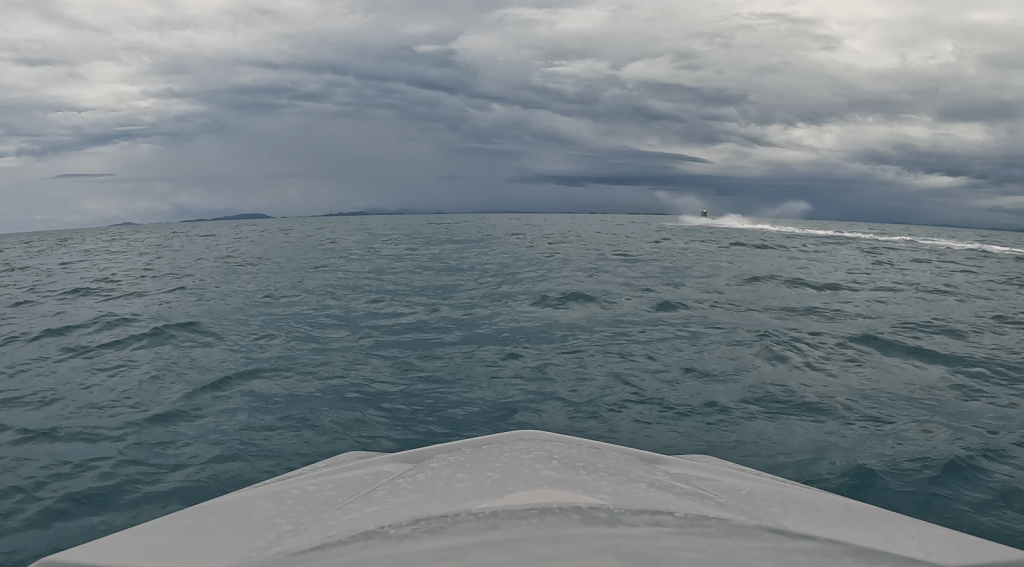
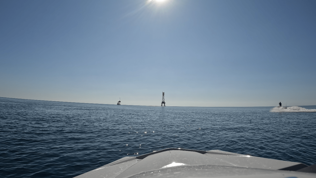
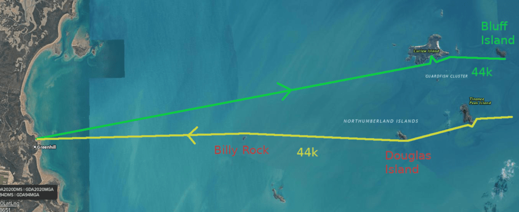
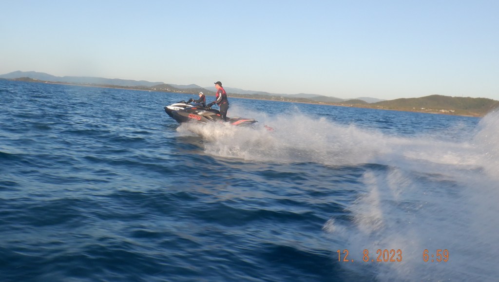
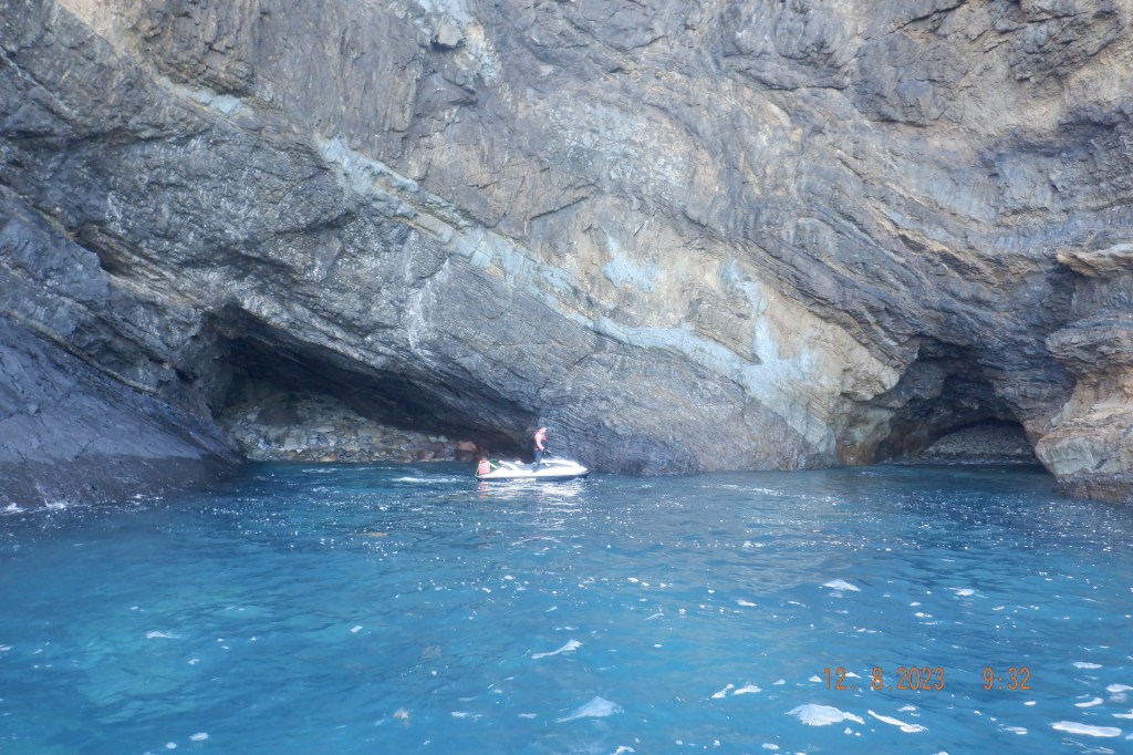
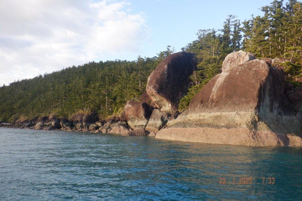
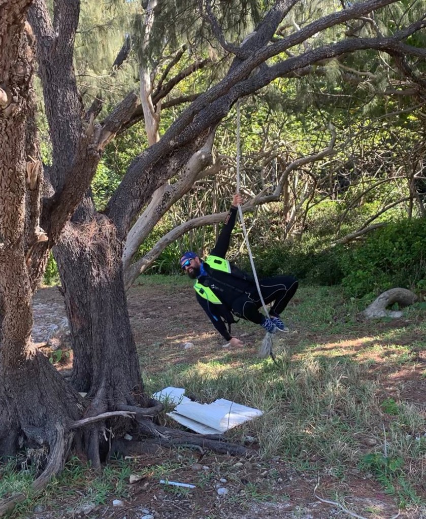
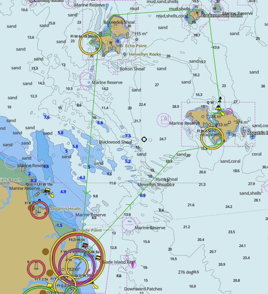
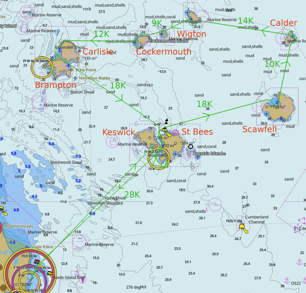
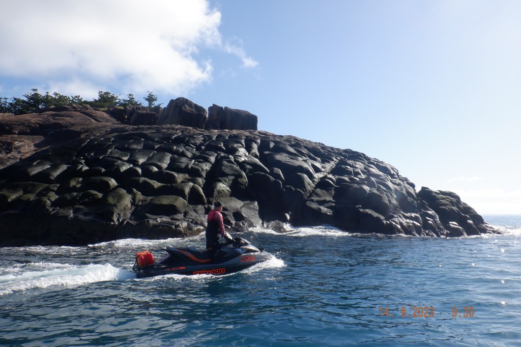
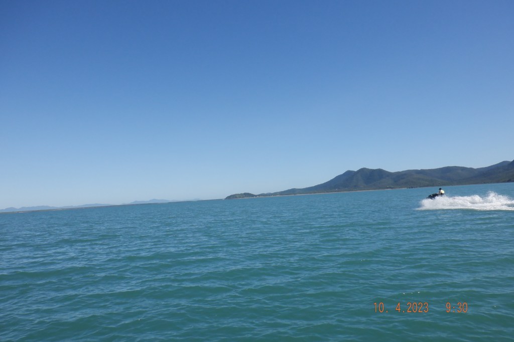
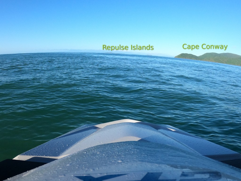
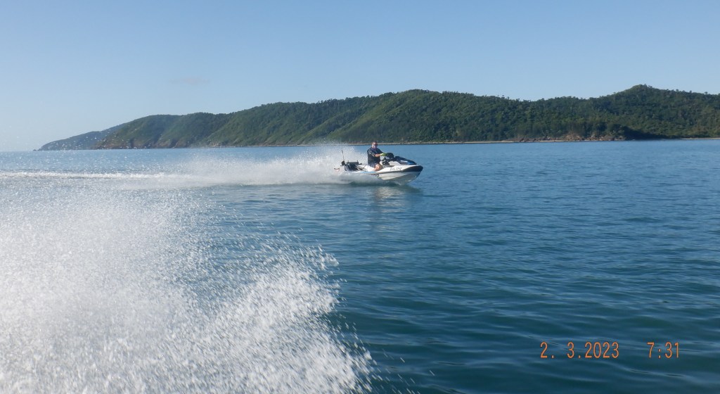
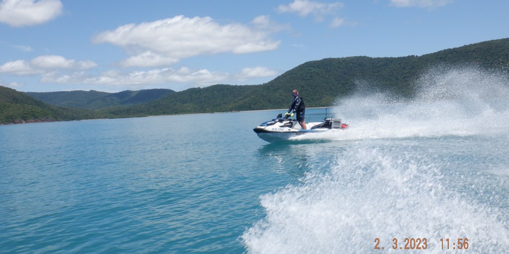
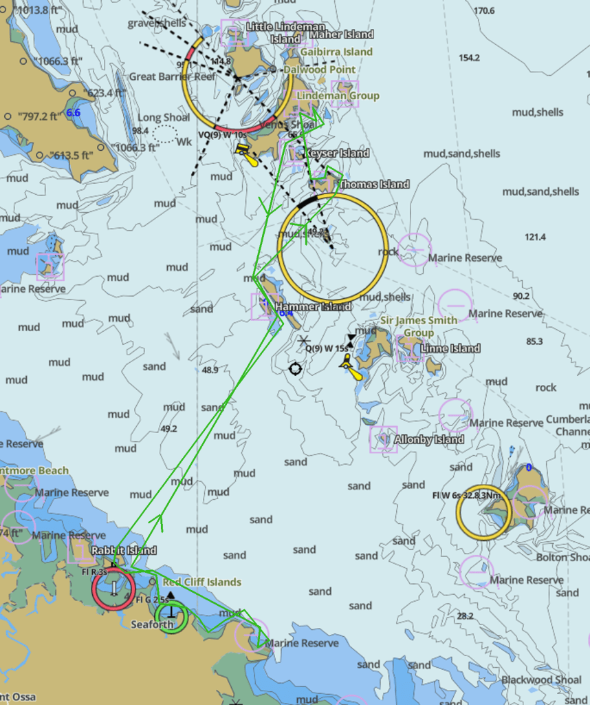
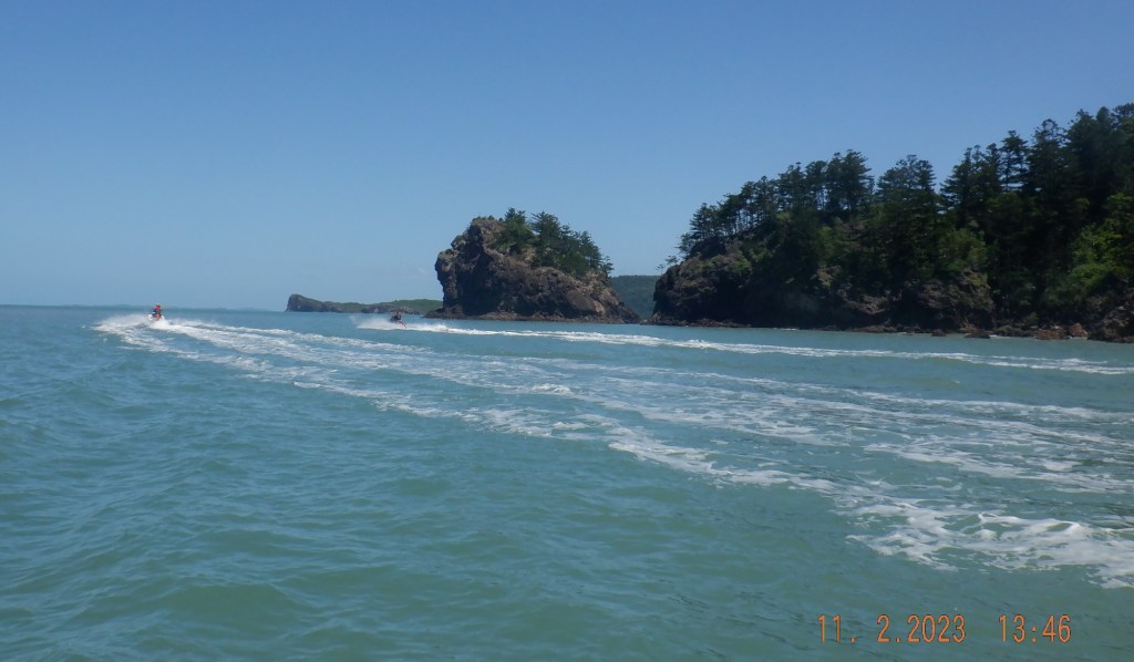
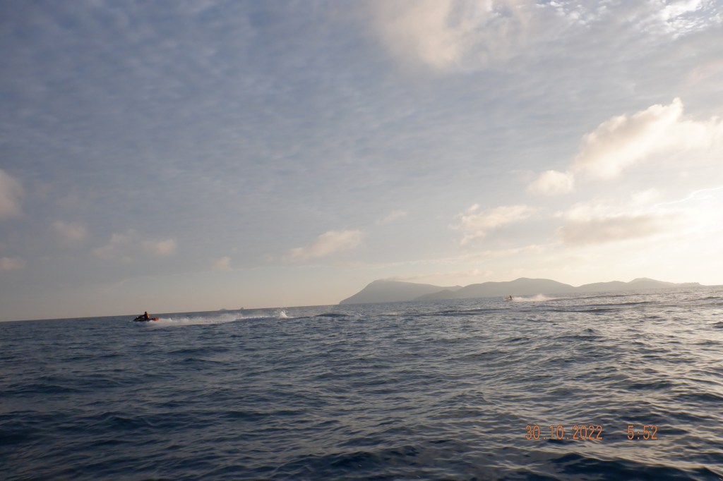
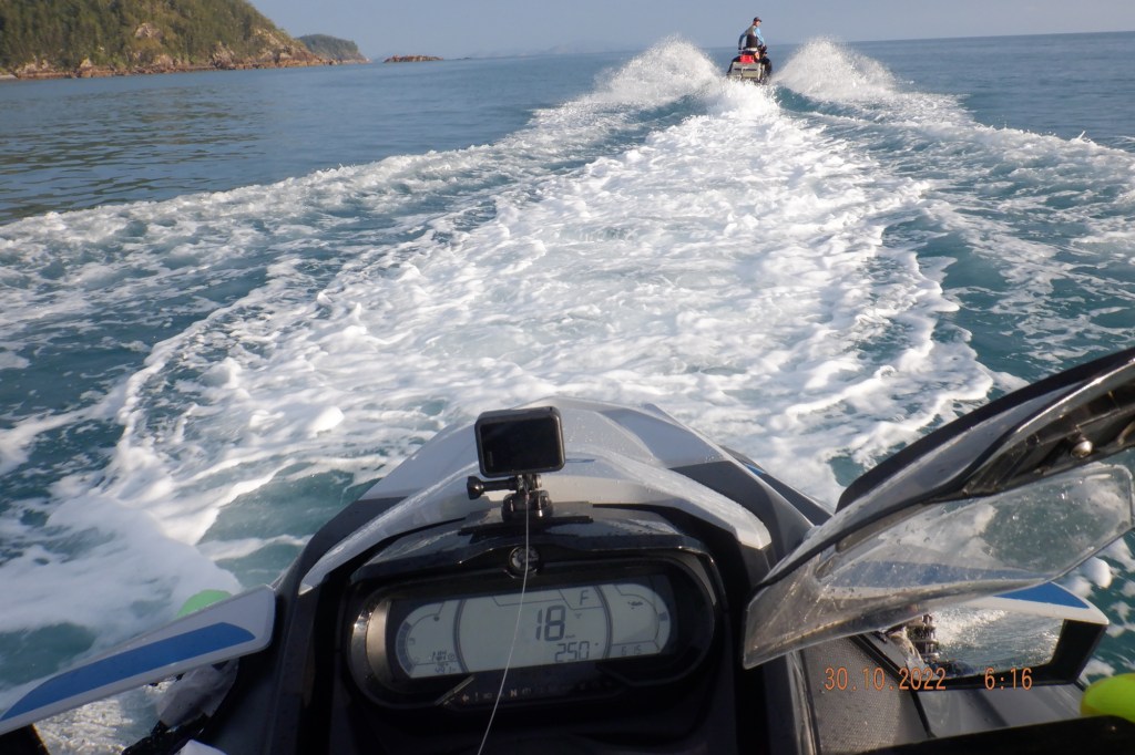
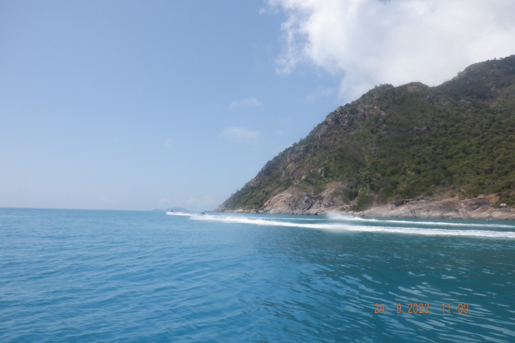
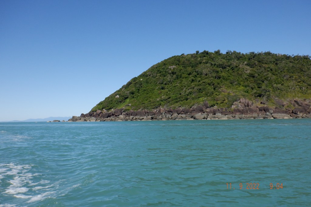
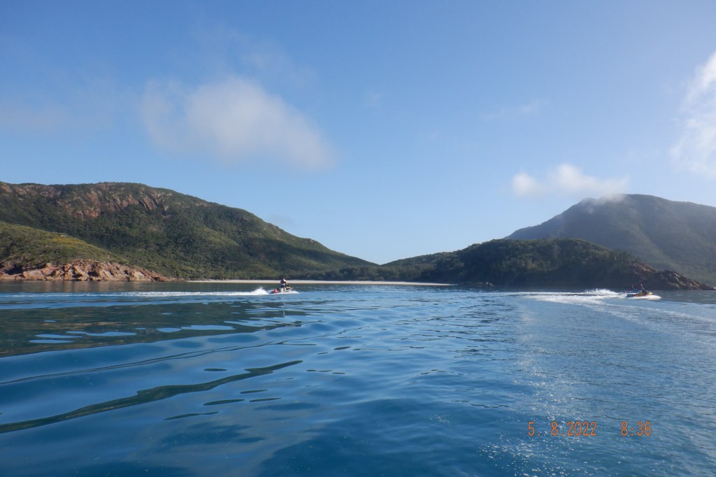
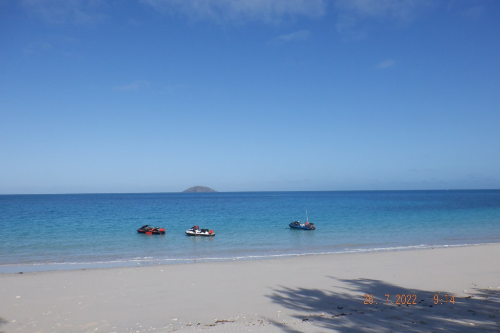
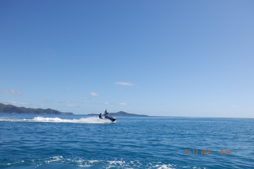
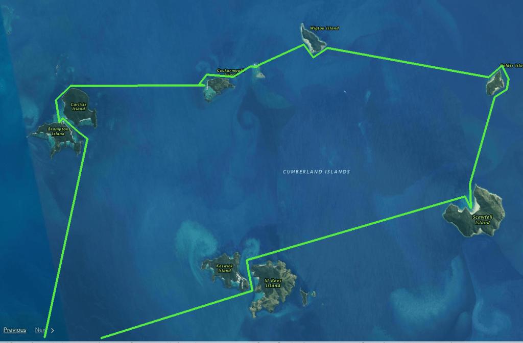
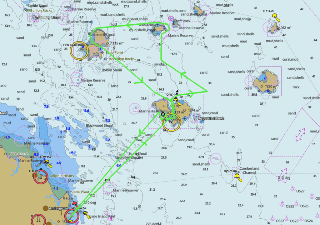
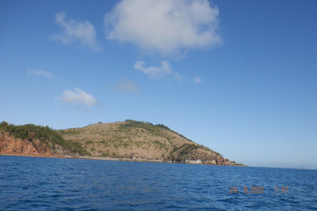
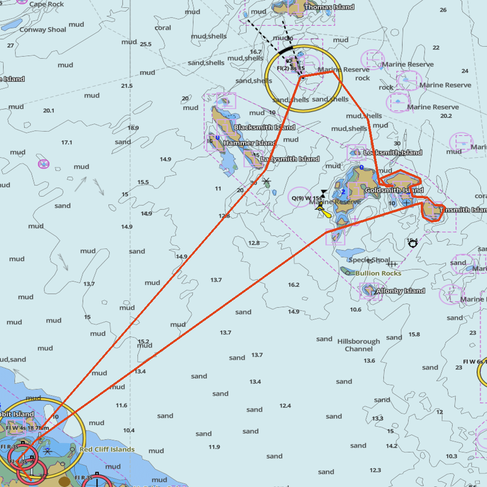
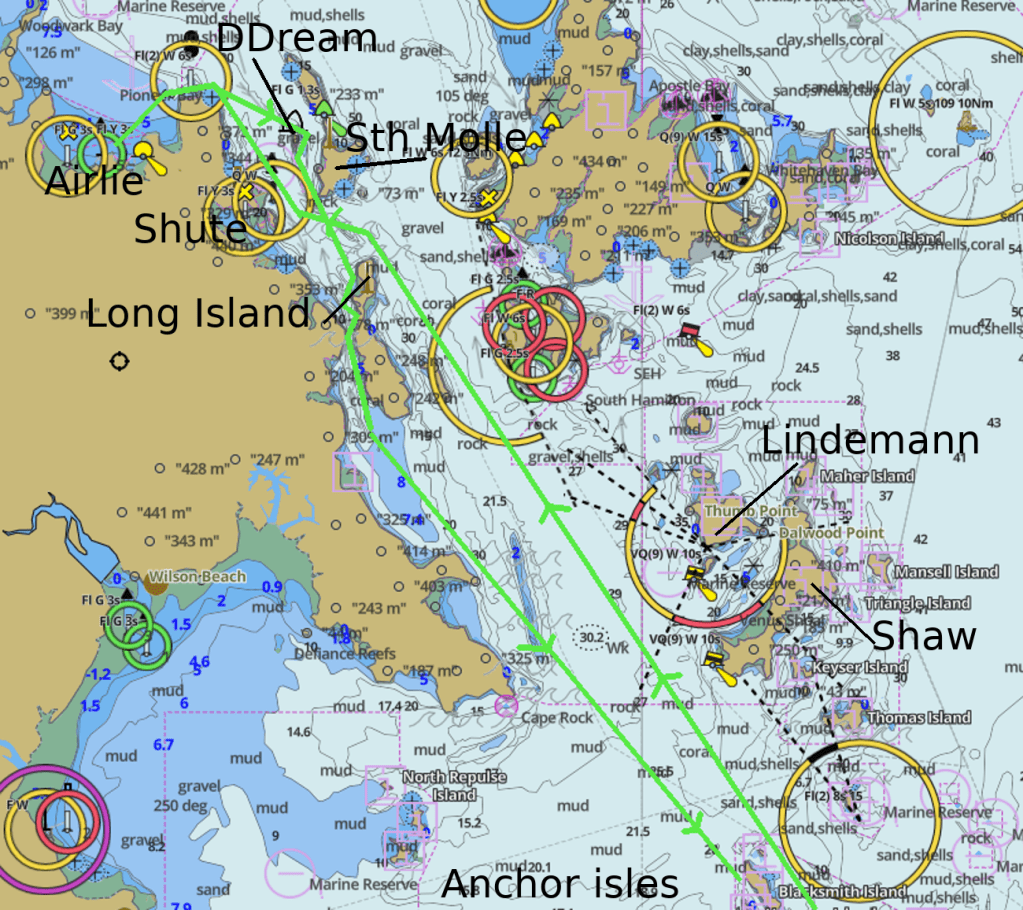
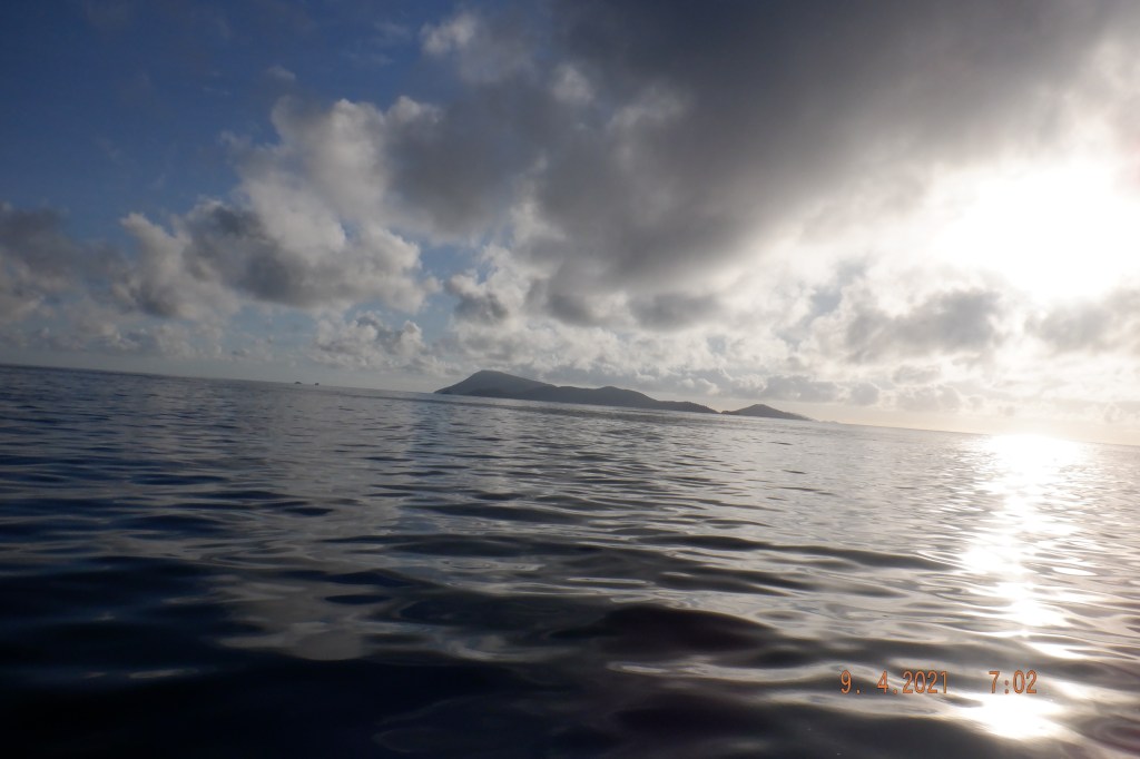
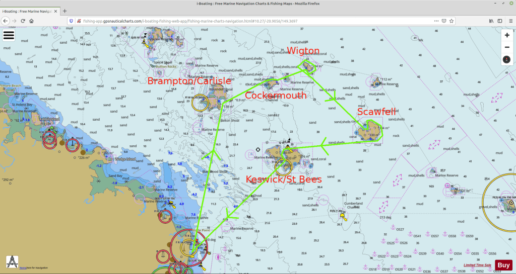
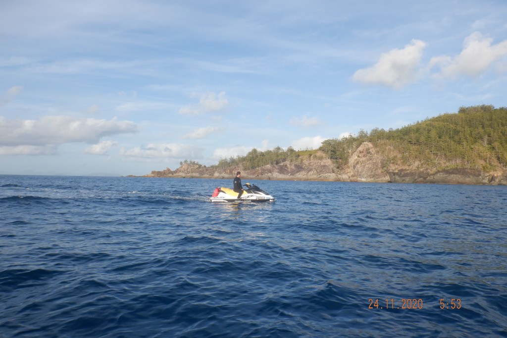
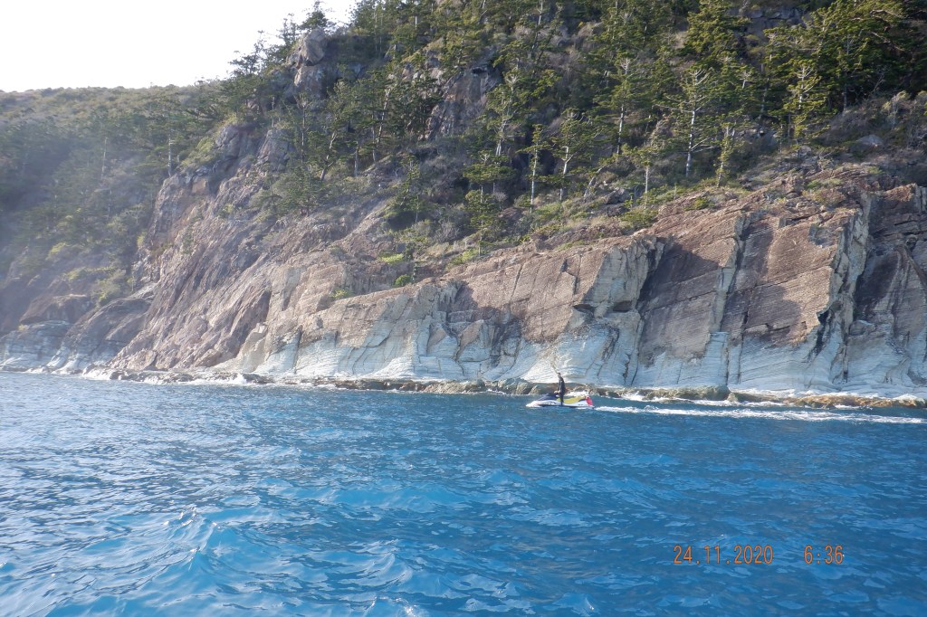
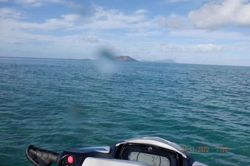
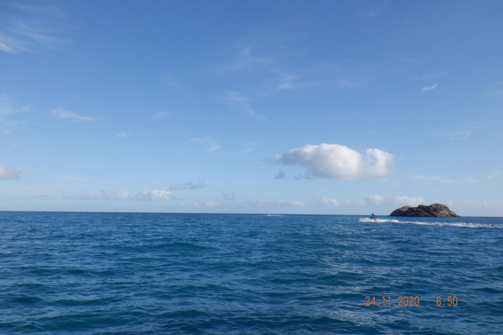
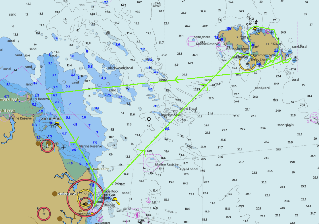
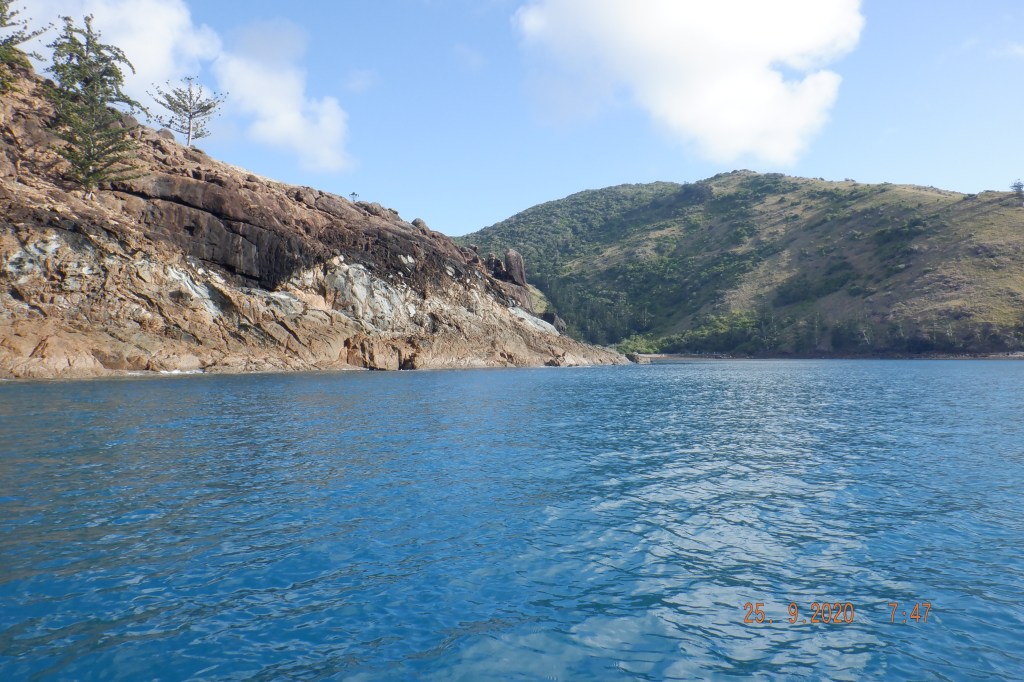
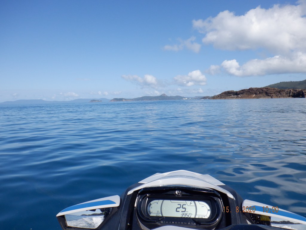
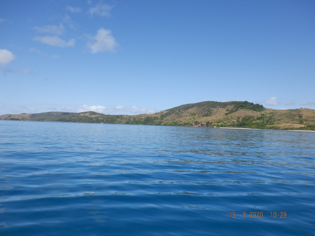
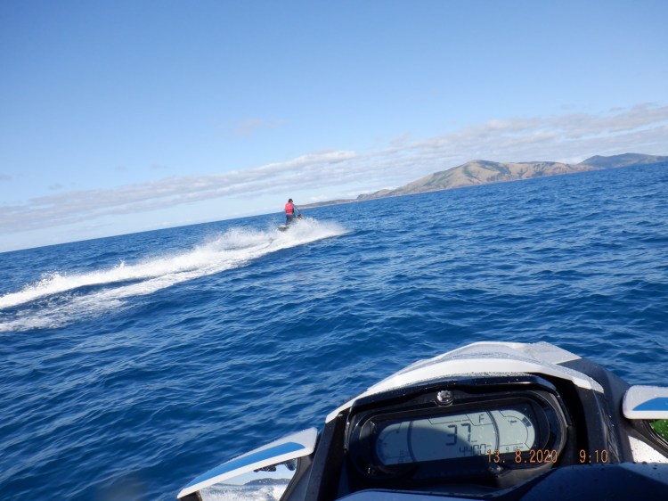
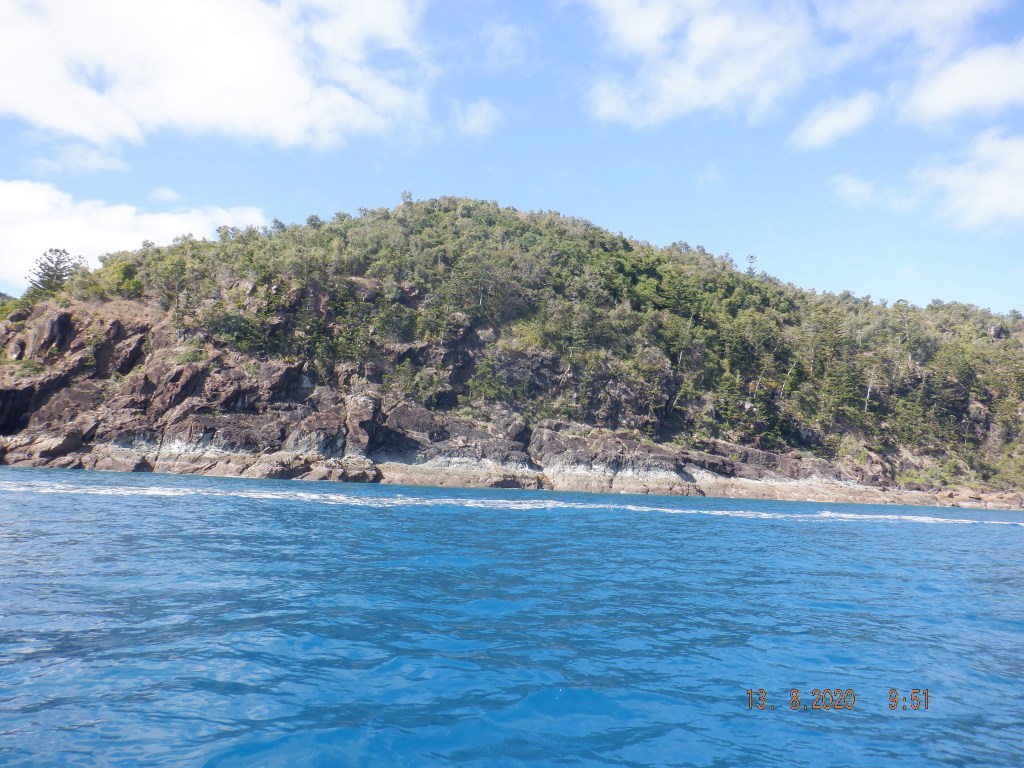
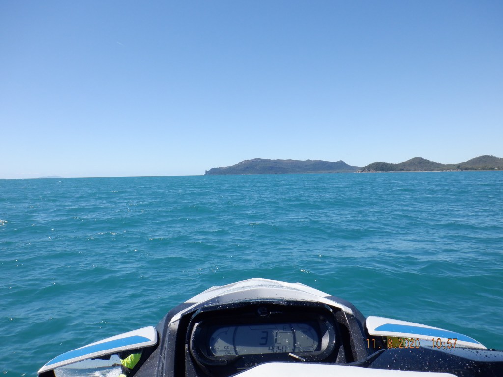
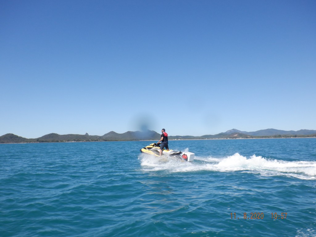
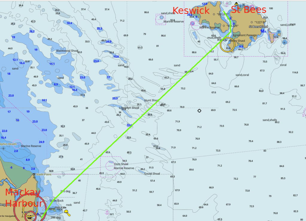
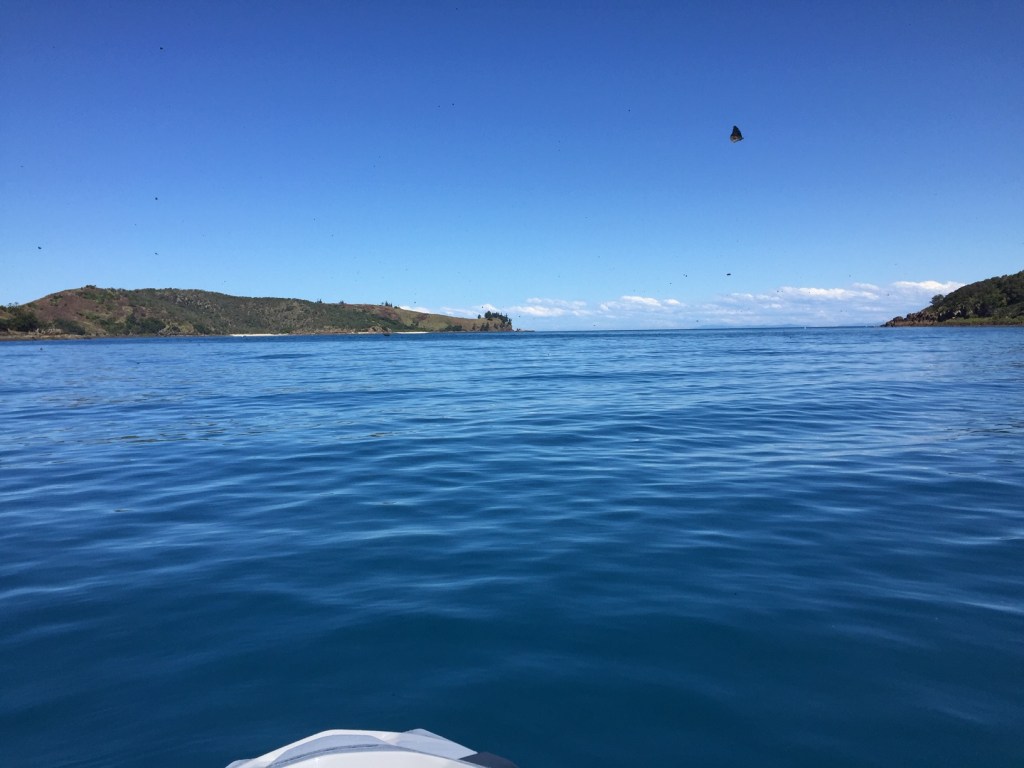
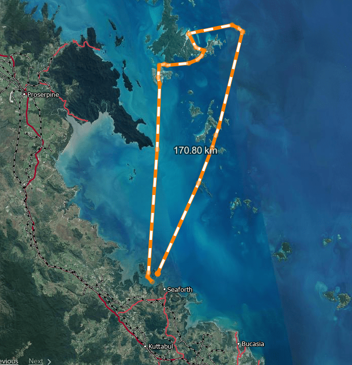
So off we go again and I clowning around jumping and turning on waves and my ski spits me out. My first fall in 750 hrs it had to happen eventually. Hope thats done for another 750 hrs or more. So my plan to run northerly to Cape Conway and run ENE towards Lindeman through to Pentacost and across to Whitsunday was scratched. Instead we we ran from Cape Conway that was flat turning a little lumpy closing the Cape past the Cape it was flat again then directly to Hamilton one of my not so favourite places that i avoid but had no intention to go in so a passby was acceptable. This route was going to keep us in the forecasted quieter winds and it was flat.

Pretty flat for those wind strengths ? but direction with tide for most. PS this is Observations (actual recordings) not Forecast a big difference.

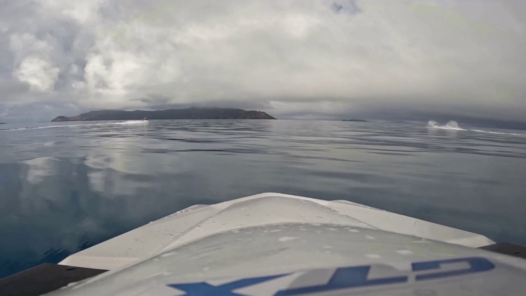
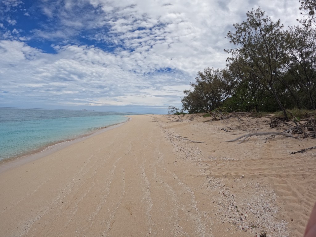
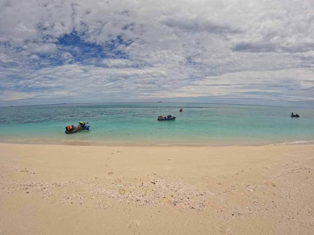
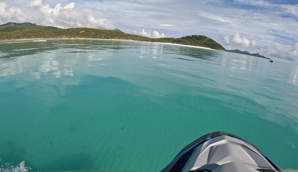
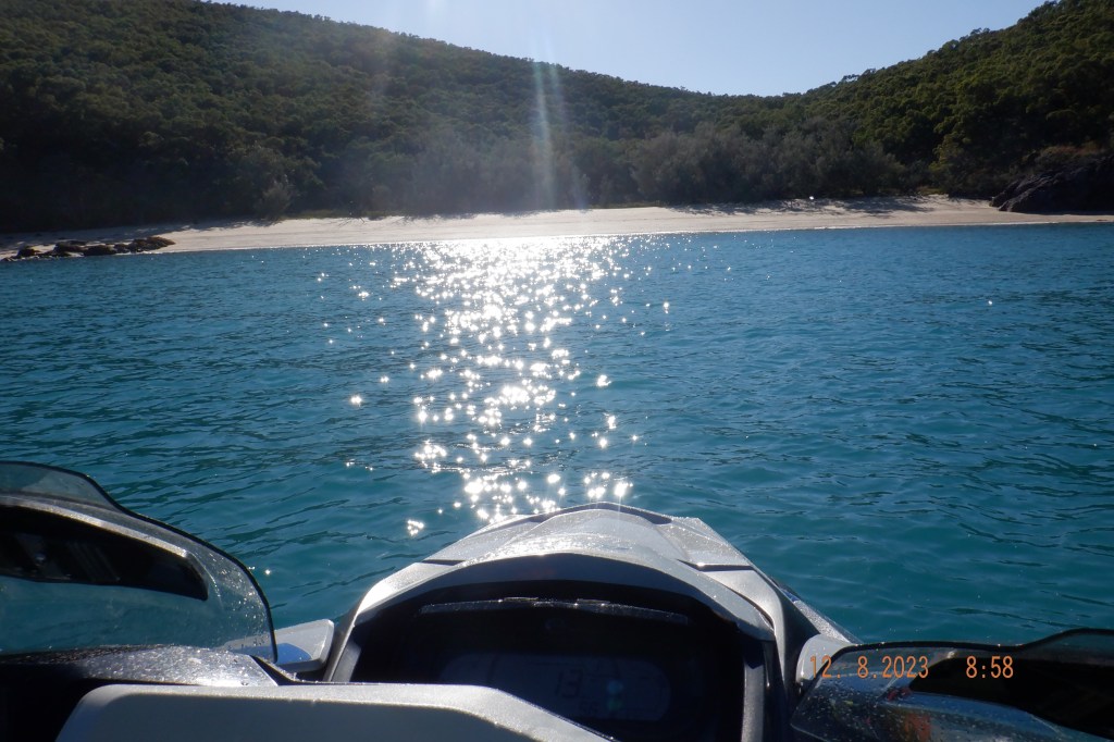
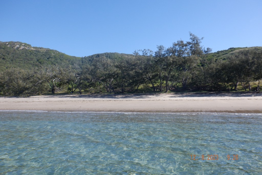
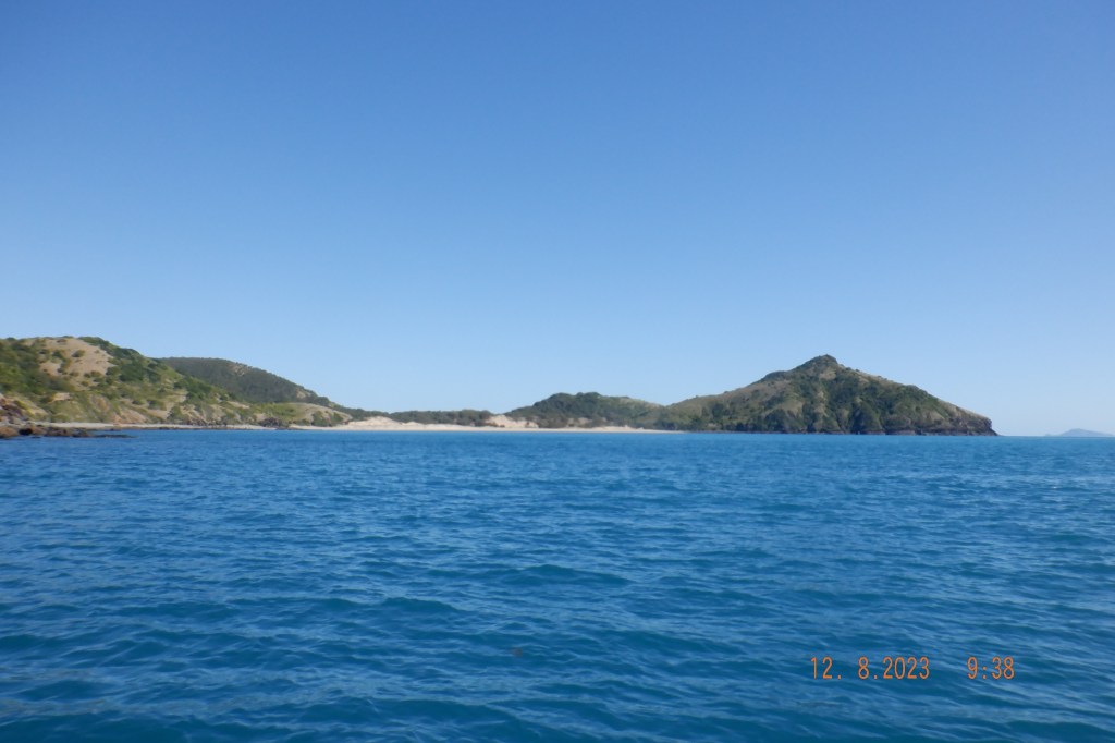
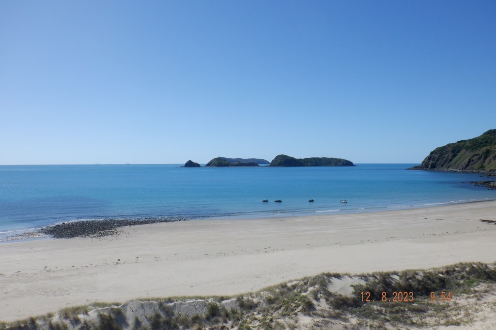
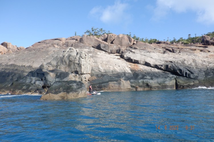
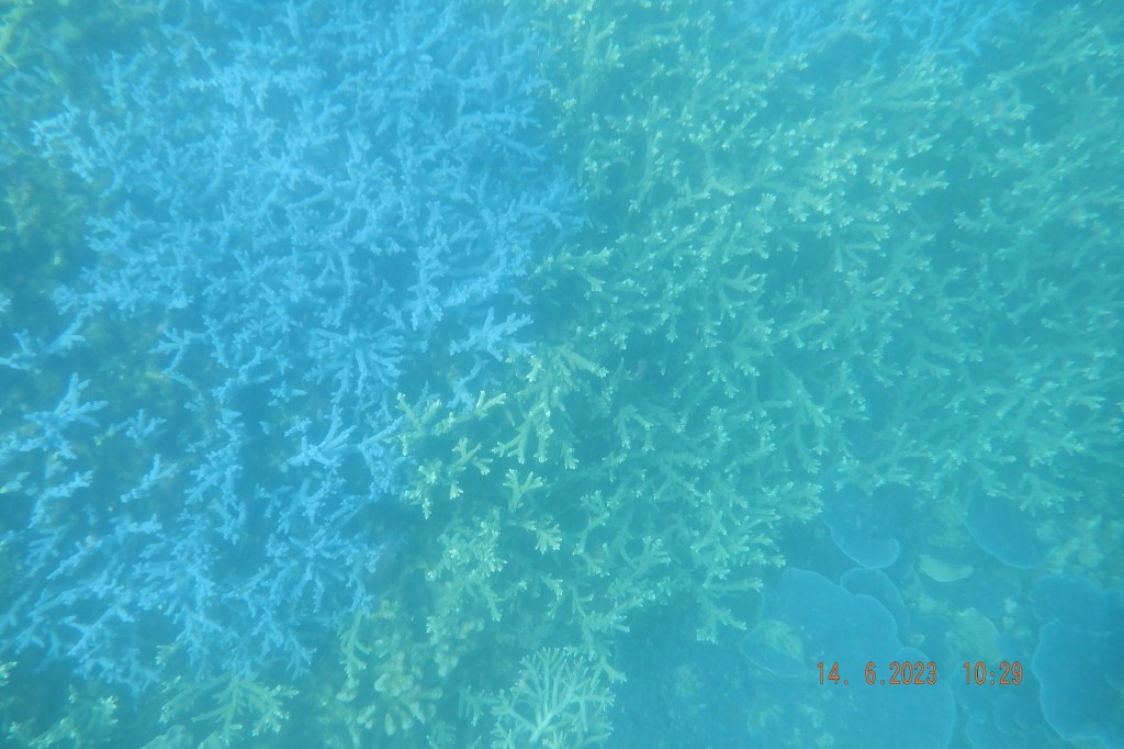
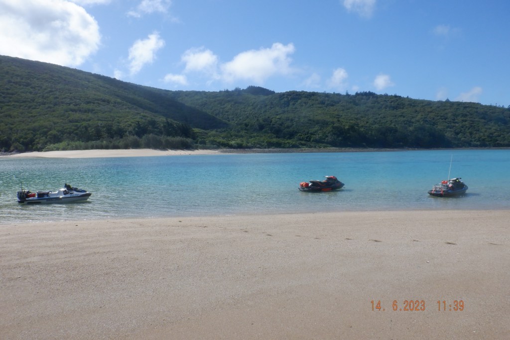
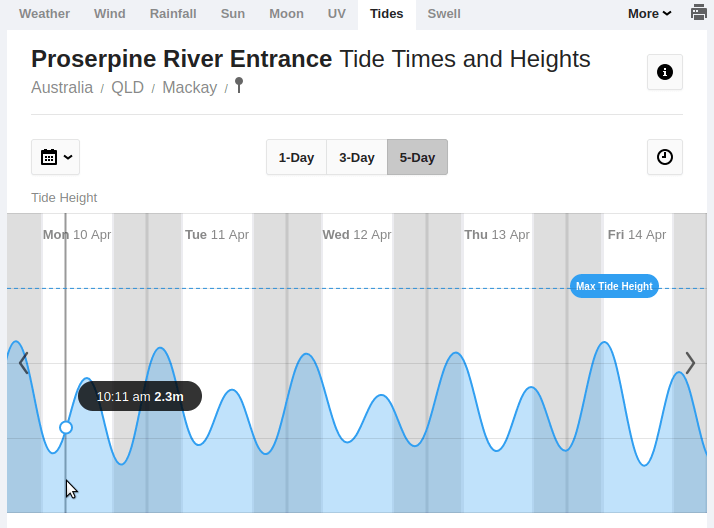
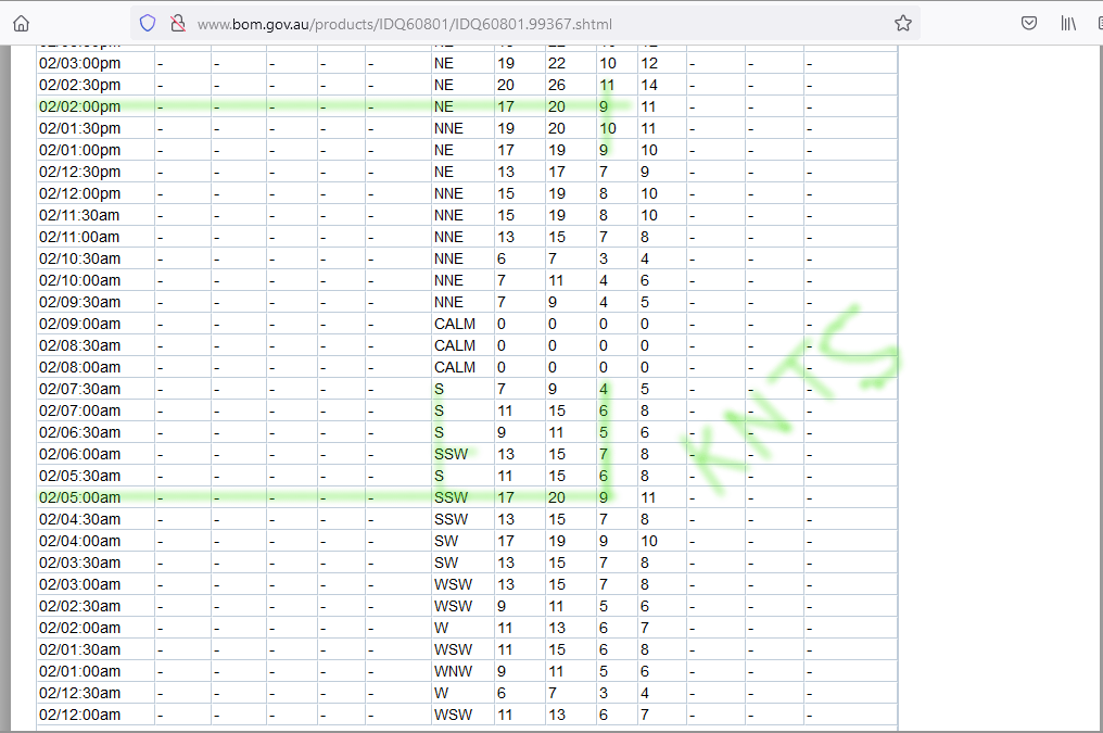
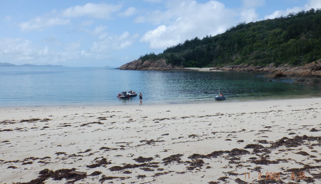
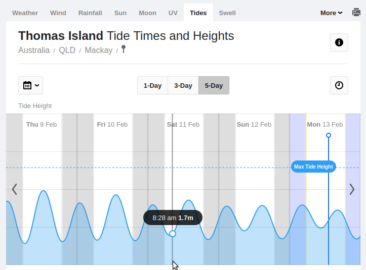
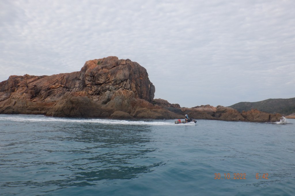
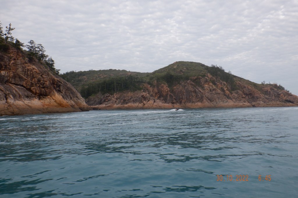
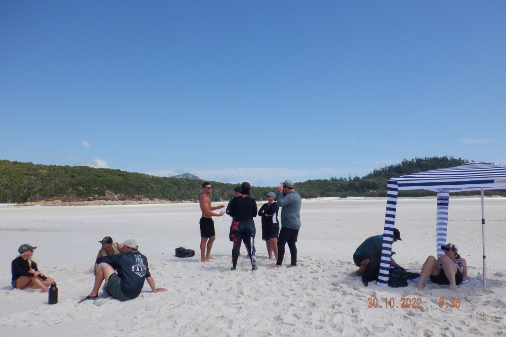
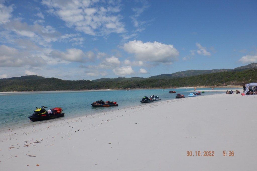
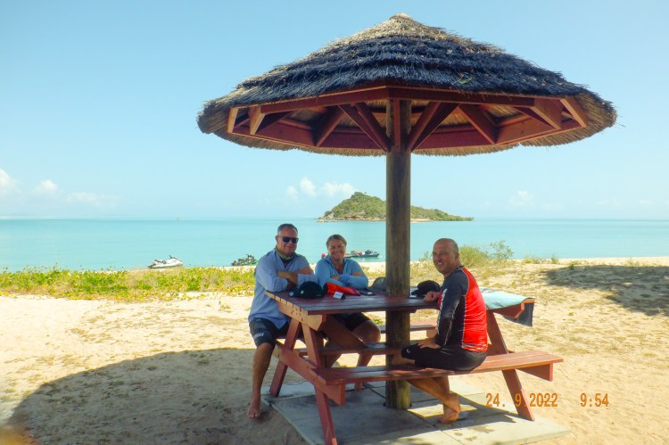
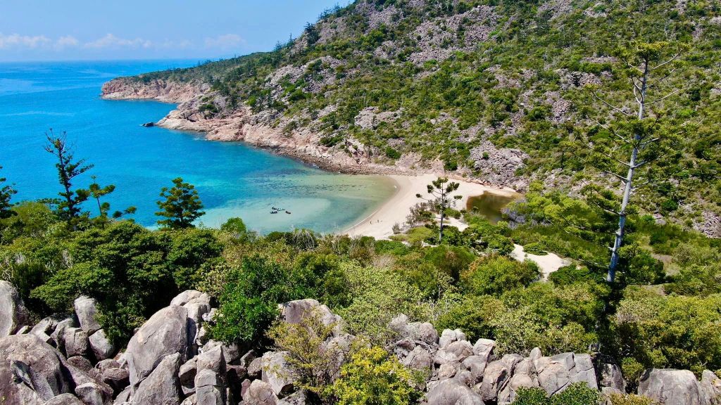
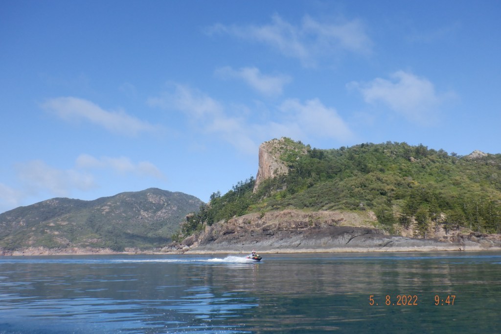
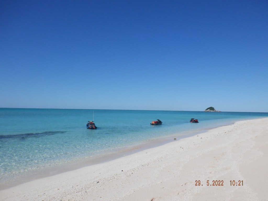
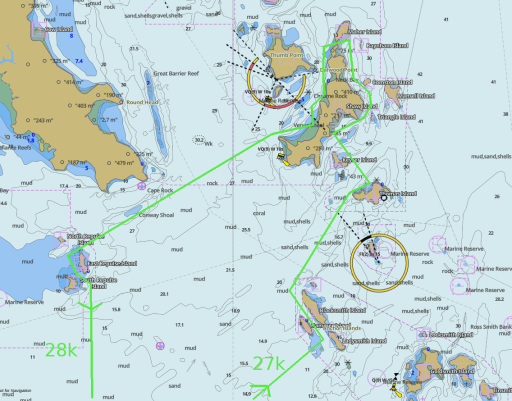
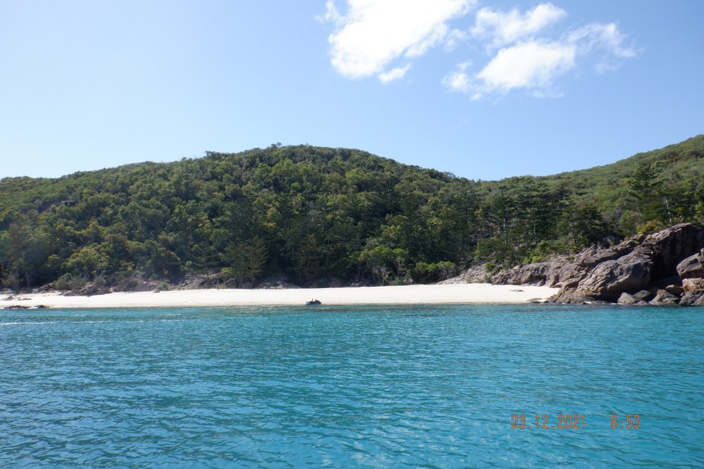
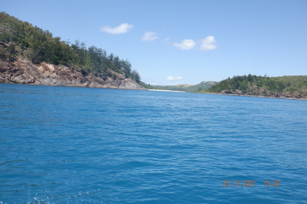
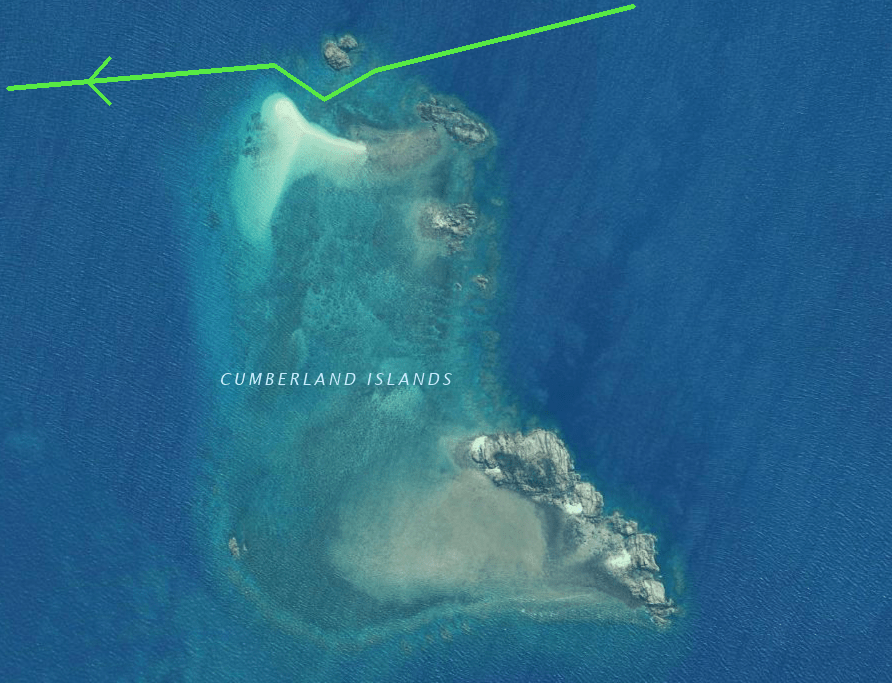
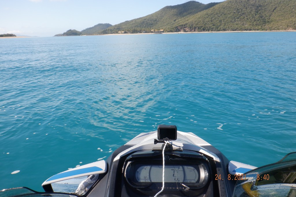
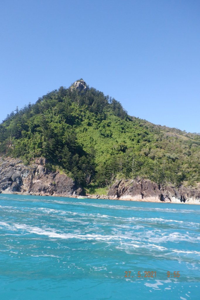
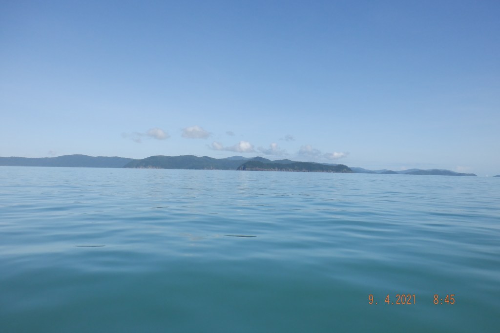
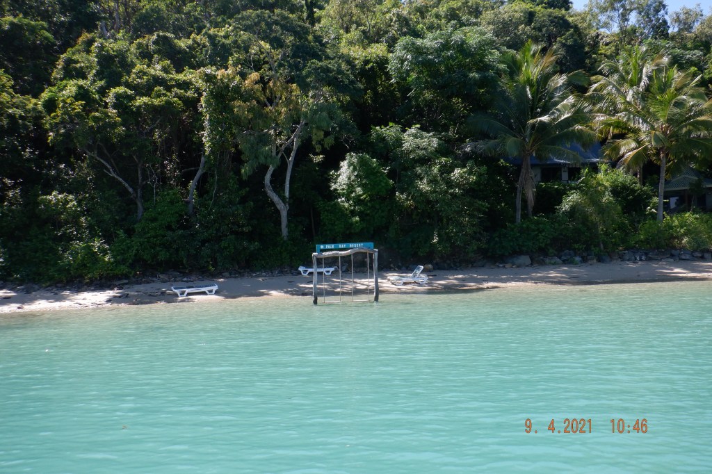
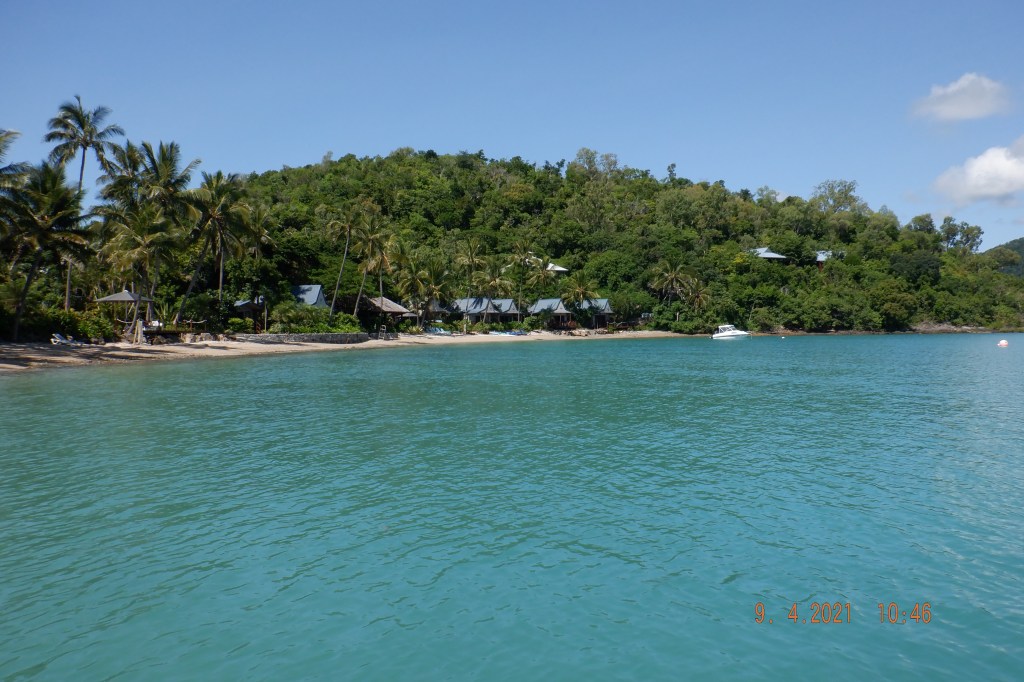
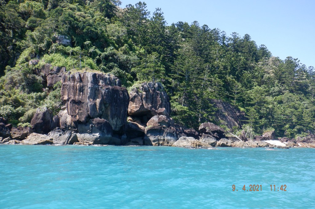
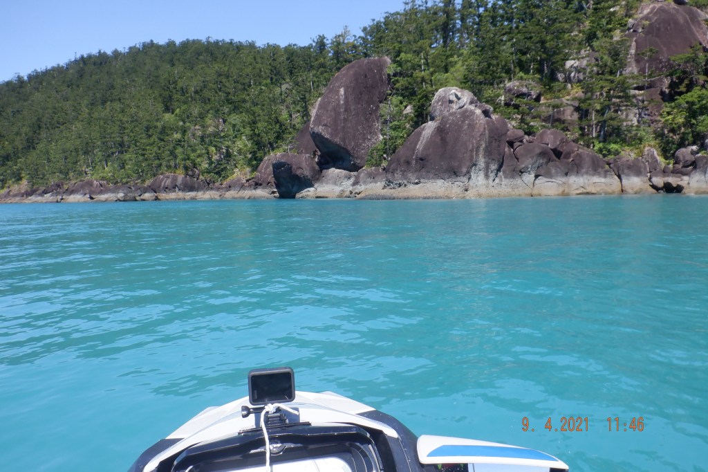
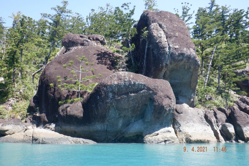
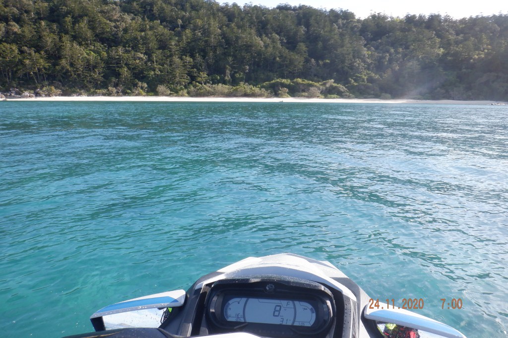
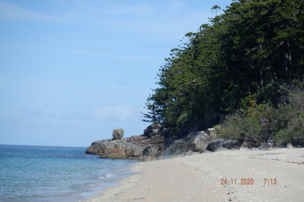
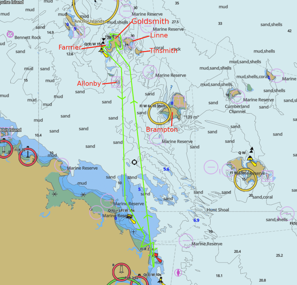
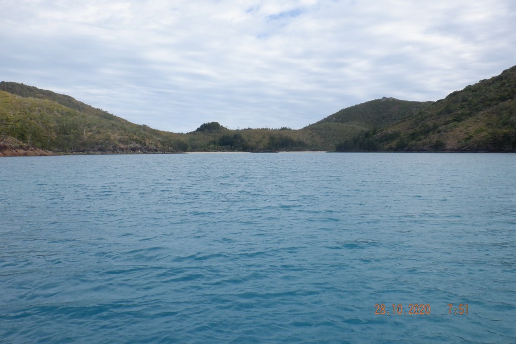
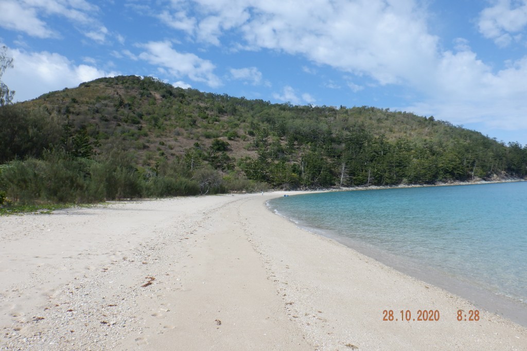
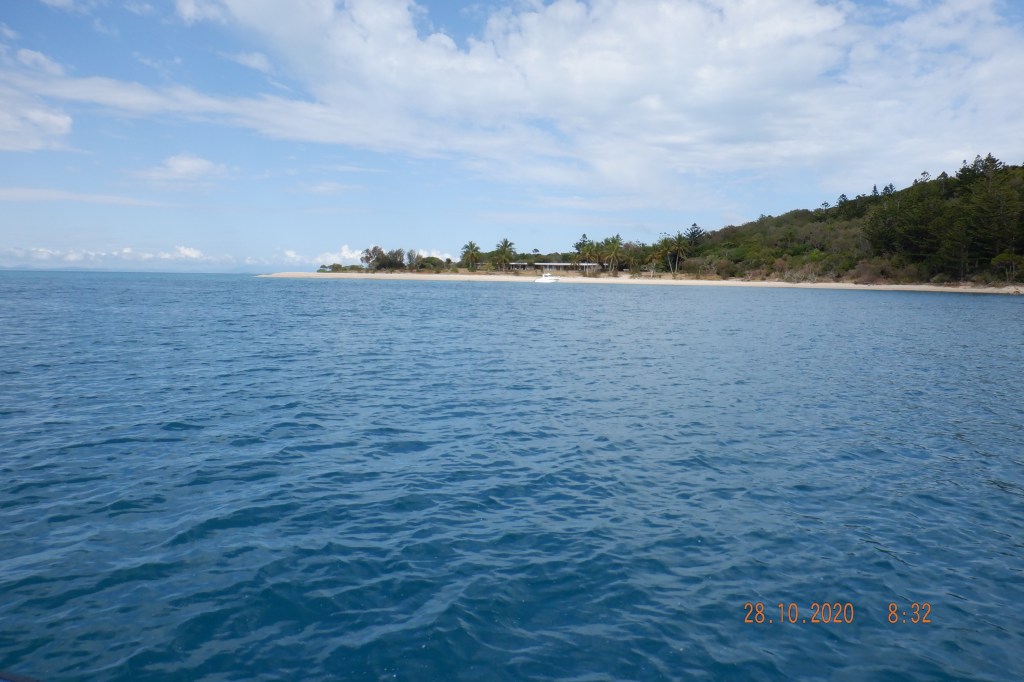
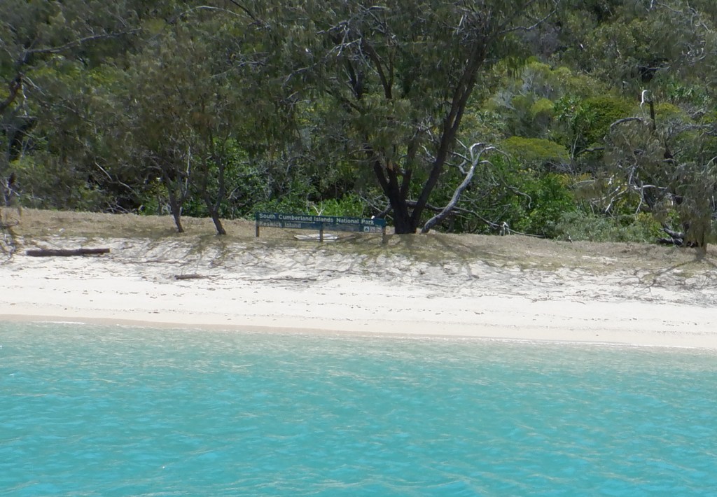
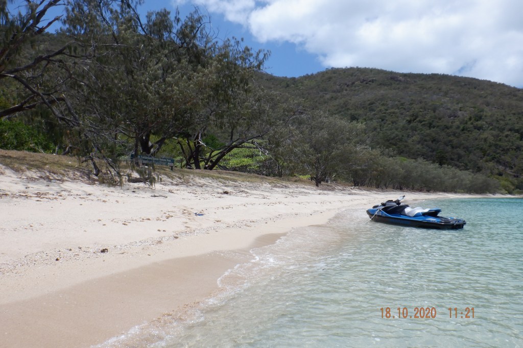
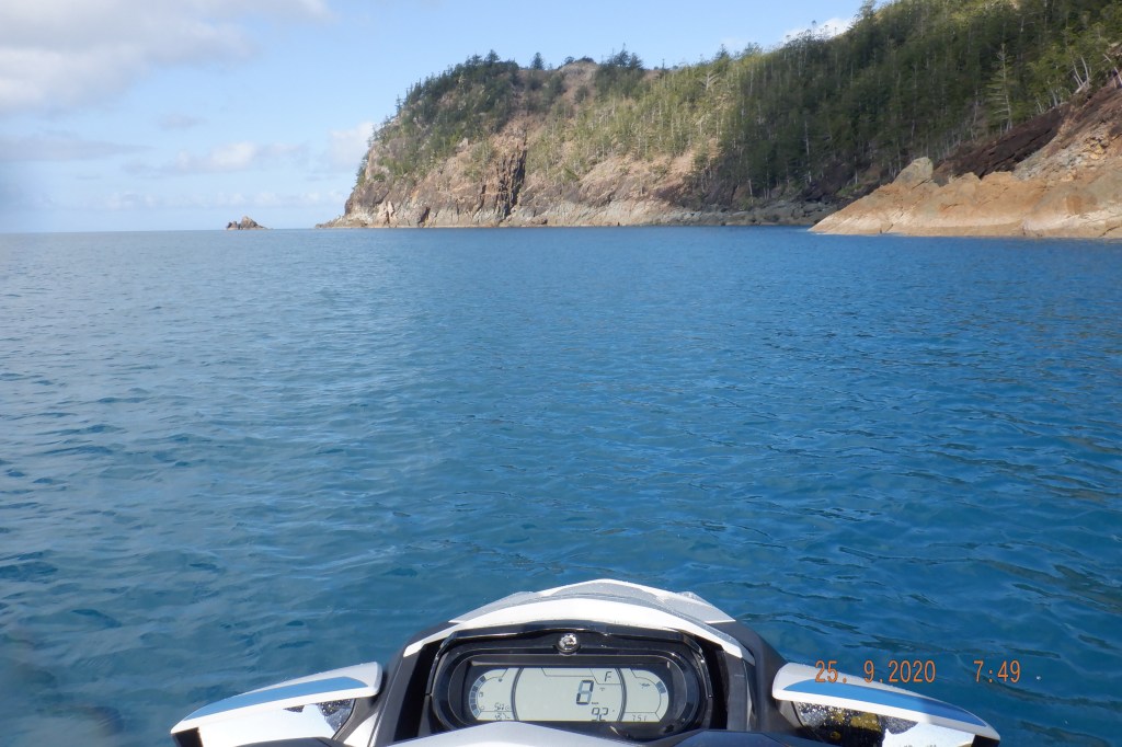
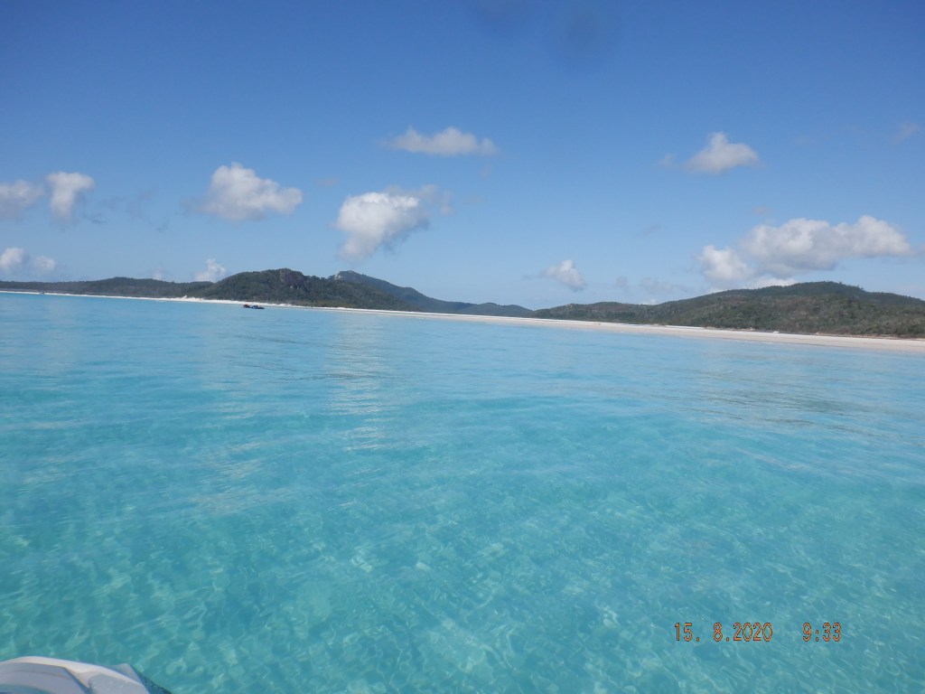
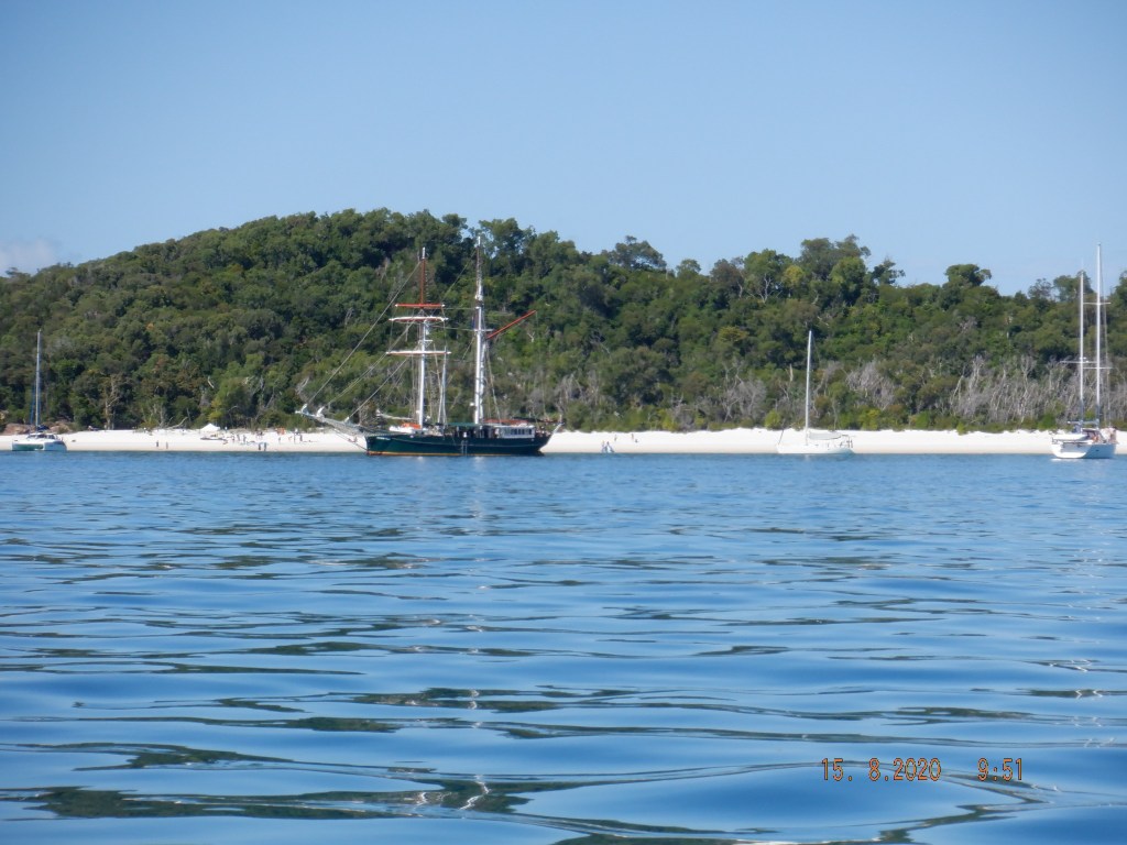
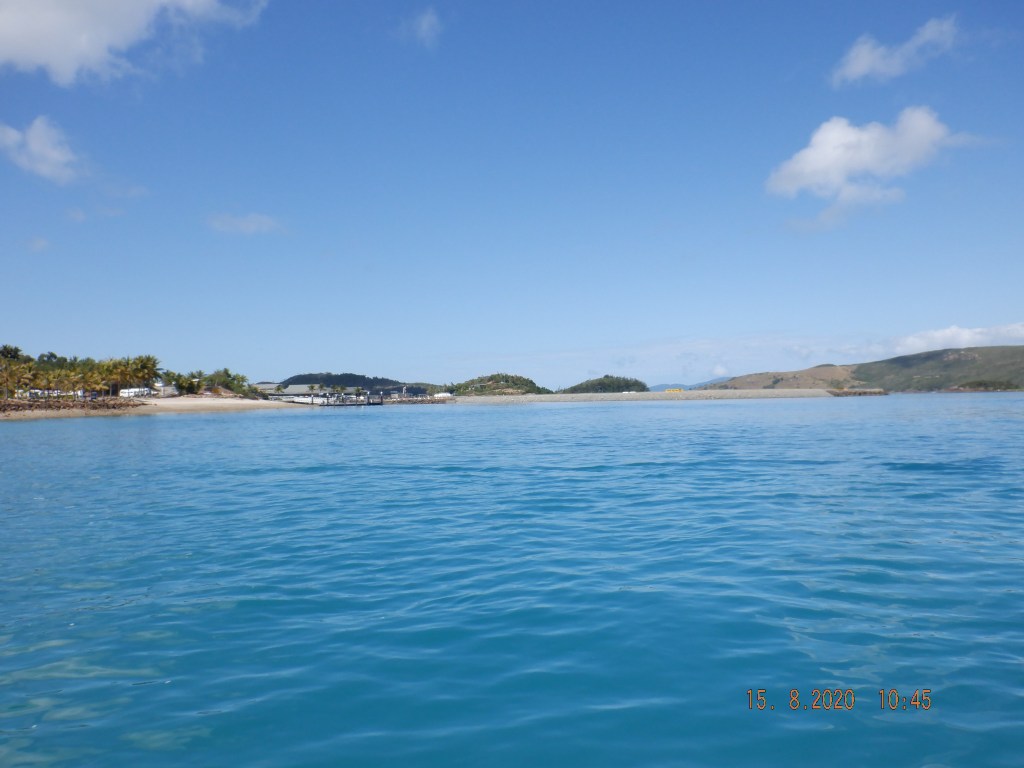
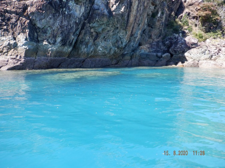
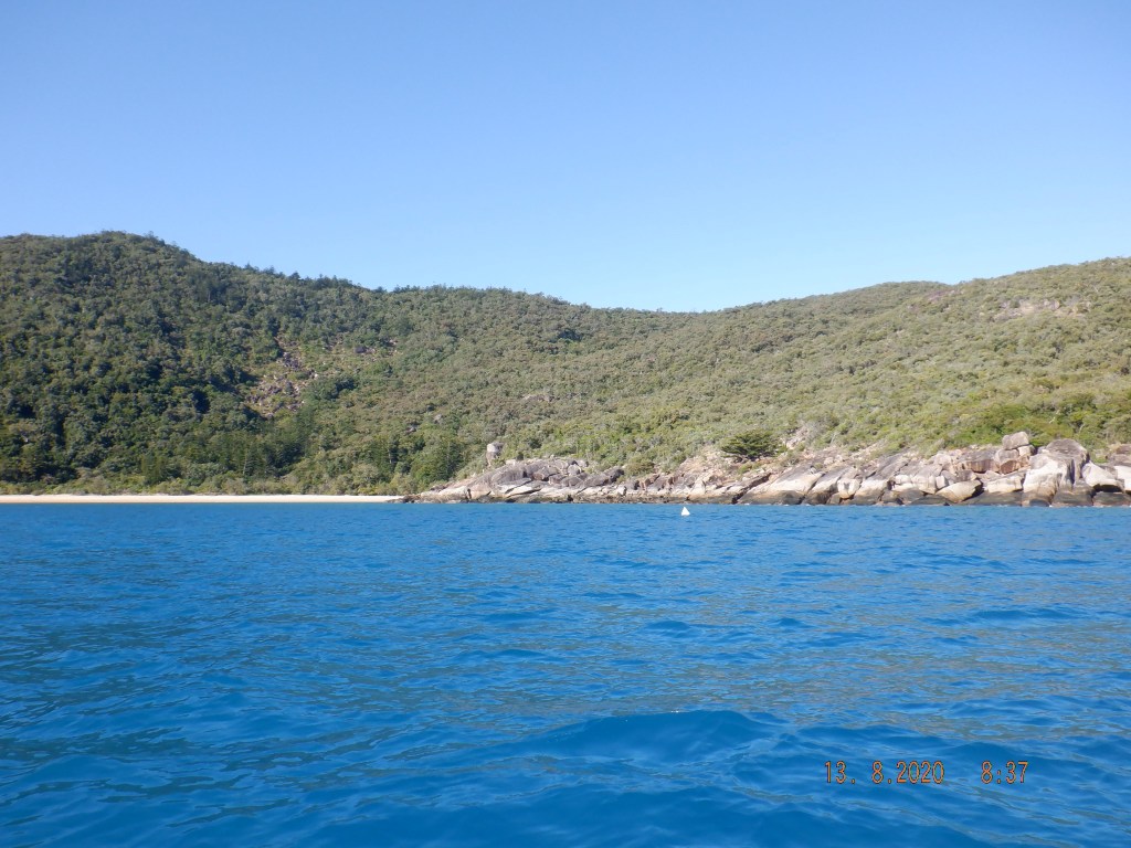
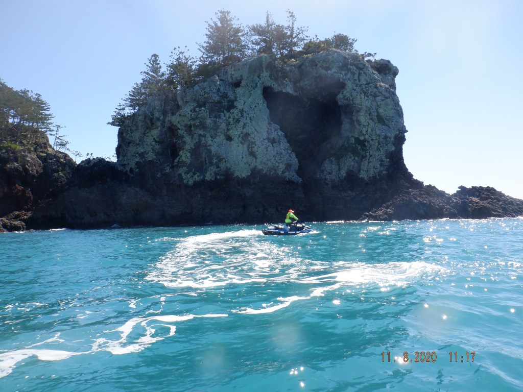
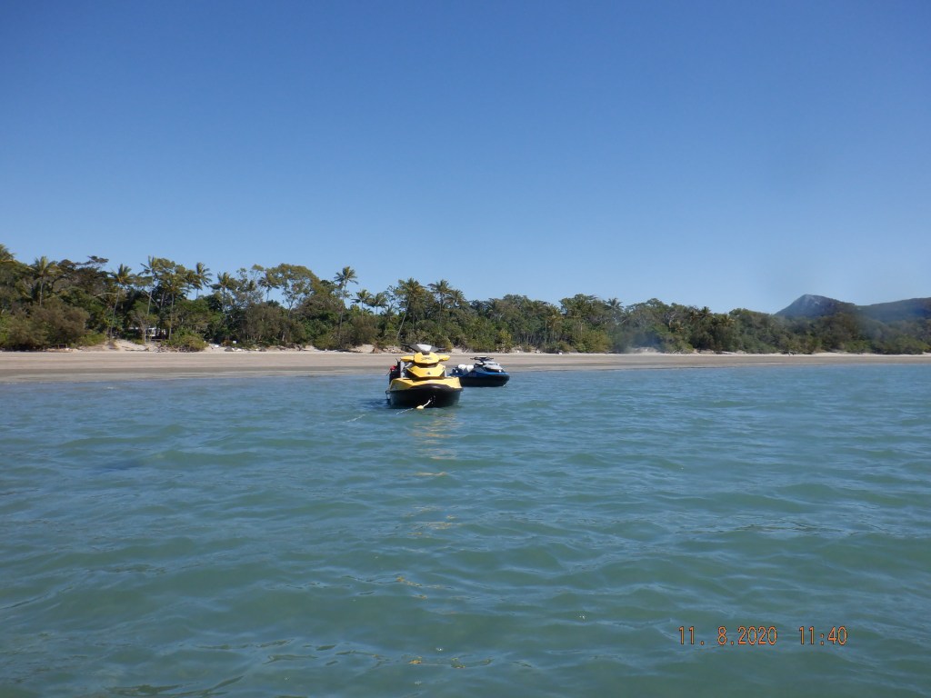
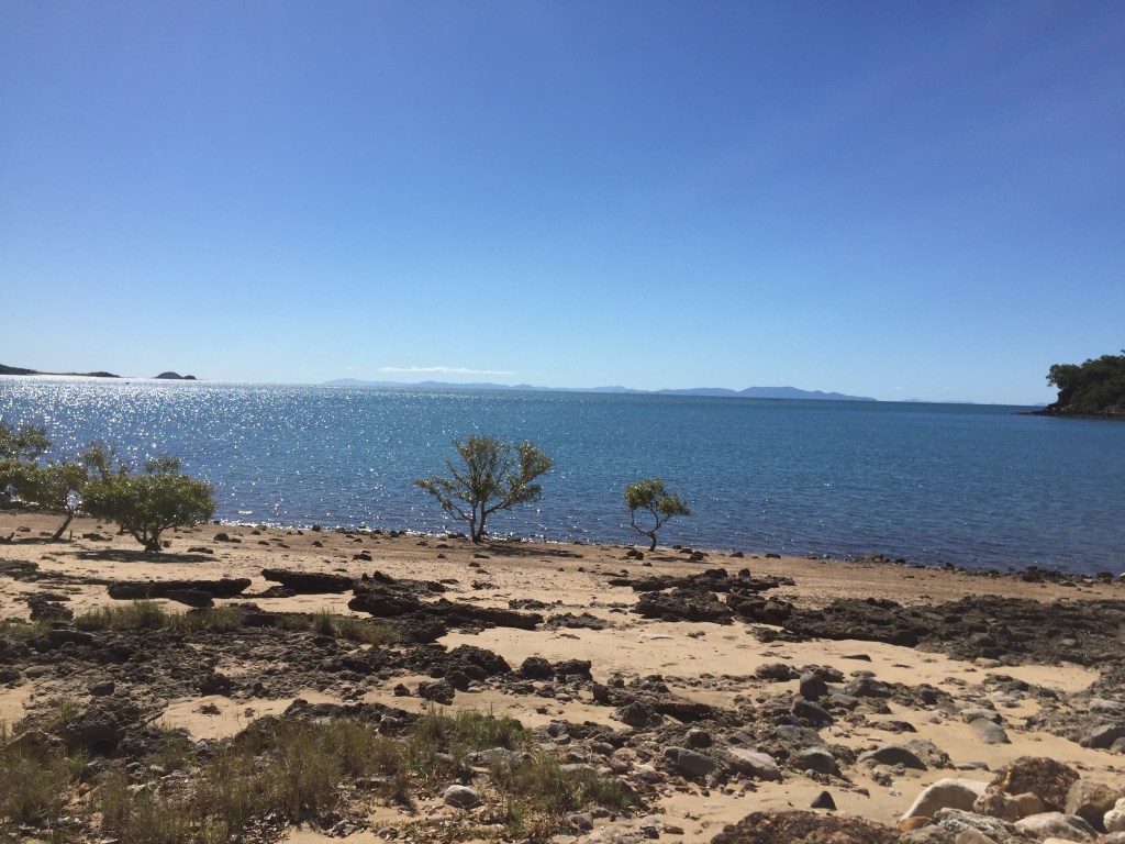
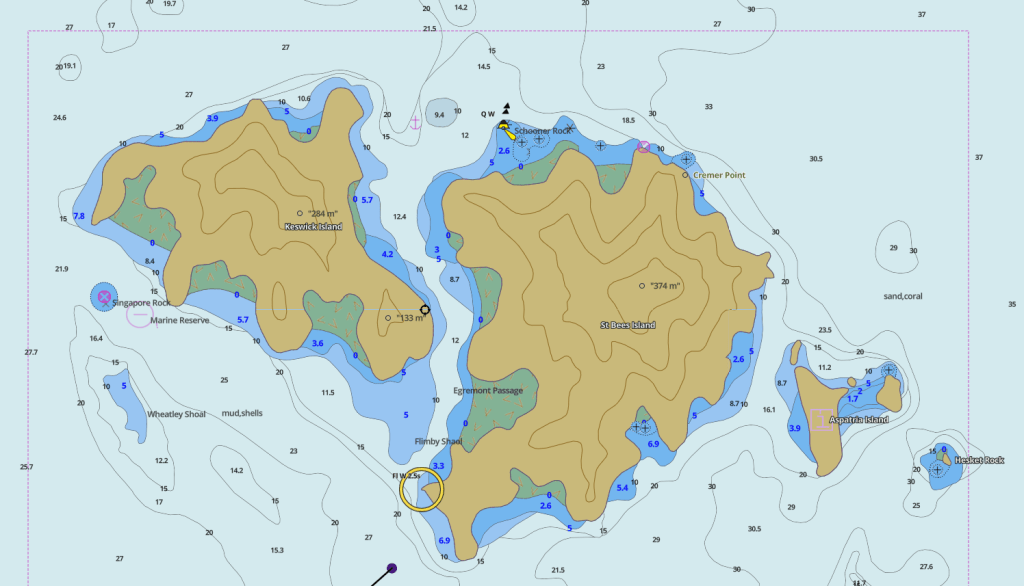
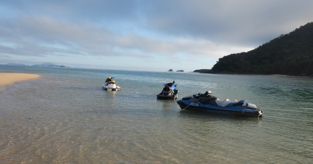
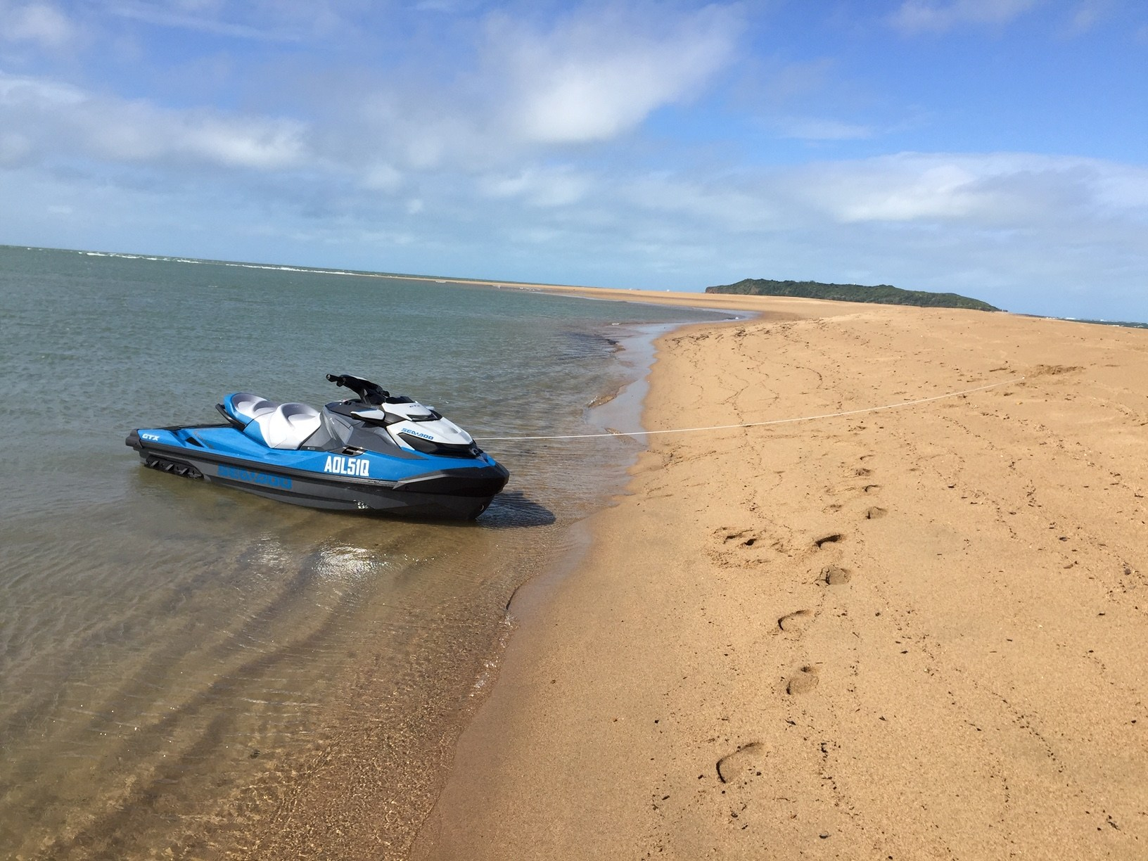
Making our way around Fitzlan Island that I hadnt passed in years along the bottom of Whitsunday up through Solway Passage the southern entrance into Whitehaven Beach. All on a flat sea. There would of only been about 6 vessels anchored off this popular beach area. Continuing north up the beach without another vessel in sight we had that stretch of beach to ourselves so we ran it up to Hill Inlet. We anchored for a spell refueled with our jerries had a bight to eat. At this point my radio is beeping continually my Garmin screen is flickering ? auxiliary battery has carked it ? Investigation needed back home so turned both off.

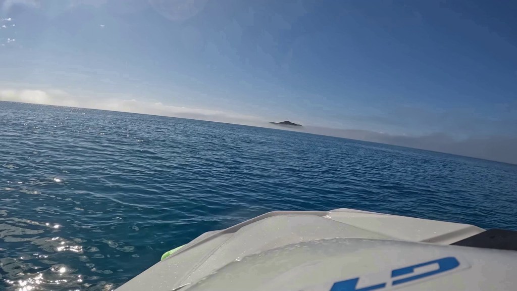
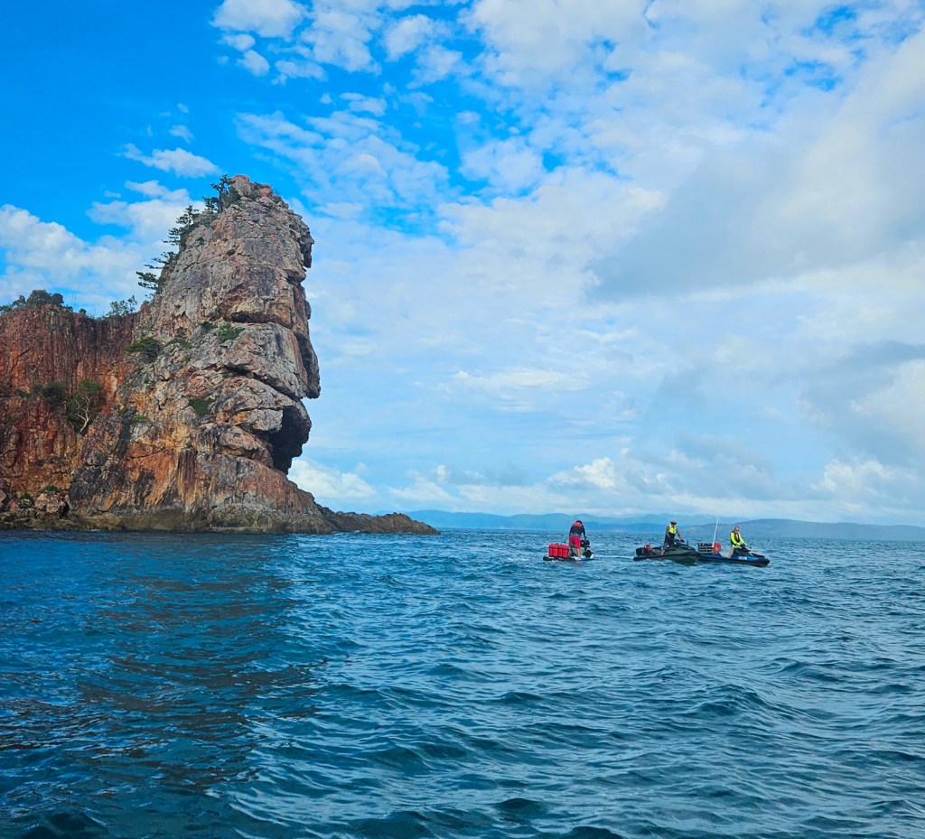
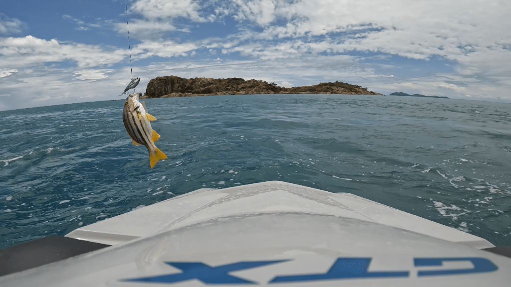
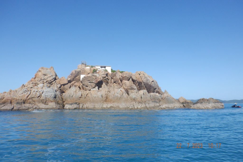
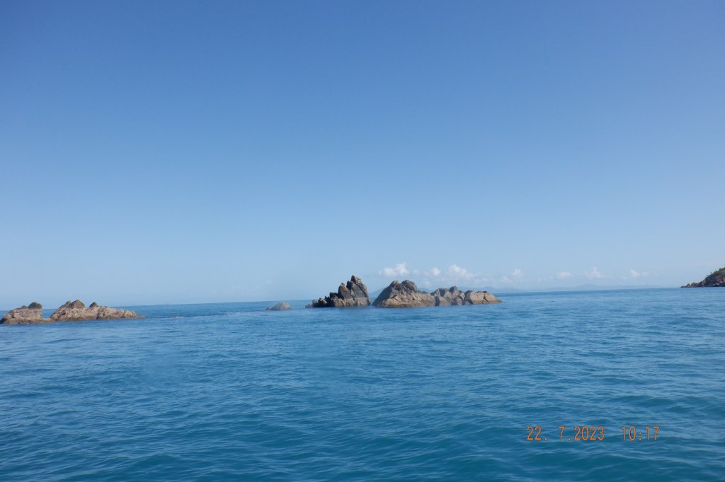
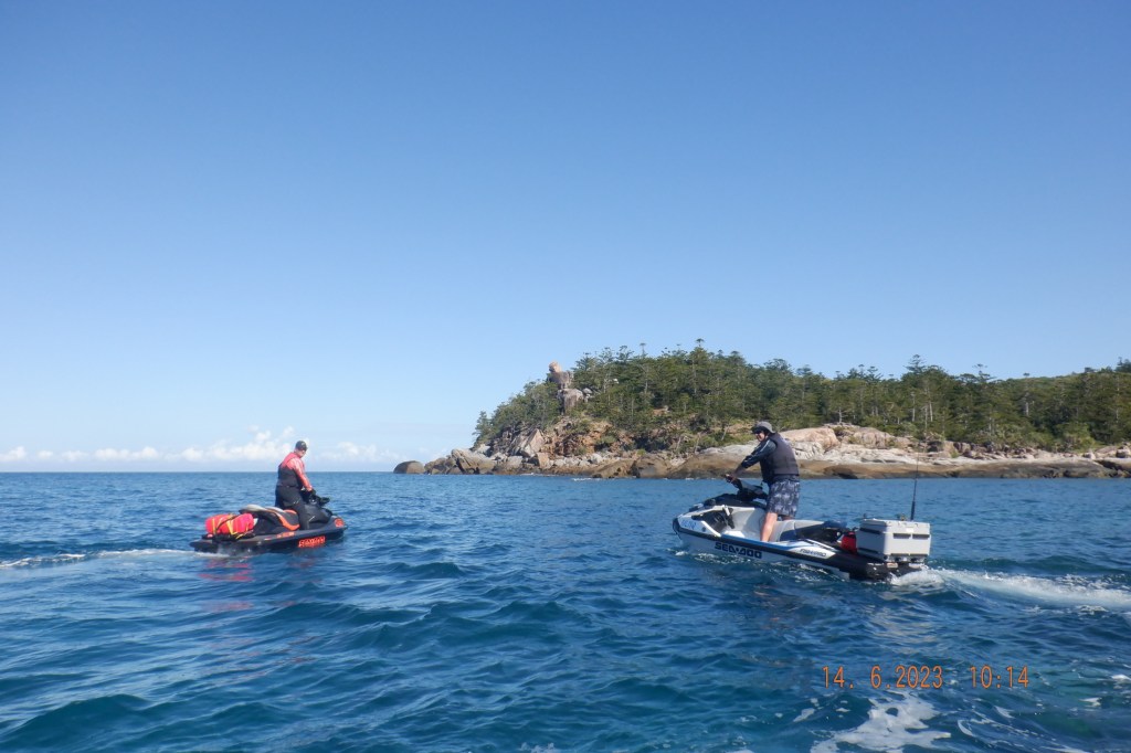
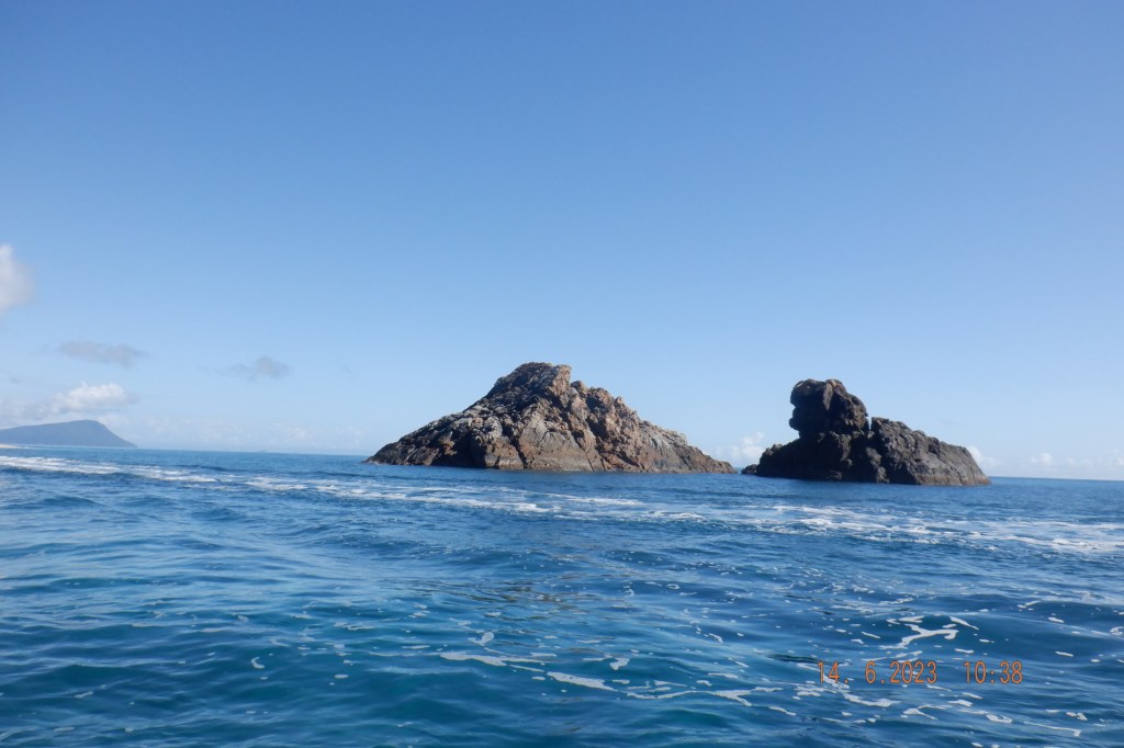
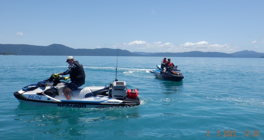
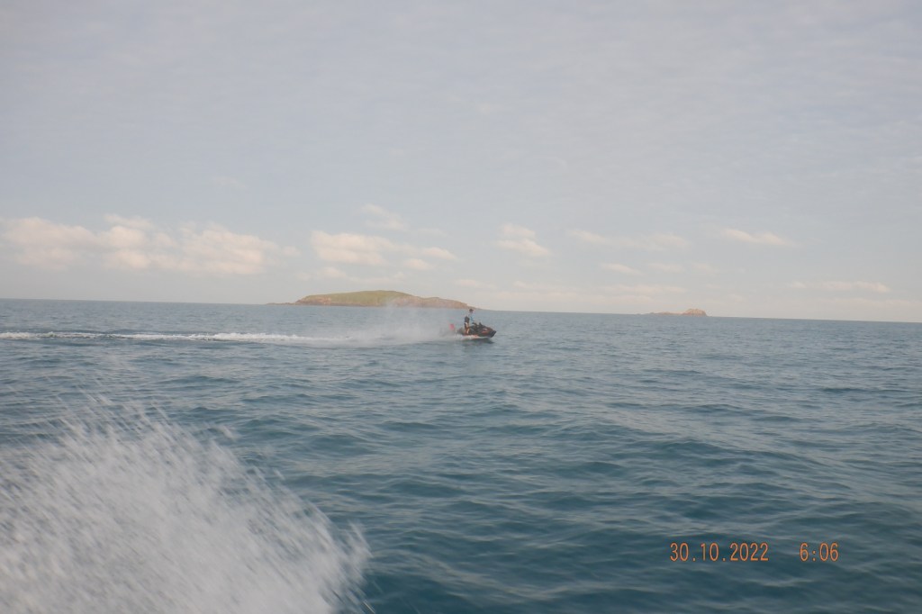
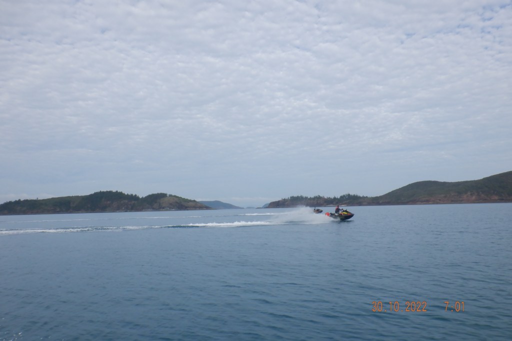
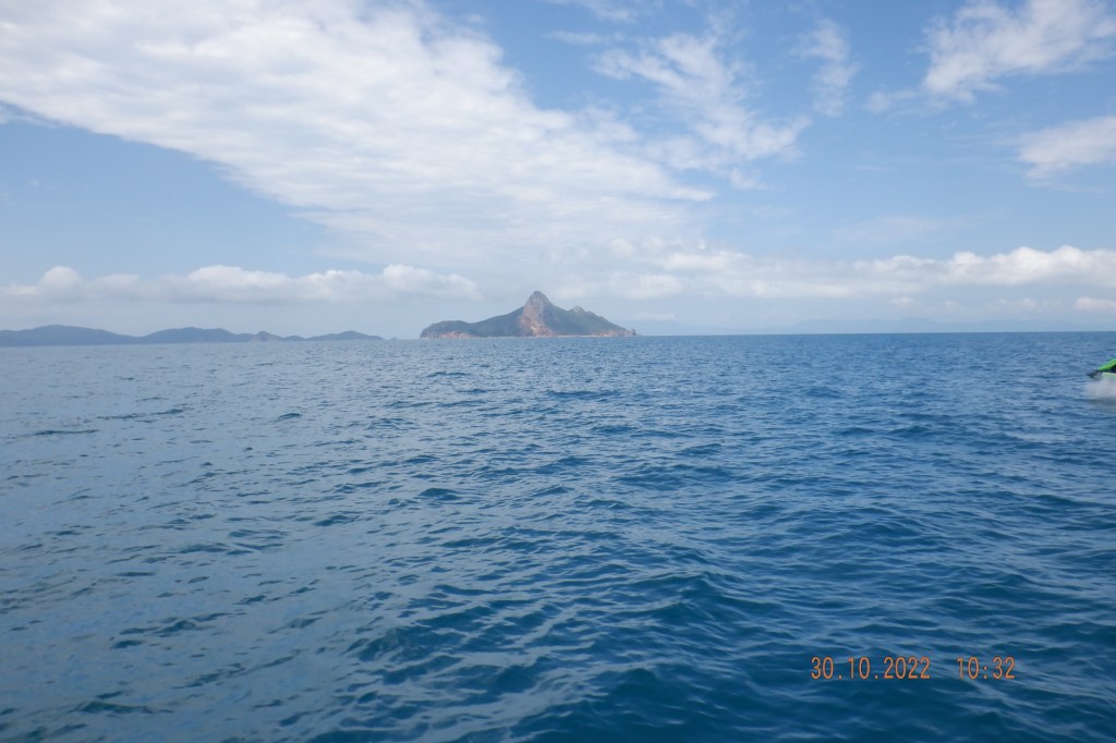
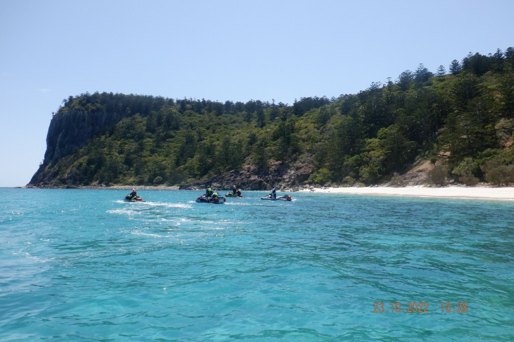
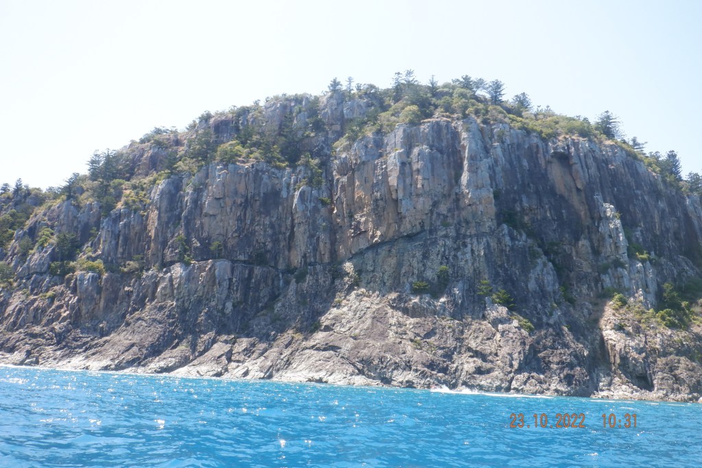
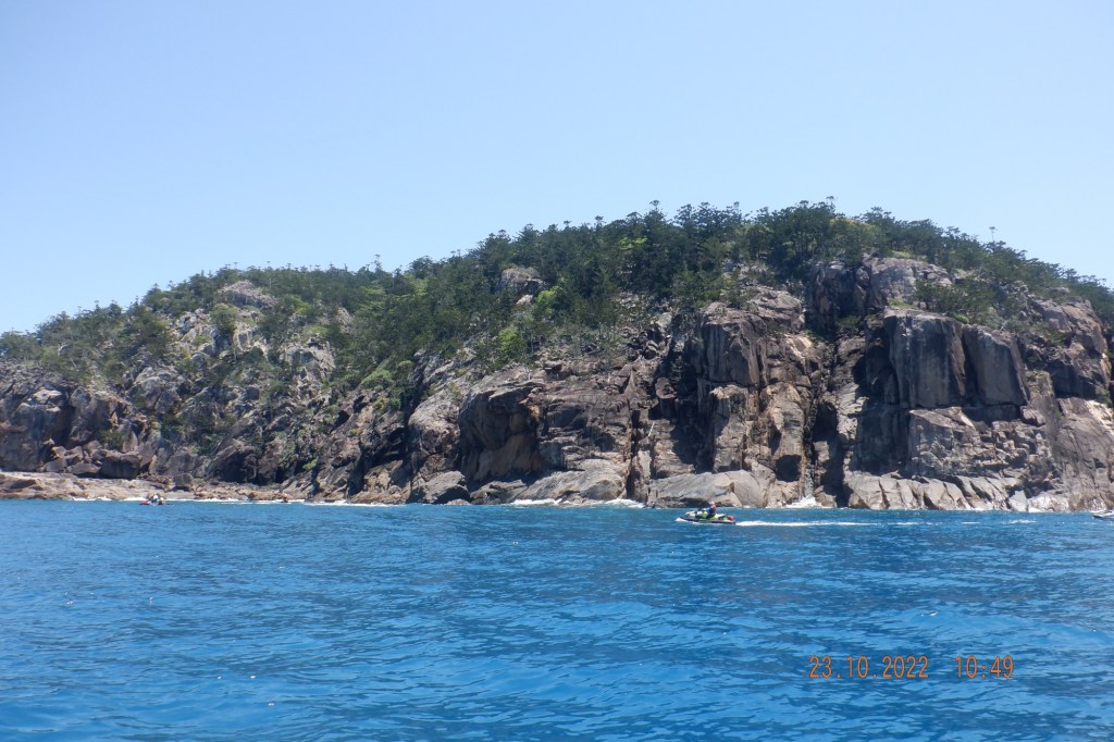
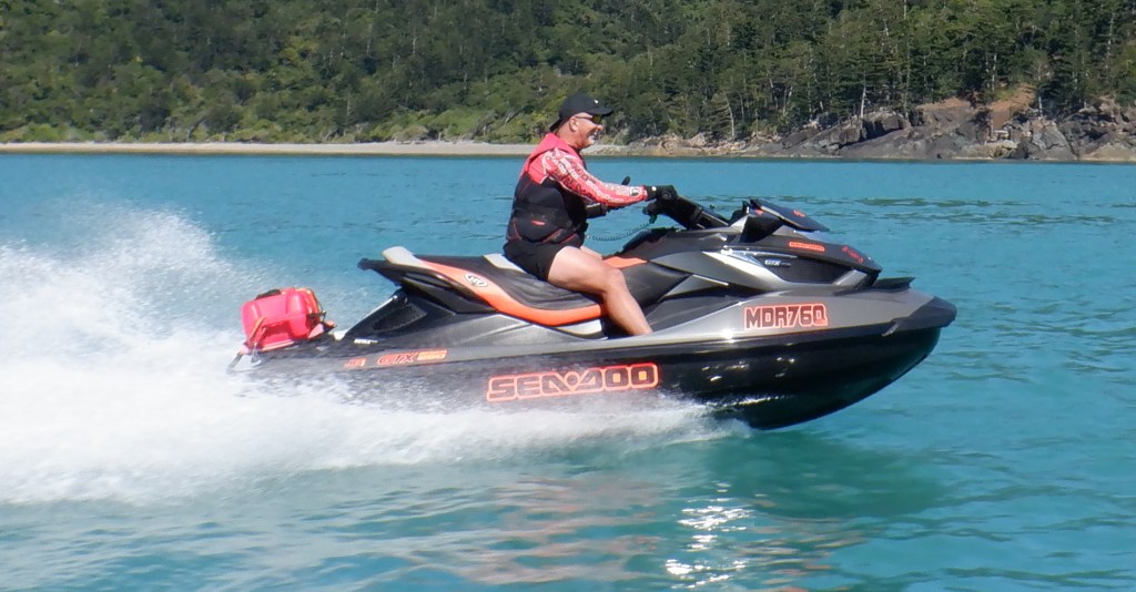
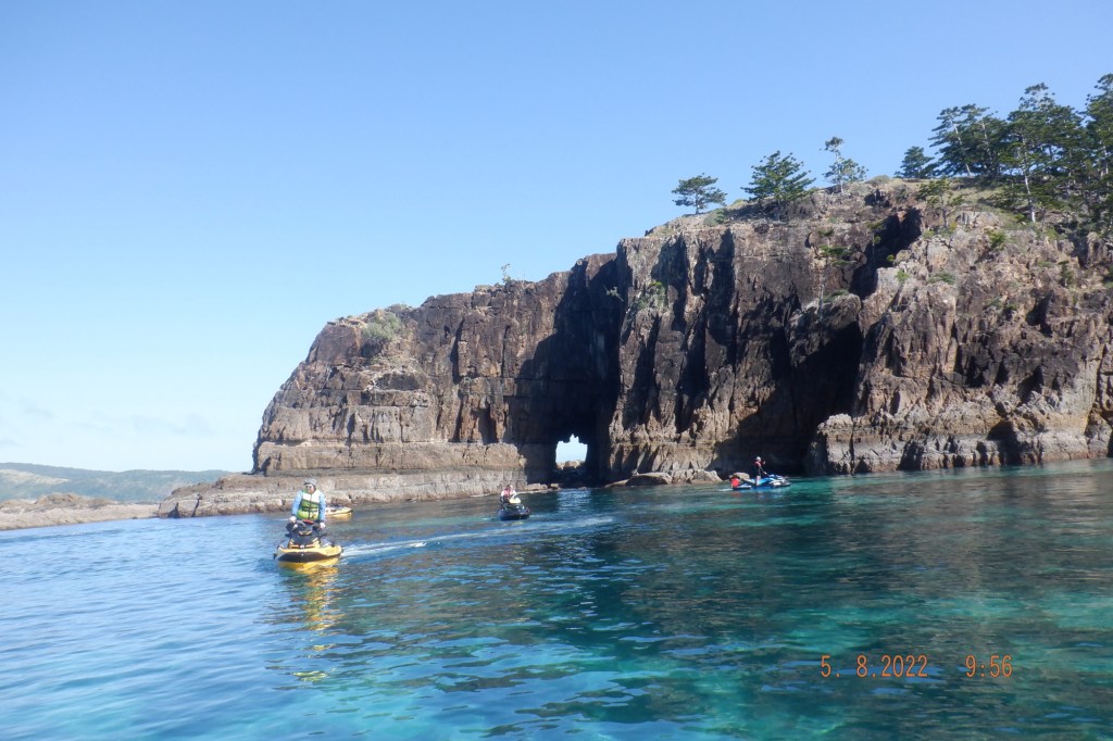
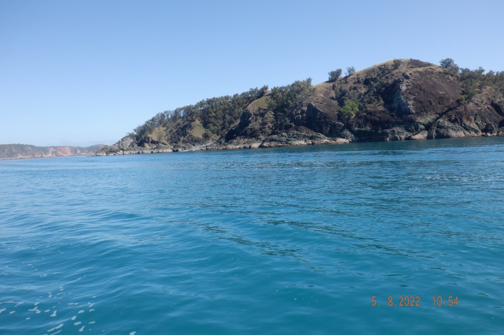
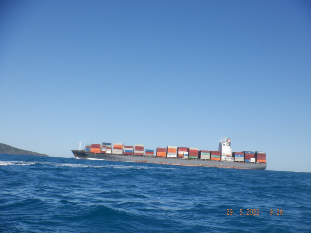
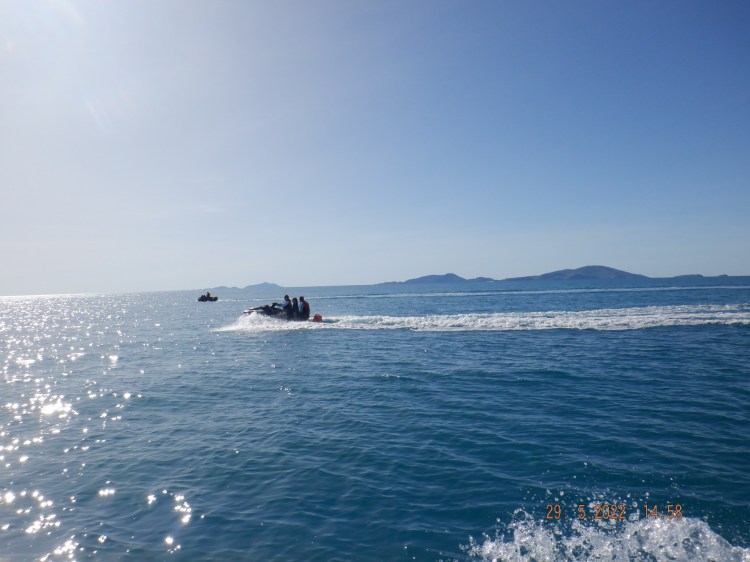
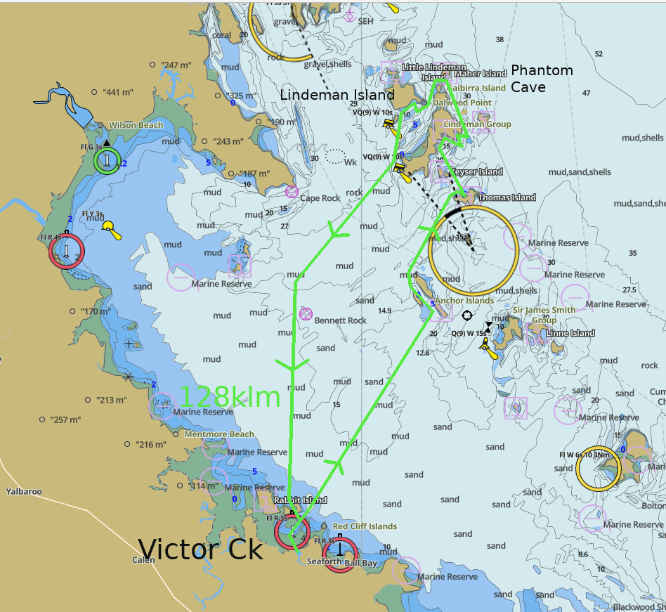
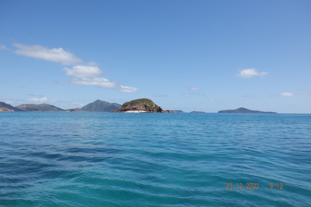
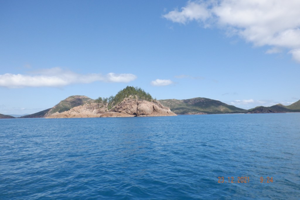
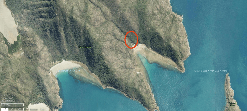
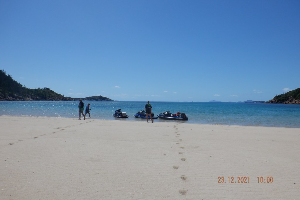
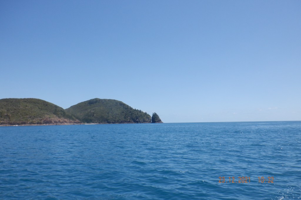
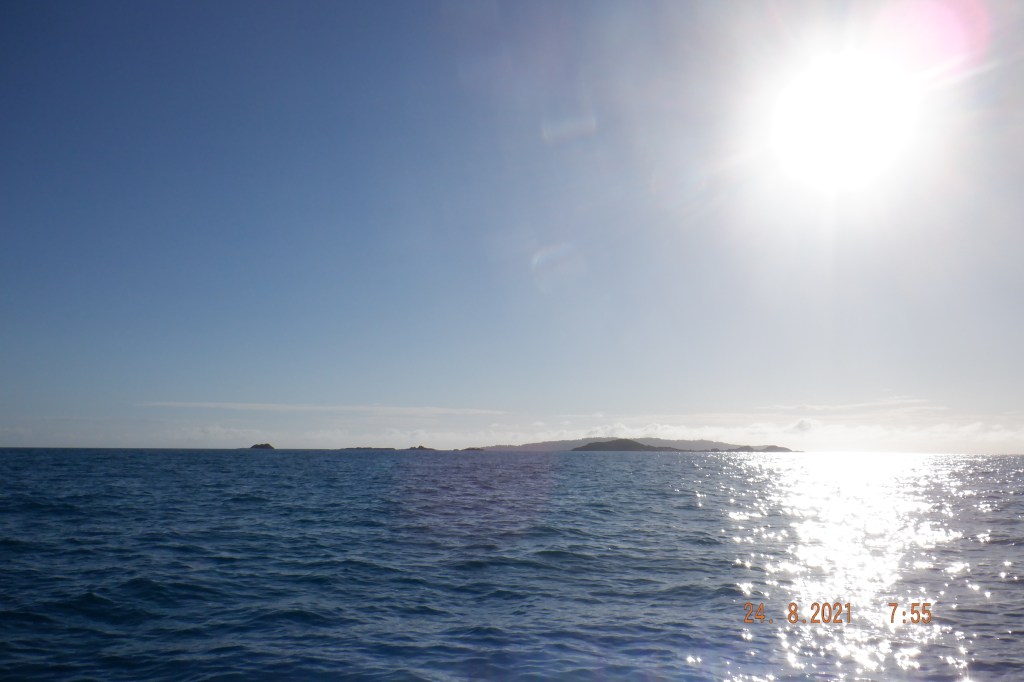
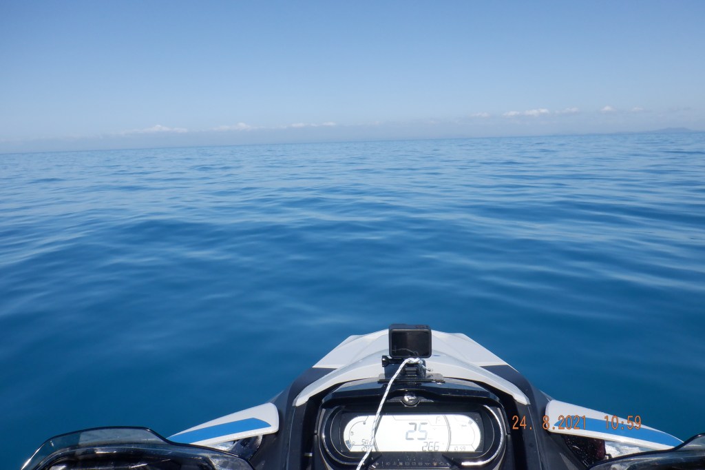
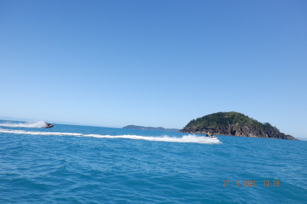
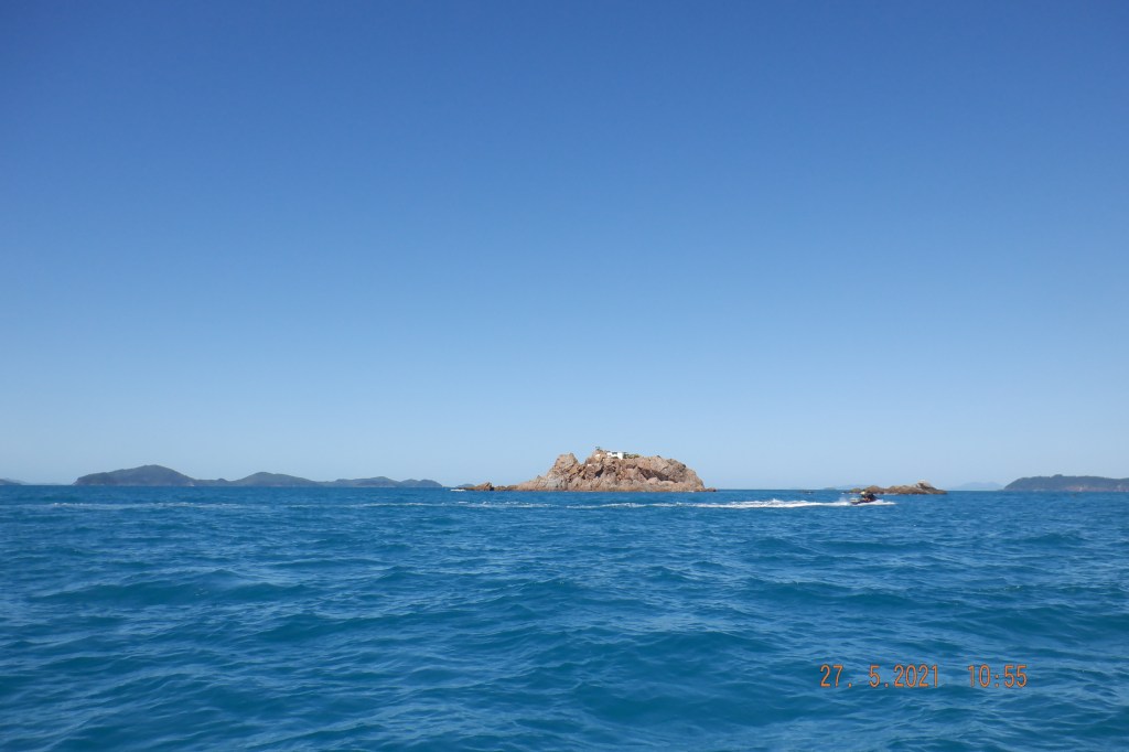
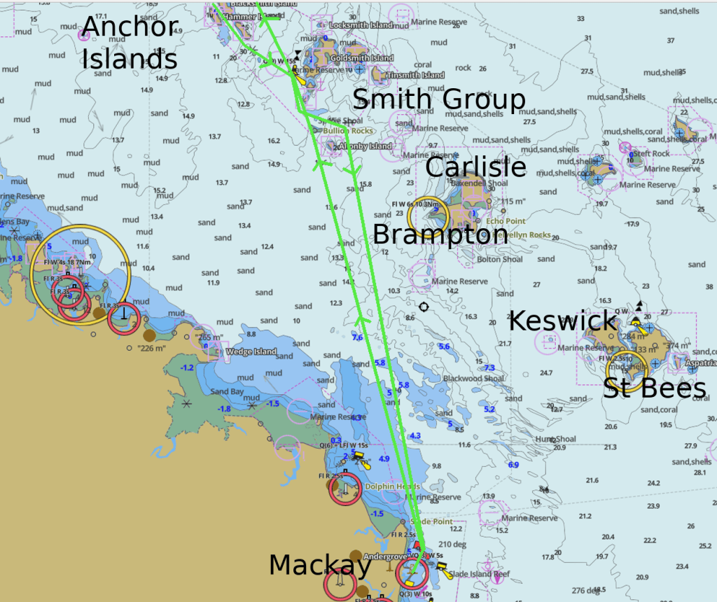
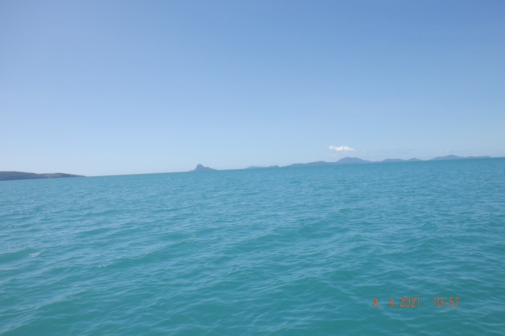
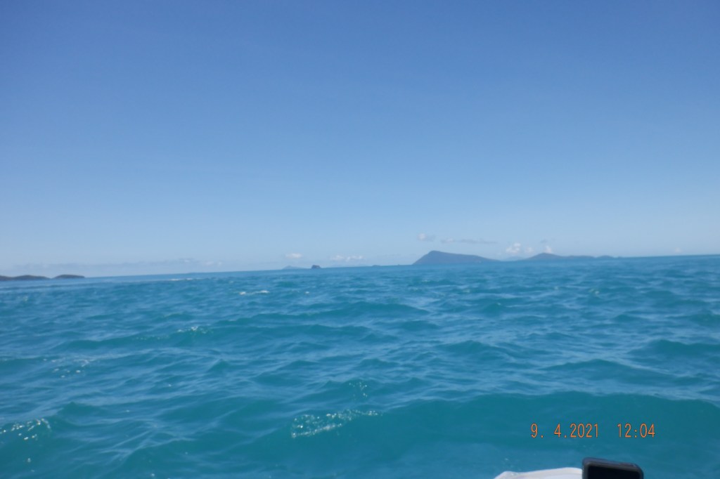
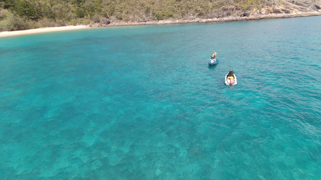
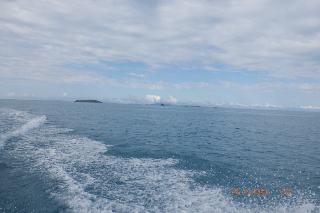
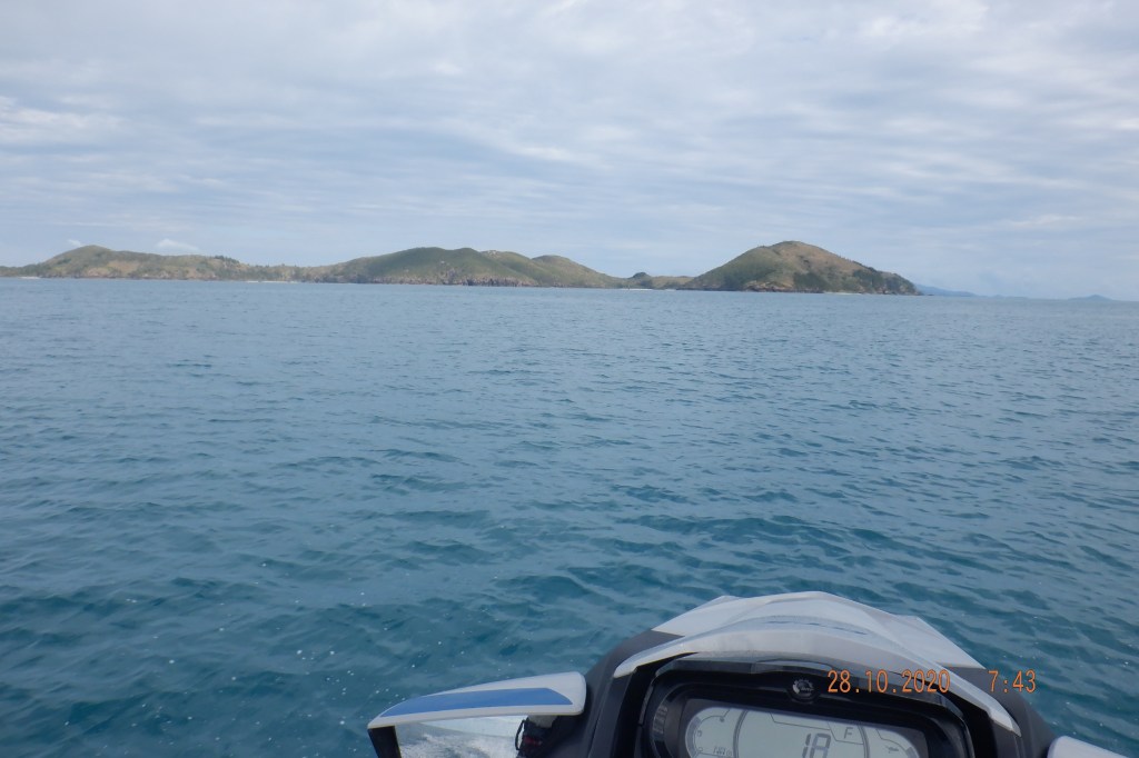
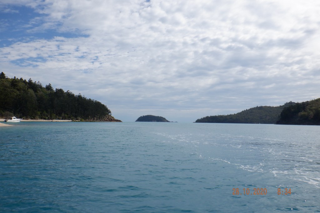
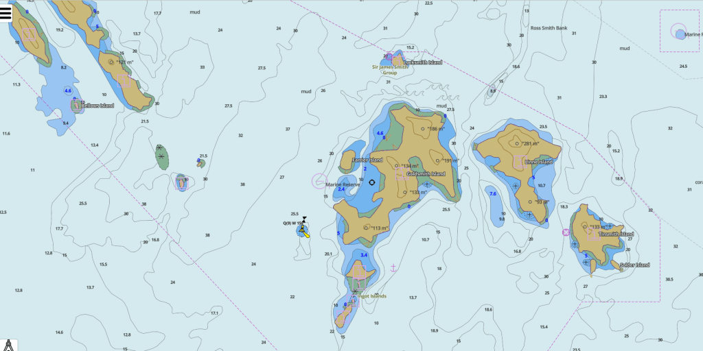
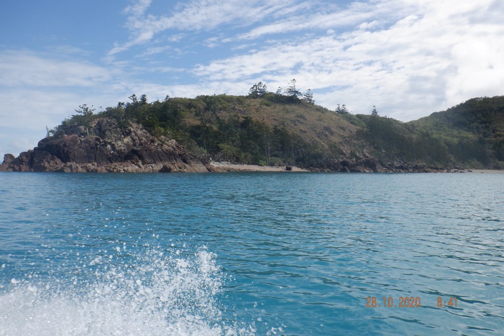
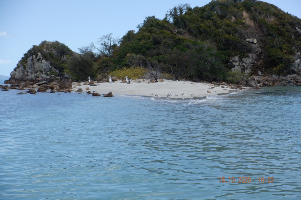
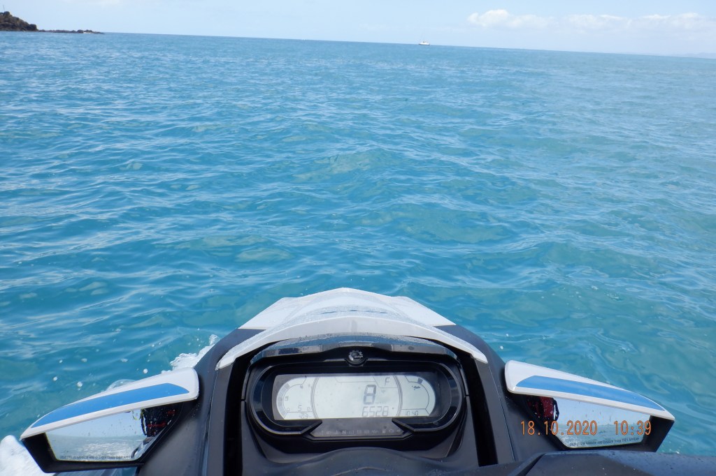
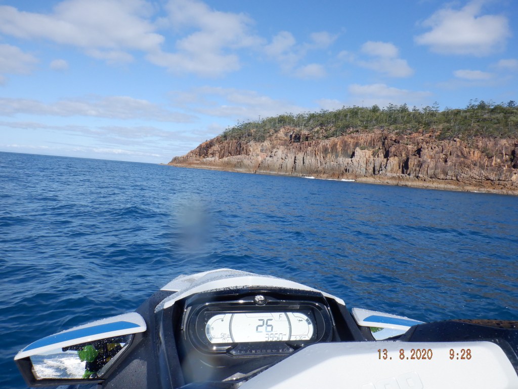
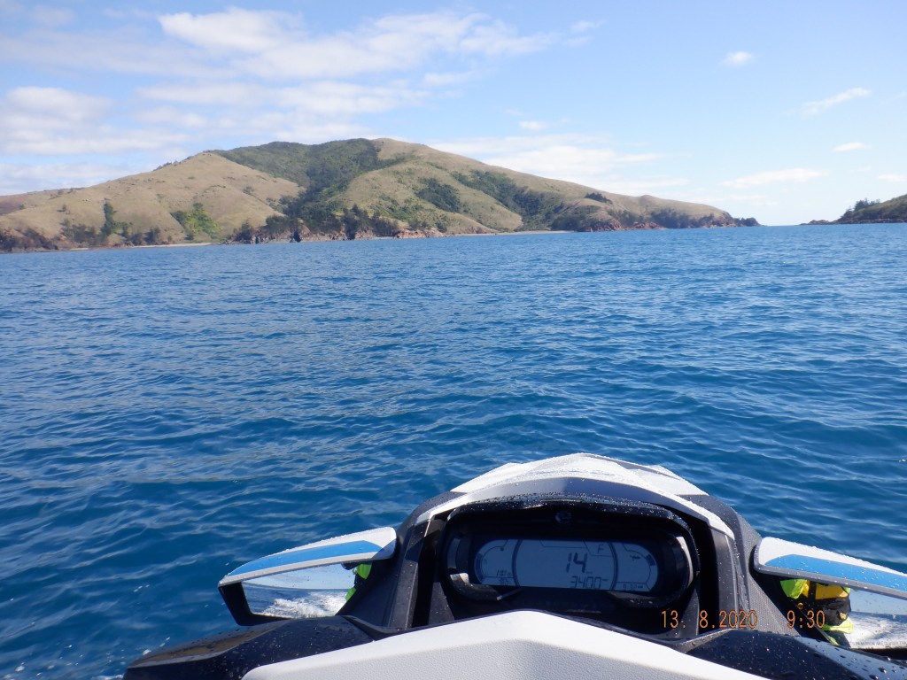
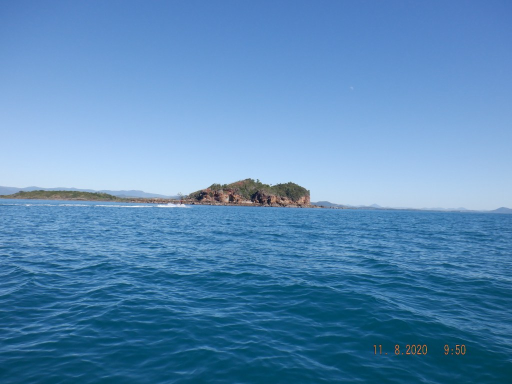
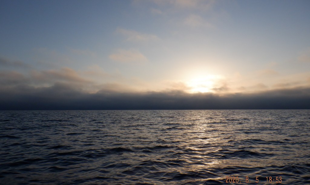
1030am we head off to give the Edward Group a drive by. Each of these little islands has boat fishing on it one of being a fishing charter. These Islands are in depths 40m + and enough out of the way to not be over populated with boats. From here we beeline by sight for a headland hanging off the SE side Shaw Island still on a flat sea. We then make heading for the Anchor Isles that hang off the NW of Goldsmth Group that they are a part of, on a very flat sea. At this point point Ann leads us back to Seaforth area with her Garmin on a sea trying hard to glass out. 1230 back at ramp after a great day and conditions with just enough minor incidents challenge us to overcome all part of the journey. Thanks to fellow Tramps for a great day on the water a decent trip long overdue.

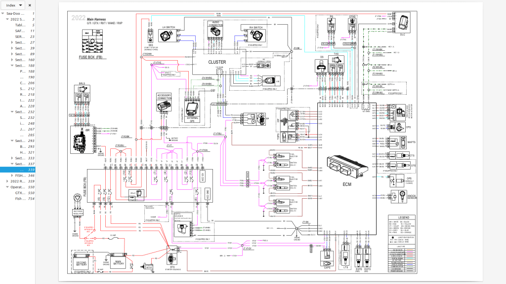
Here is drawing for electrics with Relay. Ann tells me to follow the pink lines. That look like it handles a bunch of stuff. So best to carry one.

Hope this can be helpful.

Percy Fog Sphinx

Evening before a sea fog rolled inland at Mackay as to be expected it was nice and thick this day. Grasstree Beach ramp up Cabbage Tree Ck has its own hurdles to be negotiated. Low water this creek dries out. We waited for water and daylight getting in the water around 630. I have a little experience in this creek and had some idea of the better passage between ramp and the lateral marker.

Getting out of the creek by 0700 encountering a depth 0.9M back near ramp. With 2.2M tide suggests that this is in the minimum amount of water to safely negotiate for a Jet Ski.

Heading out we are all thinking fog will breakup soon. Not so after 45klms we are still in the thick soup. Navigating solely from our Chart Plotters a course predetermined and plotted with the files loaded on the 3 Skis. Made our first stop at this point (near Knight Island) to marvel at how far out the fog persisted. I moved a short distance away from the others for pee to look back to be out of sight of the others. We were separated. I moved to our track at approximate distance moved. Still could not see them turned off engine and yelled out for a reply of yeah over here. I started off in direction of voice for a short distance killed motor and repeat call. This repeated 3 times before they spotted me going wrong direction. Bit of a scare and lessons learnt.

Continued on our journey with a heavy fog as our close companion. We hadn’t sighted any land sense leaving mainland until Hull Island in the Beverly Group 60klms out. To experience the appearance of a island to seemingly jump out of no where had a bit of wow factor to it. The fog seemed a bit lighter in patches revealing a couple Whales.

Hull Island

Moving through the Beverly’s our hope of getting clear air waned but only for another 5ks or so we broke out to a vista of Islands. Sphinx our aim on all if not Glass as it had been from the start. A object spotted on surface we approached to investigate to find two whales that must of been lying motionless in a T formation.

Whales

Sphinx Island is a prominent ocean mark named for its liking to the Egyptian Sphinx’s from a distance. We had to give these Islands a bit of a fly bye being more of a recon due to time restriction.

Sphinx Island track

Slipping across to Pine Peak we drop into Battle Bay to beach. A couple of drones launched that gives a great perspective the circled area noted as possible camp spot.

Battle Bay, Pine Peak Island.

Quick run over the Hotspur Islands to investigate a possible waterfall that wasnt.

Pine Peak Hotspur track

Found a bit of an overhang back tracking to Pine Peak Island

Overhang Pine Peak Is

Leaving Pine Peak behind we head to Percy’s.

Middle Percy from Nth

With a lingering fog we arrive the A frame in West Bay, Middle Percy. We had an hour to get the drones up, add a badge to our plaque and have a bite to eat. Needed to beat out going tide back at Grasstree Beach to get into the ramp before 1430.

Met 5 blokes that had landed at the same time that had been at sea for 2 months traveling from Sydney. I spotted one going up a Palm for some fresh Coconut successfully.

Getting away at 1200 with Fog moving in on Percy.

I estimate that we traveled out in 70% of the distance in heavy fog and returned in 50% of the distance not so heavy fog. Maybe the sun high over head just made it seem that way.

Certainly more clear patches with the occasional Island sightings in the distance. Had our first and only sighting of Knight Island peaking out of the fog. This Island on a normal day is a stand out Marker we see for most of this trip.

We arrive 1350 back at Grasstree Beach after traveling 100klms none stop from Percy that is a first for us. We get into ramp with a bit more water than going out.

I probably banged on a bit about the Fog but that was the domination of our day. A completely different sense of emotions Awe, Cold, Wet, Fear, Relieve, Surprise and Achievement. We handled an unusual environment over a fair distance with a time constraint dealing with a tidal ramp. Thanks Ann and Paul it wasn’t our average day on the water with all of the above Including exploring a new area. Well Done a great journey.

Lessons Learnt:

Tidal Creek Launch ? Use it with a Low tide in the middle of planned trip. This will give you maximum time on water.

Separated in Fog ? If intended Paul suggest we hit MOB (Man Over Board) marker on our plotters of all skis. Unintentional I suggest the same and do a full circuit of that marker with the other party doing the same or at least 1 ski leaving a trail in the water to be picked up. Audio contact is reassuring and deceiving in fog you could relay coordinates ? Different situations/elements may make all this useless or unsafe so use common sense.

Fog alone can saturate you.

Bushy Bash

Satisfied the finicky wind forecast was holding good enough. Woke up to consistent rain at 0230, being our last element to hurdle the radar showing it moving out to sea and it did by 0500.

We met at Mackay Harbour 0630 got away by 0700. Ann, Paul & James a debutante to our group JetSki Tramps Mackay.

We got away on a flat sea with light lump close to land and flattening as we get out.

We arrive about 0830, we attempted to do a run inside the lagoon with poor visibility due to over cast so was pointless. Have not seen this many turtle tracks any were on the one island.

Turtle tracks

Anns Video

Beach anchored SE corner Paul & I put the drones up.

S end of Bushy

It was a bit different from previous visits as in I thought there was a palm tree missing and beach seemed different ?

N end of Bushy

Couple of us went for a walk to the hut inside the island and found a full size Coconut Tree chainsawed down and not to long ago.

Hut

Pisonia trees ( Cabbage Tree) are abundant that has a large sticky seed that stick to the birds that nest here. The seeds can overwhelm the fledglings with weight and cant fly. The link might explain it better. In video there is a research vessel anchored off Bushy, it belongs or has Planet Earth written on its super structure the link below has video supplied by them with David Attenborough narrating it. The Vessels name was different just cant remember.

https://www.sciencealert.com/this-tree-seems-to-kill-birds-just-for-the-heck-of-it

Good bye Bushy and head back on slightly different track via Skull Rock off Derwent Island.

Skull Rock

Then Bailey Islet cruising home on not quite Glass all the way. We didn’t get wet at all and sea conditions were better than expected. Back at the Harbour before 1400

Disappointing overcast but cant complain was a great trip. Hard to ask for better sea conditions great day in good company.

Arrival
Departure

Hill Inlet / Whitehaven Beach

https://www.relive.cc/view/vPv4dLAdPRv

Weather had not been kind for a Month now and we were keen to get on the water on a descent trip. The right forecast fell on a Sunday, so to avoid the traffic jam at Mackay Harbour we head to Seaforth with the better part of the forecast to north of Mackay at any rate. We gets away from ramp 615 to Outer Newry Island.

My normal route would of taken us over to the Anchor Isles for no other reason than using them as a way point. This mainly to steer us clear of Bennett Rock were as a direct line to Shaw/Lindeman would of taken us close to this rock that sits out in the middle of no were. Chart Plotter changes all that now so that was our first way point and we found it with out hitting it.

Ann looking for some fog

We then go up inside (W) of Lindeman Island to Pentacost Island that is such an individual in character with its great towering peak of 288M only bettered by a few on much bigger islands. Conditions from the get go were great flat with a ripple found our self’s cruising at 60kph from the beginning.

At the NW foot of Pentacost Island (credit Ann)

We are now scooting across to Solway Passage to the southern entrance to Whitehaven near on glass and there is no holding us back. Image below has the big island out from Ann being Whitsunday and Hamilton is out the back of Paul & Simon.

nearest Ann, Simon & Paul
Ann’s Video

Arriving Whitehaven Beach before 0800 with very few boats and people around quite a change from my few visits. We beach anchored put the drones up tipped in a jerry of fuel each and off.

Big Inlet entrance

We diverted slightly from plan and gave Chalkies beach a drive by over on Haslewood Island. Up to Windy Bay to this little cove that I had visited a few times and never landed before so made sure we did this time. Its a shallow bay.

Windy Bay

Making our way north around Pallion Pt then S between Workington & Lipton Islands. Out to the E of Pallion Pt there is a small group the The Edward Group we must investigate next time.

Cove Windy Bay (credit Ann)
Paul’s Video

Another crossing S to Jesuit Pt, Maher Island. Next stop was a unnamed bay on Shaw Island. Beached here for a while were my drone footage failed.

Jesuit Pt

Then Thomas Island were Simon and I dropped Vibes for a while between Dead Dog & Thomas with out any luck.

Dead Dog Island
Swings on Thomas (credit Paul)

Through Anchor Isles and back to Seaforth with that storm that moved off for our arrival but managed our first shower the last 5 minutes of the trip. Crossing started a little lump with a slow progression as we closed the coast nothing unusual in that. Following breeze E helps didn’t alter our speed at around 60kph.

Back at the ramp and out by 1400 most enjoyable day of great adventure & mission accomplished with Zero issues . We all carried 90lts of fuel probably used around 75 – 80lts.

Thanks to the crew for their contributions and preparedness.

left Mine, Ann’s, Simon’s & Paul’s (credit Ann)
Hamilton Observations

Creal Reef

Simon’s Relive https://www.relive.cc/view/vWqBZyzMeYq

Long time bucket list item achieved. Furthest offshore we have been 140klms NE Mackay. Unable to do in the past due to not possessing a chart plotter or GPS. No islands in sight to use as a marker.

We got away 0530 I had 140lts of fuel that gave me over our 20% safety margin for this trip. Simon had 155lts.

Love Sunrise on the water. On leaving the Harbour we had small lump that was probably left over from slightly stronger winds over night. Plus the sea can have little lump to it around land when all else is flat.

We were going to Creal with no stopovers scooting south of Keswick/St Bees and shaving south of Scawfell by about 5k our last prominent land mark. Sea flattening as we go.

About 100k out we confer our location Simon must of had problem with his chart plotter we could just see Penrith Island to reassure him maybe.

Not long after moving on a Dolphin decided to have a play with Simon’s Ski. This diverted his mind from were the hell are we. Seemed to us that he was done with us so we pulled up talking excitedly over the experience. Dolphin then starts jumping around us again such an experience of a lifetime.

He had enough fun and disappeared with still 30 klms to go with nothing but water for as far as the eye can see. We needed to spot that light tower on Creal to relief Simon and about 15k out I pointed it out dead ahead to his relief.

Arrived around 0830 the top of the tide, Dolphin delayed us . I had not seen so many Sea Snakes in one trip, no photo but see them often but not in numbers of this day. May be a dozen or more.

Not sure in planning what to expect out here but always plan the unknown trips to rising water or top of tide. Still noting depths on approach as sometimes there can be a shallow reef just off beach. So great the way it turned out for a landing and escape.

I put the Drone up to try share the beauty of it all. There is the Light House/Tower & Weather Station beside the Cay. The only Weather Station out on the water with exception to Hamilton & Percy Islands in this area.

Booby Birds were perched all over the structures as they do. Simon ducked back out to drop a line.

Weather Station
Light House/Tower

We top up our skis and make our return via Refuge Bay, Scawfell Island. Refuge Bay is a all tide bay but still need to monitor anchorage during an Ebb. We weren’t in any hurry until I remembered wind forecast off the coast was expected to pick up bit from 1300. So we bee lined the bottom of St Bees and across to Harbour were it lumped up little but hardly affecting our speed.

Refuge Bay

We arrive back at the Harbour without incident except my ski running dry out the front of Harbour after only 136klms that is totally out of the norm. After some investigation back home I found the front bolt to intake grate came loose and was causing drag. Reserve fuel is there for a reason so no drama.

Hope I haven’t prattled to much thanks for reading and to Simon for his company. We were blessed in this trip good just got better and all seemed to marry up. I am sure we will do it again as soon as the wind allows.

Middle Percy Island August 2024

Simon’s relive https://www.relive.cc/view/vPOp1DR9wR6

Simon and I get away from ramp at 0700 it was a fresh morning wet suit and beanie for me. There was a light westerly in close that left the sea with a bit of a ripple to start with. Knight Island our first way point with the breeze shifting to SW that may of created a bit of lump working slightly against rising tide. Hoping that it would settle out further as wind forecasted. Would be in for a long haul otherwise fortunately the wind played out to forecast. I don’t have a battery for my pocket camera that has been such an easy reliable device for recording trips so pictures are scarce.

About 15ks out from Knight I spotted Whales jumping along heading for us and passed along side. My first spotting for this year. We arrived Knight just after 0800 and decide to move on with out beaching after a short break.

I have had this sitting as draft since August this year and picking it up now to try and complete so may be bit reduced like my memory.

Our run across to the Beverly Group to down the inside (west) of Noel Island it was a good sea. Without being flat it had this annoying little wave length that created like a Hobby Horse effect at our cruise speed. We could of tramped it to skip across the top but not without sucking our fuel. Simon seemed content with it so I just grin and bear it to.

Not long after leaving The Beverly Group it did flatten out to a glass. Across to the beautiful West Bay of Middle Island of The Percy Group. We anchor up just n front of the famous A Frame known, visited and membered by yachties from all round the world for years.

Part of our mission is Tramps addition to the thousands of paraphernalia at the A Frame. Simon and I found a good spot for it. Paul and I put this together with some input from our regular crew.

Some drone practice for me and off we head deciding to go back to Beverly Group for quick fish. I strike a undersized coral trout.

Still Islet

Then I have a tussle with this Trevally.

We head home on absolute glass mirrored for 80 klms at 50-60kph. Found if I focused on a object in the distance I kept getting the strangest feeling like a lift off as if taking off into the air so real it scared me and I would break the focus. Of course I kept doing it not believing it was happening. We pulled up at one stage and I made Simon aware of it. He said that if he focused just in front of his Ski he got the feeling of going under. I had that to but that was no fun. Back at ramp out of the water I mentioned it again and he said yes he had the same affect.

Try to avoid landing back at ramp around low water of 1.4M but failed. Best avoided managed OK but very muddy water and no doubt our jets would of sucked up some slurry at minimum. I will be blogging more often and a 280k reef run will start now.

Following is more for my reference and helpful in planning future adventures.

Tide times are important at a lot of ramps sometimes critical I wouldn’t say at Hay Pt was but definitely helpful. There is no jetty access in lower tide levels, not that it concerns us there is a beach that does have a couple of rocks to watch for.

Hay Pt wind observations

Middle Percy Island

Meet up with Paul at Ilbillbi Road House. forecast below 5knots until lunch then rising into 8knots NE. Rising tide from 930 on wards so running with the wind so hopefully that will be helpful to a good day.

Ilbillbi Road House

Follow each other in to Green Hill. This trip is a first for both of us and is some way a bit of reconnaissance. My fuel on board was 100lts, Paul 105.

Green Hill launch area

We have quick inspection of the beach for launching. Have to use Paul’s 4WD as I wouldn’t get van on to beach let alone in the water.

Paul would launch his and then swap trailers and launch mine.

Beach Launching

Visibility was not great almost looked like fog looking out to the horizon. Had trouble getting my bearings for a while and needed just that confirmation that Paul could supply. Due to the fact he was prudent enough to copy our course into his app.

Green Hill

Although we only needed to head in the general direction and it all come to light as different islands took shape and confirmed.

We hardly strayed from the planned route. Didn’t get away until 645 a bit of mucking around launching and making trailers safe.

We arrived Curlew after an hour on the water arriving 745 conditions were good no chop slight short swell petering at Curlew. Paul had 10L jerry he wanted to empty into ski to get it out of the way.

Along Curlew looking at Treble Island

Then slip over to Bluff Island the SE corner hoping to get a sighting of Percy. Made radio contact with VMR Mackay confirming trip log had been activated. Our closest repeater is Knight Island channel 80 that may have a problem lately. Scratchy contact was made on 21 in Mackay 86klm surprisingly enough and just as surprising 22 on Penrith 76klm was clear as a bell from Percy.

Bluff Island and its Column

SE end of Bluff there is this column. Would like to explore the opposite end of island to check out its namesake. In general on this type of trip I don’t go wandering around off the plan to much. No Percy in sight but only a few klms off of bluff it all become clear.

Column at Bluff Island

We had a go at getting into lagoon on first arriving. Tide may not of even turned from a 2.4M low. The entrance could of walked skis over but to what end ? We went an anchored in West Bay in front of A Frame.

lagoon entrance Percy Island

The Iconic Middle Percy A Frame 2.25hrs at a dawdle arriving around 9am. We try to make radio contact with the caretakers to no avail.

West Bay Percy

Had a bite to eat in the A Frame marveling at the paraphernalia. Like there is so much to see that I didn’t stop to read anything as it would consume so much time if one started. Video will give you an idea of what I am saying. Mementos, messages and emblems from vessels from allover the world that stop in every chance they can.

A Frame

Caretakers were finally contacted and we were given a friendly welcome by Mal & Kerry.

West Bay from upper A Frame

Tour of the Tree House that is an amazing Icon in its own right. Not sure my understanding picking up on bits is used for private guest.

Treehouse

Obviously a lot more time could be spent here but being our maiden trip out here the need to get going was upon us. I fueled 20ltrs leaving the other as back up that wasn’t needed. Had quick look in the Lagoon as it was low on water with only neepish high tide at 330pm.

Heading back out of Percy

Getting away 1145 we are on almost a mirror that stayed that way with exception the last 10k a small chop that didn’t break our stride. Tinonee Peak Island was our first way point on return. Could be worth a better look around next time interesting rock face NE side.

Tinonee Peak Island

This has to be the southern end of Tinonee Peak Island and that means I haven’t got a photo of Douglas Island that we scooted by.

Ridge Island is aptly named and is up for a circuit next time passing.

Ridge Island

Ridge Islands NW corner had this to share with us along with 2 shallow caves in that rock to the right in the shadow.

Ridge Island

We had a dream run all day back Green Hill at 145pm. Skis behaved and performed admirably. Fellow explorer had dedicated himself to the trip that made it more comfortable for me. Both had ample fuel I know I had a minimum of another 75klms. Paul’s ski was sipping along brilliantly for a 300. He only added the 10ltrs to his 70ltr tank and may of had close the same excess ? I managed to bring wrong key for padlock on trailer chain that the angle grinder fixed. Great day thanks Paul and VMR for their coverage.

Bushy Atoll 3rd Time

Been waiting for a decent forecast to fall with a tide around noon. Last visit was September 2022 being harried off the island with the falling tide as it was the first time.

Planning to arrive anytime around 8.30 giving us about 2.7M of tide. A good chance to check out the lay of the rocks that seem to surround Bushy. Conditions started with a small chop and a short swell that lasted about 15klms and kept getting better the further we went. Basically great for the rest of the day flat.

We arrived 8.45 not able to beach unless we anchored over shallow rocks so Simon went out for a fish. I snooped around for a while looking for a way in.

Bushy

Gave that away after 15 minutes and decided to go in and walk the ski over the shallows. anchored over some sand starting to get water. Estimating the tide to be about 3M at this time 9am.

Bushy Island

Simon returns without a fish and we take a walk through the island. The Turkey nest that is nearly 2M high that I climb to photo the top

Then on to the hut for a closer inspection than before.

Simon at Hut

The Dunny that I promised myself a closer look this time. What did I learn well not much other than it had a window and wasn’t a drop hole ? maybe a can ?

Dunny
Dining Bedroom

Had a bit of a snoop around

Hut
McLeans Bushy Boatel

Leaving the hut we head west through the bush to get back on beach.

Bushy western beach

Back at skis we decide to ski around the Atoll. To my estimates we now have just over 4M of tide.

Inside Atoll

We head from Bushy to the eastern edge of Atoll. I wasn’t keen on getting to close as I seen the rocks standing up along this edge on first arrival. Inside the Atoll was bombie as with a couple of lagoon type areas. The fish were in abundant seen my first Maori Rass x 2 huge fish so close.

The Atoll eastern edge

Going back to Bushy via Redbill Island that had over half a dozen Egrets that we disturbed from there roosts. I have never noticed Egrets out on the islands before ?

Redbill Island

So now we are back on the SE corner of Bushy having some lunch sitting beside what was a turtles nest with all broken shells. That must of been raided by the Bush Turkeys. Nether seen a Turkey out there but the evidence is compelling but how did they get there ??

Turtle beaching

Enjoying the scenery when this Turtle decides to join us with the rising tide probably to lay her eggs. I slip into the bushes and sneak my way closer to get a half decent shot. Without disturbing her. This turtle is different to the once I normally see she was smooth dark green.

Turtle

Goodbye Bushy we are heading home with a variation to travel over.

Bushy Island

Not ventured down the eastern side of Penrith Island before so we did. Found this interesting area half way down. A crop of rock has a passage running through it. The sort of thing I have seen Jet Skiers from down south ride through for fun. This had a small long swell bursting through it. It scared me to look at it but I reckon those loonies would love it.

This is the gap. You can get a glimpse of it on the video at the 1.04 mark of video.

Nearing the end of the island we cut through this gap and into this sort of bay. After awhile we realise we are surrounded with these little rollers on ground we have no idea about. Except it is rock and it is shallow well 2M is plenty shallow for me over rock. Rollers that I have zero experience with and get myself in a tangle with the top of a wave and Simon’s wake. That turned out to be nothing thanks to the Ski they must be good. Then dropping over the top of waves that have taken water away. Relief with stimulation might be way to describe the feeling once through. Parts of this is on video not so sure it expresses it the way I felt it.

Penrith Island, Bay south

Pass Penrith and on to Derwent Island with Skull Rock.

Derwent Island with Skill Rock

We cruise along the northern side of Derwent Island. From this point we make bee line for the Harbour.

Skull Rock

Turned out to be a great day with plenty of adventure without drama unless we count Simon losing his winch handle on way in this morning. Our Skis are to be commended they didn’t miss a beat. Back at the Harbour requesting to be taken off the log at 2pm.

Thanks for reading till next time. Blog and Video compiled in chronological order.

Some tide reference only

Curlew Island

Hay Pt Ramp is easy enough with a bit of water got away just after 630 Sondra, Duane, Mornê & myself the crew. Make our way out of Harbour and head south down the coast and pass some sought of work rig/platform sitting outside Half Tide Bay. Heading for Irving Island just out from Cape Palmerston.

Platform Half Tide Bay

Not that familiar this part of the coast I had a bit head scratching. Not that there was any danger of getting lost. We had to hit the Cape one way or another. That we did after a bit of whale action.

Come across this strange whale standing on its head with its tail in the air. Don’t know whats going on some say its sleeping/resting and some suggest its feeding a calf ? Seems to be known as tail sailing. It submerged disappeared then reappeared behind me and done the tail sail thing again for a while. From a distance it looked like a boat with persons standing either end of it. Apparently rare to see.

Leaving the Cape and whale behind us we continue on a flattish sea with a little lump that’s comfortable enough. Curlew Island was new for all the crew we had heard a little and had some expectations. A couple of waterholes to be found a lot of debris washed up on beaches and of course the need to go because it is there. There are ideas of a Percy Group run and this or Digby Island may well be a leg of that journey.

We come to our first bay on the WSW of Curlew. As much as I research I cannot find a name for it so WSW Bay it is. Nice little bay there was easy enough access for beach anchoring. We just done a drive by for a look.

Moving around the southern end of the island there is another deeper nice bay well call SW Bay that we give another drive by.

This SW Bay is a beaut and will get more than a glance next time seemed to be all tide anchoring but will need to be confirmed.

Mornê had earmarked a spot that needed investigating from the maps and charts that could of revealed a cave. He was close but found a couple of holes instead. Thinking of nick naming them Mornê’s Holes but rather say Blue Holes ? Character of the rocks on all the islands continues to throw something different every now and then.

Shear face above the holes was pretty good. Shame I wasn’t able to photograph properly in one shot. You may of worked it out I am not a camera mans backside.

Around the SE corner we come to Davidson Bay on the eastern side. We anchor here and go for some exercise up a couple of sand dunes. To gain a terrific view.

Davidson Bay

From the dune I believed we could see the Percy Group. In truth they are behind those islands Treble and Bluff. The small islands visible out the back are a small group just north of Percy’s.

Davidson Bay Treble Island with Bluff behind

Looking to the north are the Beverly Group. Standing on this sand dune I was convinced that we should of spotted a descent internal body of water. The area didn’t look like a great catchment but it had a descent basin ? Believe we missed it and worth another look.

Davidson Bay

Back at the skis we spot a few small reef sharks in shin deep water near beach that hung around a while. Going around the northern head of curlew and west to a nice big bay.

You would think these Bay’s and prominent Headlands and Bluffs would be named. After hours of research I can hardly find a thing. As presumptuous as it might come across I am going to give them a nick name [ * ] if only for our own reference.

Curlew NE head
Large North Bay, Curlew

Anchoring in great beach situation we have a sit on the beach in the sun as it was not hot. Had a bit to eat enjoying the view I spot a sand bar appearing on the dropping tide just offshore. That I had completely missed on the charts preplanning. Tinonee Bank about 1.5klm long running SE – NW about a kilometer off the beach.

Went for a walk up the beach looking for possible waterhole and come across this camp of 3 swags, large esky, cooking utensils and many crates with lids ? We had seen a boat leaving as we arrived lucky buggers.

Some great drone work supplied by Mornê that really put some perspective to it.

* Timonee Bluff Curlew

Great beach with blue water looking north towards Knight then Prudhoe the larger 2 Islands to the right.

Curlew looking across Tinonee Bank

Lunch with a view at Curlew.

Moving into our run home we skim by Waratah Island a large long rock no easy landing then on to Knight Island on flattish water. Where we had our last stop before the stretch back to Hay Pt of 45klms.

Run home wasn’t as good as we closed the mainland but wasn’t bad. Boat ramp was usable but not good on that tide level 1.4M at about 2.45pm. We must have the worst boat ramps in Australia mainly due to the tide levels. Had of we got back 1.40pm tide would of been at 2M. That 600mm would of made it a bit better.

Great day on the water whales in abundance crew and skis returning safe and sound. Majestic area requiring closer attention. Thanks to Duane for this 34 minute video. Thanks team.

Coppersmith Rock

We had planned a run out of Hay Pt over to Curlew Island this weekend but forecast had the wind kinder further north. So were compelled to Seaforth over to Shaw with a around a mid day return after 120klms.
Team consisted of Simon, Dale, Duane and myself. Duane’s first run since his harrowing experience of taking on water 40 – 50klms out to sea solo at the time. Understandably cautious and checking all was A OK.

In the water at 630 we make our way slowly out of Victor Ck. Tide at 0615 1.9M. We didn’t have a lot to spare and plenty of mud banks exposed high and very narrow passage in one spot. The Estuary area mud bank was only 10M or so away from the lateral marker.

Outer Newry Island, Consatina Rock
Out the front we are confronted by a flat sea and a brilliant sunrise. Smiling we head straight for The Anchor Isles. We arrive Hammer Island after a whale encounter with a 45 minute crossing. We had a sedate look around on our way through this passage.
Hammer Island
Leaving The Anchor Isles we head for Keyser Island of the Lindeman Group. Keyser Island at 800 and check out Megan Bay for access. We found some reef rock off the beach with still just under a meter under us and could of accessed beach.
Megan Bay
10 minute ride up the east side of Shaw island My favorite Queen Margrethe Bay. This Bay is always accessible just go up the center. Has rock and reef either side good for a dive.
Going for a land explore we walk up a rock bed of a creek.
Small waterfalls and pools as we climb found our self’s wading through some water that chilled the nuts.
Pandana pool
I had walked part of this creek bed before to the first waterhole. The trek up can be very slippery. Not a good spot to break a leg, twist an ankle or worse.
Reaching the third waterhole it meant a swim and mountain goat climb out. Maybe another time with a bit more warm sunshine.
Three Amigos
Walked out to clearing sky’s and a bit of sunshine.
Queen Margreth Bay
Moving along we depart my favourite Bay and head for another Gem Thomas Island.
Queen Margreth Bay
Beaching our skis on Eagle Beach we go for a bit of a look around above high water and a bit of monkey business. Dale got us a couple of pictures.
Monkey business
Trapeze duo
Now for The Smith Group via Coppersmith Rock That has a light and concrete structure.
Coppersmith Lighthouse
Some research leads me to believe it is considered/categorised a Lighthouse.
Coppersmith Rock
We snoop our way around the rock couldn’t see any sort of landing. Concluded must of all been helicopter dropped materials for construction ?
Resuming our trek to Goldsmith we take quick look at Locksmith Island.
Going through the gap between Linne and Goldsmith Islands and around to Stingray Bay another gem. Had a bit of a fossick around picked up some rubbish and added to a overflowing chest. Be good to be able to have a islands clean up with a boat. I think Duane had that idea about a clean up.
Stingray Bay
Stingray Bay Can dry out big time be extra cautious on a dropping tide. Dries out for hundreds of meters. We walked skis into beach a short distance knowing we were on rising tide. Walked just as far out in leaving before starting.
Done playing enviromentals we make our way home on a Glass Out that was Mirroring all the way. Seemed a shame to come off the water. We had a great day cruising, exploring and whales. No break downs no incidents nothing but good time.
Back at the ramp around 1245. Realisation set in later that we had done all the above in 6 hours. Only mindful to try and be back just after lunch. No racing off from one point to another nor continually watching the clock. Just a relaxed run.

Some Info on Pandana

” Furthermore, pandan leaf powder is used to flavor both savory and sweet dishes. Its taste is described as a grassy vanilla with a hint of coconut. “

” What’s more, pandan has long been utilized in Ayurvedic medicine to treat constipation, boils, and cold- or flu-like symptoms (1, 2Trusted Source).

” Pandan fruit can be eaten raw, though it’s commonly boiled and turned into a paste that’s rich in provitamin A and iron. “

https://www.healthline.com/nutrition/pandan#what-it-isdan#what-it-is

Mackay Local Islands June 2023

This was our second day in a row of calm winds holding high expectations after a quick run out yesterday solo in a superb sea. Mick, Anthony making up the group with Fox joining us for the run out and heading off to do some fishing.

Getting out of the Harbour at 9.15 we head for St Bees in flat conditions. Small chop appearing around the shoals with a little white cap about generally good. Not as good as yesterday that surprised me. Mainly overcast expected to clear and didn’t much that was a little disappointing.

We made for Joseph Bay around the bottom of St Bees.

I had a meter of water under me close to beach (Mackay Harbour tide at 10 was 2.4M). I wouldn’t leave it much lower than this to plan to get off on a falling tide. A fisherman here held up a good size squid to show me.

Note; This is a screen shot for St Bees I mentioned earlier Tide Times for Mackay because that is were most people would use. The difference 100mm and I prefer to use this method. Calculates the same as long as you dont mix them, use one or the other. Mackay 2.4M I have 1M. St Bees 2.5M I have 1M. Point of reference is the only change. (exaggerated example) If it was 10M at 1000hrs in Derby WA I still had 1M under me at St Bees.

Leaving Joseph Bay we go back around Mackay Pt to Egremont Passage. Quick look at the Coral Gardens. Where Fox departs for Cockermouth Island to start his fishing. We weren’t decided what to do at this point until we come out the northern end of the passage to a flat sea. Lets see if we can see the Cremer Wreck and on the way we stop of at a beach in Turtle Bay. Having passed this bay a number of times and never stopping. This was a good time to check it out with the rising tide.

I then discover water hole that the the bigger tides would make brackish if not salt water. The extent of it surprised me I walked just under 100M and it kept going. This would flush fresh after rains and may have holes further up holding fresh.

We mount up and head for the western side of Cockermouth. We had noticed what seemed to be fog hanging around Scawfell Island. Then we go across the northern end and over to Carlilse and Brampton. I was like Merekat diligently watching for whales after seeing so many the day before. Not a sign of them this far I spot a whale leaping and splashing around over towards The Smith Group maybe near Coffin Island.

Attacking Brampton from the East and crossing the bar with plenty of water. Anthony and I had quick look at Sandy Pt on Carlisle Island opposite Brampton’s old resort nothing much to report there.

Brampton abandoned resort

Caught up with Mick over at Brampton threw anchor and had lunch. It wasn’t warm felt like a slight chill in the air maybe of that fog.

We decide to go home around the top of Brampton another out of the ordinary track back to the Harbour. Maybe visit Western Bay on the way through. Once on the water and traveling I was feeling cold. Arriving out from Western Bay we decide to go straight back to the Harbour on glass most of the way and finally the sun shinning.

Carlisle Island, Sandy Pt

My expectations of

1: Weather were a slight let down with the overcast nearly all morning.

2: Bugger all whales. (Plenty yesterday ?)

This was made up with a couple of Gems discovered under my nose. A dedicated explore closer to home is in order.

South Cumberland Group

8 Island Circuit out of Mackay

Long time between drinks one might say. The weather has been at its worst over a long stretch since Easter in fact last decent run.

We planned not much as the forecast of late deceived us on several occasions. We went out winging it. Get out there have look prepared with extra fuel. Leaving Harbour 640 to a light lump across to Keswick Island. Brief stop in Basil Bay the island had a cloud clinging to it. We then slipped around to a bay Mornê wanted to investigate around on St Bees.

Southern Bay St Bees

We had bypassed this area several times in the past and never payed any attention and probably should of. Has a bit going for it deserving a bit more respect in future.

Southern Bay St Bees

Backtracking to Egremont Passage up out the northern end of the islands confronted with a flat as sea. Shrug of shoulders and off to Scawfell Island. Going around the top of St Bees we have quick look at the wreck Cramer. Glassing out conditions we arrive Refuge Bay were we anchor up for a while.

It is concluded we take advantage of flat conditions and try the circuit out to Calder Island as this was new to the majority. A short run over to Calder Island we go up the eastern side.

Beach Calder Island

Some unusual rock formations along this side of the island * (nick named)

Calder Island *(Brains Rock)
Calder Island *(Giants Dice)
Calder Island
Calder Island *(rusty rock)

We run around the tip of Calder that is like a razor back range running into the ocean. Duck into this great cavern in the side of the range. Mornê contributed a splice from his 360 camera for this video.

After a bit of caving we head over to Wigton Island still on a flat sea. Large Cuttlefish x 3 are spotted here.

Wigton Island

Western side provided a good quantity of deep blue coral. Photo does it no justice to the colour.

Wigton Island

Leaving Wigton Island we go to Zilloth Rocks that has a coral & sand quay.

Zilloth Rocks

We run by Cockermouth starting to shallow out.

Zilloth Quay

We decide to have a go at the northern end of the passage that divides Carlisle & Brampton there is a sand bar that will close you out. We crossed with a small bit to spare and anchor up for a while. Very happy with a our experience for the day in superb sea for most the journey.

Brampton

Have nearly been caught out in this passage known as Brampton Roads that drains out at low tide. Have yet to see it and must make a point of a drive by at low tide from the outside. We left just before 1200hrs with the tide at 1.7m. We were in 0.7M at times to clear the northern end of passage heading south. Northern exit closed by sandbar now exposed.

Bottom of tide 0.3M @ 1425hrs would have those 0.7M areas out of the water by 0.7M. As it was we managed with out having to stop engines to wade our skis through shallows just. These areas can and have changed with shifting sands.

Rather than run straight back to Harbour we diverted back to Keswick St Bees through Egremont Passage and back to the Harbour just before 1300hrs over a flat sea.

Winging It adds to the venture with a feel of freedom or the unexpected. This days conditions allowed anything only restricted by fuel. I had 80lts all up, Simon 85lts and Mornê 90lts.

Video is mostly snippets of conditions of the crossings between islands

Thanks to fellow adventurers for a great day in good company.

Late addition Mornê’s Video. Thanks Mornê.

Proserpine River & Laguna Quays

This was the planned trip

Arrived Victor Ck, Seaforth at 535 and parked out the way of car park to rig up for launch and waiting on the others. I walk down to check out the ramp and there is Paul & Steve waiting on me on a busy jetty and Dallas and Stacey are launching. Forgot to mention to them the part about waiting in car park. Dallas and Stacey are running over to Thomas Island with us then doing their own thing a bit of fishing/diving ?

So we get away a bit after 0600 and get through Creek and Estuary out to the open water that’s not flat but OK.

Heading straight for the Anchor Isles that seems to becoming a normal passage heading for Lindeman Group. This photo taken not that far out of The Anchor Isles shows Cape Conway out the back to right and above Dallas’s head is The Repulse Group that is our destination on return leg. Arriving The Anchor Isles and saunter up the passage and out the other end and take a right to head east for Thomas Island.

Water is flattening that seems to be the norm in this area so far. We pull into Eagle Beach in a neat little bay. Have a bit of a chin wag say our goodbyes to to Dallas and Stacey and move on.

Thomas Island south

My intention was to visit Keyser Island but after leaving Thomas and rounding Dead Dog Island I bee lined it for Queen Margaret bay on Shaw island forgetting Keyser. Then to add to it I went straight past the bay and wasn’t until around the the ford of that bay and looking at Maher Island I realised I over shot or went to sleep at the helm just soaking up the ride.

Paul with Pentacost Island and the Whitsunday to the back.

In the video you will see us making straight at the bay. So readjustment of plan was in order the beauty of carrying extra fuel. Well take a look at Phantom Cave run around the bottom of Lindeman and up the west side and check out a couple of bays there.

Lindeman Resort

This Coconut Bay seemed inviting so we ventured in. Closer to the beach becoming a bit reefy so we didn’t push it although tide was on the rise and save enough to have a go but a lot of discoveries ahead of us yet.

Coconut Bay Lindeman Island

I hadn’t visited the west side of Lindeman before so we poked in and around a bit ended up off of Little Lindeman Island a lot of shallow ground and bombies between these Islands.

Coconut Bay

We have now made the crossing to Cape Conway and heading for Conway Beach area to get some headings/bearings into the Proserpine River. I believe the body of water south Conway Range can be a bit disturbed at time with stand up waves. We ran into as slight westerly after rounding the cape that become very choppy and a little confused water that abated as we got deeper into the bay and closer to shore. From Cape Conway I am winging it and all new discovery for me down to Midge Pt. Coming into the mainland can be challenging to find your way in at times.

Conway Beach

This area is very shallow for a long way out and the day we had was very dirty water. Eventually found the river markers and went into the mouth. Was intending to try and get to the boat ramp not far up river. There was nothing to like about the area this day.

Under a meter at times and the water was like mud so we bailed on going any further. Had a refuel from jerry’s we had covered over a 100ks. Surprising Pauls GTX 300 had not had fuel alarm go off and we had. Shows riding at sedate pace it didn’t gusle fuel. Mindful of crocodiles without being concerned the immediate threat was the depth and vision.

This is about as far as we ventured

Deepwater Point marked on that image above. More chance of breaking your nose than drowning. Gently making our way out of Proserpine River to find some depth and head down to Laguna Quays. On entering marina depth went from 2.7M – 0.7M it seems the whole mariner has silted up.

Plenty of markers to show the way although maybe a bit out dated with sand shifts or no dredging to the mariner entrance

Strangely enough there were people on the breakwater. The area is blocked off by road with fences so not sure about that. A small dingy was being launched on the ramp also ?

Just another waste sitting around deserted like the many resorts.

Midge Pt boat ramp was our next way point. Just north of it is a low peninsula/Island that looks to have causeway at low water. At first I thought to be an the old boat ramp but that is were they built the new one Jimmy’s Rocks.

Just north Midge Pt boat ramp

After passing Midge Pt we decided to head out a bit and go for Inner Newry Island rather than stay close to shore with all the rocks in this area south of Midge Pt to Victor Ck. At inner Newry it was a little populated so we called it a day and headed for the boat ramp out of the water before noon the car park was over flowing with cars parked on both sides of the road down past the boat yard there.

Midge Pt boat ramp Jimmy’s Rocks

It was a great day in a kind sea and good company thanks guys for joining me on this adventure. I think Captain Cook named Repulse Bay for a reason.

Mackay Bowen Return

Another bucket list item bites the waves. Simon had a surprise for me turning up with a brand new Fishpro. Only 1 hour on the clock of merry go round stuff on the dam. So still running in on this trip. Another surprise to see us off and wish us a safe trip was Jason from Ski & Sea Safe Boat Training.

We didn’t get away until 520 waiting on the sun rise. Striking a bit of slop probably made worse for me with a little extra weight on the back. We weren’t real keen on a 360klms of this and thought to see it out the other side of Brampton Island and assess. Seemed to be on the improve deciding to go for Anchor Isles to reassess.

Perseverance and 50ks put it behind us. Around the Anchor Isles sea started to flatten.

Running a bit behind of plan we pushed through to Shute Harbour with the sea getting flatter with every mile.

Cape Conway

Approaching Long island we went up the western side the inside. The Fishpro is a good touring ski. Only thing I would change would be the seat and put the saddle type with the high back it helps from sliding back. I’d probably piss the sound system off unless the VHF could run through it.

Shute Harbour at about 8am for our first refuel after 105klms were they had unleaded 95 with high jetty’s and not much chance of tying up Skis. Could of managed but would of been a task.

Shute Harbour

We had no concern of fuel issues and headed around to Airlie, Coral Sea Marina. They like you to ring them or Radio on channel 9 (make a booking if you can). This is more to keep fueling births clear for the commercial boats that may of booked a time slot.

Coral Sea Marina Airlie

They have fueling births near the boat ramp eastern end that seemed to be used both times I had been there. The other end seems quieter ? Simon handled the phone call with no issues. My ski took 50lts Simon”s ski took much the same.

Its 850 leaving Airlie and time becoming precious. Forecast had the wind picking up slightly around noon in the the area south of Anchor Isles. Knowing full well we wouldn’t beat it. Not wanting to be any later we high tailed it to Bowen.

SaddleBack Island

Hello Dingo Beach, hello Hideaway Bay.

Hello Echo Resort

Bowen in a hour checked out the jetty. I could see the big Mango.

Bowen Jetty

I would of liked to of gone into the Harbour and took photos of their ramp and fuel jetty. Forsake that and headed back to Airlie.

Bowen Harbour

I emptied a jerry can in at Gloucester Island on the way back.

Saddleback Island
Airlie again
Simon fueling at Airlie

My ski only took 34lts as I had added 20 up at Gloucester. Octane 95 @ $2.20ltr.

The Machine
Heli pad on Harbour wall

Just north of Shute Harbour I radio VMR Mackay to confirm my log for trip and a radio check of loud and clear. Thank you VMR 448 Mackay for the coverage.

South of Pioneer Point

We were south of Long island bearing for the Anchor isles when I spotted a couple of skis over in the direction of Lindeman Island bearing on us. Rebecca had told me Melanie and John were going from Shute to Lindeman and to keep an eye out. So we diverted to them had a quick hello and chat. Nice to catch up even for a short time. They were on there way to Palm Bay Resort for some cocktails of sorts.

Melanie, John & Simon checking his dash for a change

Moving on north of the Anchor Isles I am anxiously looking into the horizon looking for any lumps. Seeing a couple I was bracing myself for the worst. Turned out to be nothing and a easy 60kph run down to Mackay staying wide of Green Island.

Hammer Island I reckon this is the hammer.

We arrive back in the Harbour 1400hrs as we had planned from the outset. Congratulations all round and to Seadoo machines they did not miss a beat. Simon so pleased with his and mine well !… 368hrs well into 10,000 sea kilometers she is amazing.

  1. Kilometers 369
  2. Fuel 155lts
  3. Time 9hrs
  4. Cost $313.00

I left the Harbour with 100lts on board could of done trip without carrying any. To arrive at fuel births with less than 10lts onboard on long trips is stupid. I finished trip with 30lts on board = 75klms. Hope it wasn’t to long. Until next time.

Mackay Observations 02 March
Hay Pt Observations 02 March
Hamilton Island Observations 02 March

Thomas & Shaw Islands via The Anchor Isles

Sondra, Mornê and Myself going out of Seaforth over to Shaw Island to catch up with Rebbecca, Michael, Brad, Sarah and Harley coming out of Shut Harbour. We get out of the Creek and Estuary into open water by 720. Its looking good and flat making a heading for Hammer Island of the Anchor Isles. The crossing being 26klms open water we arrive 0750hrs cruising at 50kph.

Anchor Isles

We pull up in the passage between Hammer & Blacksmith Island that has Ladysmith on its southern end. We soon make our way through the north end of passage and head easterly to Thomas Island. This crossing of 10klms had a bit of wave happening only small of no consequence.

Thomas Island

This bay on the SE end of Island. Sea Eagle Beach is the name of the beach. Should I assume the bay named same ? This seems to be a all tidal beach meaning there is always a passage in and out.

Sea Eagle Beach

We landed this beach with 1.7M of tide with no sign of obstruction.

Sea Eagle Beach has great camping potential swings and all. That’s not a Pissonya tree behind Sondra is it ? A quick drone run and we off again around the eastern side passing Dead Dog Island. Check out the bays on the northern side including Naked Lady Bay that was stark (see video).

Sondra testing the swing
Mornê, Sondra and Me

It was time to rendezvous with the Airlie crew. This 6klm crossing was a flat cruise to Shaw Island. We had seen there skis as we closed Shaw and bee lined to greet them and made for Queen Margrethe Bay. This wasn’t my first visit here it is one of those places that attracts you from the start. Something telling you it has more to offer without showing anything upfront.

Queen Margrethe Bay

We landed this beach with 2.1M of tide with a clear run. There is reef coming out from the peninsulas but south of center there is a wide sand channel that is clear.

Throw anchor, intros and chinwag out in the water then a day camp under the trees was perfect for snacks and drinks.

Camp in Queen Margrethe Bay

The Airlie crew were going back up the north to Maher Island to investigate Phantom Cave. Rebecca put together this amazing video. Thank you Rebecca.

I noticed this little waterfall. This the first one for me to find on the islands and I had been looking for them.

Frail Water Fall

I detached myself from the group knowing that creek bed I walked up a while ago in the dry season would not be so dry. I took off on me own taking care of my footing and then arse up I go and on a down hill fall on boulders don’t know how but didn’t get a scratch sore knee and back cause I landed mainly on my back. I was a little shaken by it for while.

Realising my bifocal glasses were the problem causing me to misplace my foot, so removed them and continued. Wasn’t long before being rewarded with this water running into a pond big enough to bath in.

Mornê has put together this Awesome video. Thanks Mornê

We were heading back early so we said our goodbyes and headed home back through the Anchor Isles. We could of made a beeline from the bottom of Shaw to say Outer Newry Island that is the entrance to Victor Creek and saved 3klms.

Home run

After some discussion we were comfortable with this extra 3klms. This reduces a 39klm open run down to 26klm open run for sake 3klms. Direct route being 39klms. Via Islands being 42klms.

The Wedding Cake Outer Newry Island

Closing Outer Newry Island its decided to duck around the back and pass Newry Island that has a bit of history to it. ( https://jetskinthqld.com/2020/08/20/seaforth-cave-island-and-hillsborough/ )

Boat Shed

We now have time to kill so a 10klm run down to Cape Hillsborough is happening. The breeze has picked up slightly with small waves heading into them although not directly.

Cape Hillsborough Nth

Have a bit of a look around the beach is still dirty from the big rains of late. We had a look at the pool on the headland.

Cape Hillsborough Sth

I fuel up at this point after 135klms might be pushing it to get back on the one tank (60lts). Cruised back up to the entrance to creek.

Pool & Mornê

We get back to the ramp at 1445hrs with 150klms on trip meter. Great day out thank you all involved.

Mackay Creeks and High Sands

Combination of several short coastal creek runs due to poor weather over the last month.

Thursday 22 December: Jason, Mornê & Myself had decided on a McCready Ck run and I thought Slade Point boat ramp would be suitable. We First take a run to the north and end up in Bucasia Ck. We had some lumpy stuff in mainly a following sea. We had a very quite cruise up the creek. It is only 6 knots from Eimeo Pt across to Bucasia Beach and all waters south of that line.

After a ride back head into it to McCready Ck mouth. Making our way up we travel under power lines that is nearly impassable at lower tide levels. Today tide at McCready Ck mouth at 0954 of 5.9M. We pass the Andergrove boat ramp and finish up over 5klms up from the ramp.

McCready Creek

The power lines go over some scattered rocks the satellite image is taken at lower tide.

Slade Pt boat ramp is not a good ramp the area is very tide reliant. There is no were to tie up unless the the tide is down a little a beach can be used. On our retrieval the waves from the north would crash over the ramp. Making it difficult to load, not big waves but enough to move the trailer a couple of feet before getting ski on.

Saturday 24th December with Simon & Dale out of Pioneer River Mackay to explore up Bakers Ck. I had not planned or studied to much for this as it was only down the coast a bit. As we neared the area of Bakers Ck I spotted some sand banks that I had expected. Made our way through and around the head land to see a line of nice homes not shacks that I hear of at Bakers Ck. Penny drops this is McEwens Beach. I have missed the the turn off.

McEwens Beach

So we confide and shrug shoulders it doesn’t matter and go up short ways before turning around. We catch up with another ski Huet and decide to have a look up Lucinda Ck down near Hay Pt Dalrymple Bay.

Dunrock

We enter Louisa Ck an hour before the top of tide being at 1123 at 6.8M. Made it nearly 6klms up and seemed a clean run and the water not as muddy.

Louisa Creek

Sunday 8th January: Pioneer River at 1145 of 5.5M. Mornê wanted to clear the cob webs out of his ski and I mentioned this High Sands that I had encountered recently from a distance. We were keen to have a closer look and tide should be suitable and was perfect for our first explore. This horseshoe sand bar was so majestic on the inside the sand dropped away at 45 degrees and seemed like it was 2M in depth all over the inside.

Sand Bar High Sands

The tide at Bakers Ck a kilometer away was at 1140 of 6M we would of had about 5M. So 3M may not be deep enough ?

I imagine this would be a place to watch the tide and make sure you had enough water plus some. To avoid being stranded dry there is a lot of shallow water around for long distances. I am guessing at this stage but would say a minimum of 3.5M plus but need to experience more of the area to be sure.

High Sands

With still plenty of tide we head of passing McEwens Beach, Dunrock and enter Sandy Creek. This unknown territory for us and you cant see anything in the water for the colour is like mud. We made it 8.3klms up stream only 3.3klms from the bridge that Bruce Hwy runs over before turning back.

Sandy Creek

Whitsunday Island from Mackay

Tide was low around 0730 so most of the morning wasn’t great for getting into bays and beaches. More so for unexplored or inexperienced islands. A long run was looking favorable with the forecast and tides.

The 4 skis with 4 POB leaving the harbour just after 0500 we carried a minimum of 100lts each. Making a direct line for the passage between Goldsmith and Linne Island that would be our half way mark 50ks for the outward run.

Mackay Harbour

Sea wasn’t flat but OK to start with slight improvement past Brampton. The tide was receding. That should be running to the north and forecast of 5kts southerly blowing with tide. I expected better conditions with a chance of maybe a glass out.

Carlisle Brampton from the west

Kyle discovered a breather cap missing off of one of the jerry’s. As soon as he was able to squeeze it in he did.

Allonby Island

Reaching half way at 0615 wasn’t bad allowing for coming out of the harbour we were on schedule.

Goldsmith

From this point on the sea was basically flat

Heading for Dead Dog Island that hangs off of Thomas Island that we gave a quick inspection in passing.

Dead Dog Island

Leaving Dead Dog we make for the northern half of Shaw island on the eastern side.

Thomas Island

Next way point is Jesuit Pt at the end of Maher Island. Photo below shows us passing the gap between Shaw and Maher Islands with Lindeman through the gap. Phantom Cave at that end of Maher there.

Shaw & Maher Islands

Rounding Jesuit point and clearing Maher we are looking at the Whitsundays. Not being able to see Solway passage at this point. We needed to make a heading in the general direction until I could get a better sight. After a short distance I make out the passage a little to the east of my guess.

Whitsunday Island

I don’t have a GPS / Chart Plotter of any sort. From the beginning I have studied charts and rely on memory of were islands should be in accordance of were I am going. Along with some sense of direction has got me by. Fog will kill that theory.

We arrive through Solway Passage looking at Whitehaven Beach at 0724 according to the date stamp on photo below. That makes it 2hrs & 16 minutes from harbour in a comfortable ride.

Whitehaven Beach

Solway Passage has some interesting points like it’s average depth up the center is 60M and has a 80M hole at North end. The water on the approach had some changing aspects to its flows and currents. I have been told it has caught a few boats out and has whirlpools that can turn a 10M motor vessel. You might note evidence of a premature whirlpool in the video attached.

Hill Inlet

Hill Inlet our destination we cruise up Whitehaven beach and anchor on the north side of the mouth. Were we basked in our achievement and safe arrival. Refueling was done and not long after the Whit Crew turn up and we move around inside the inlet. This crew consisted of Rebbecca, (birthday girl) Michael, Melanie, John, Sondra & Mornê. They were pleased to see that we got there safe and sound. Intros and a bit of a camp set & up went the drones.

Our crew and I were getting itchy feet and curious to what lay ahead for our run home. We would start to make our way back.

Hill Inlet

Before leaving I radio VMR to confirm my log sheet was active and that we were leaving Whitehaven and ETA to stand at 1400.

Making the passage between Shaw and Lindeman sending us down the inside of Shaw (west). Keeping the majestic Pentacost Island to our right (west). As we close on the passage we cant pass Phantom cave when Ann had not been there before. Drop by for hello good bye.

Pentacost Island

Down the inside of Shaw Island with Lindeman Island to our west. Some of us gave our tanks there last drink for the run home.

Burning Point Bay, Shaw Island

The leg from Shaw to Anchor Isles was good without being flat. South of Anchor to the harbour just seemed to get worse with every kilometer. Ended up close to mainland at Green Island. Wouldn’t of made things any better. Have had a healthy dislike for Green Island and surrounds now I hate it. Shoal Point says it all shallow dispersed rocks all over the shop often dirty and if its going to be crappy it will be crappy there. Survived hour or more of crap to arrive back in habour at 1400.

Not making excuses I am a shit photographer but overcast makes me shittier. The video and this post for that matter isn’t out for any awards it is just a record of excursions. Video contains mundane snippets that might give insight to some conditions.

Thanks to the team it was a legendary feat we achieved.

Cumberland Group

Forecast had been conflicting and fluctuating all over the place but at least providing a few windows. Like Sunday being borderline and worth a look ? With high tide at around 0900 falling through out the day. I couldn’t bring myself to commit to a group ride. Fortunately Duane had no reservations and had one on the go.

My plan started off solo out to Calder investigate a cave and catch up with the others later. Making my way out of harbour just before 0630. It didn’t look real promising out the back seemed pretty lumpy. Get out 10ks and it is lumpy and much the same out further.

Brampton Island

So I turn back and it flattens out not completely but improving. Sat north of Slade Island waiting for Duane and crew. They comes out of the harbour and head north for Brampton Island 34klms.

Cockermouth Island

So I hang out wide shadowing them for about 15ks before they pull up and I join them. A diverse bunch with 2 skis that are 2 up and another 3 up. Thinking this could be interesting watching this day unfold. At Brampton its meet and greet all and reacquaint with Justin, Brad & Duane.

Cockermouth Island

After a spell and a chat were off to Calder to see the cave. No I did not shanghai them that’s what was decided. Cockermouth Island the first way point that we edged along. Past Silloth Rocks and over to Calder shaving Wigton Island. Sea was good for this part.

Just south of Wigton Island I spotted something in the water. Turned out to be this massive log with maybe `5 meters of rope hanging off of it. This was well out of the path of the crew as I was riding a wide flank to the south of the group.

Log skis top left

I should of put a SAY-CURE-E-TAY over radio only thought of after I moved on and realised I couldn’t remember how to put the call over and left it. Should of at least contacted VMR and they may of broadcast it. (see below)

Calder mid east

We arrive Calder all in tact even the pillions.

Calder east

At the cave get up close and stick our noses in. A little choppy to go all the way in or just plain gutless. Had visions of a swell running in smashing me ski to pieces and spitting me out in great wash of white water. I do have a plan for next time.

Cave entrance Calder Island NE

We go around the end of island and along the southern side were we break off for Scawfell Island about a 10k crossing.

Calder Island sth

Arrive at Refuge Bay, Scawfell Island to find the Wild Cat there chartering visitors to the Island. A bit of droning, swimming and snorkeling seemed the order of the day. Curious to know how the pillions were traveling. I had to ask and to my surprise they were all wrapped and happy as. I am astounded and as if that wasn’t enough they were up with the front skis most of the time.

Refuge Bay

Brad and Melissa headed back a little earlier that made us conscious of time. Forecast was strengthening winds after lunch. So got ourselves together to head across to Egremont Passage through St Bees and Keswick. Starting get a bit lumpy on a fair swell we get to the Passage and cruise down that and out the southern end heading for the harbour. It was sloppy enough but the shoals probably added their lumps to it. At one stage Duane waved me on while he checked on the back runners. I was siting on and around 40kph sometimes under and some over. Checking behind now and then, there they were the 2 skis with passengers the other (Brad) had gone earlier. Just goes to prove I was wrong in my statement 2 up should only be in smooth waters. Duane thank you and well done in putting it together. And thanks to the fellow explorer’s for being part of a not so cushy ride that was a great day and toughing it out. (scroll down to video)

SAY-CURE-E-TAY

Thanks and bye for now George.

Gloucester Island

I was Not going but that was only until I woke up at 3am thinking should I go? at 318 decision made. Fueled up and text Mornê at 424 ” Am going to Airlie doing Gloucester maybe Bowen ” They including Rebecca & Michael were unsure of what they were doing. Arriving boat ramp 2 hours later the crew turn up and plan is made.

Southern Trek from memory

Michael & Rebecca having done Cape Gloucester before. This making them Admiral & Vice to lead the way. Conditions through Pioneer Bay were good and the further we went the better it got, like glass.

The trek basically takes us up along the coast passing several large bays with long peninsulas like Point Grimston.

Point Grimston

We arrive at our first stop over for drone exercise and a wander around at Olden Island.

Olden Island

Up anchor heading for Saddleback Island just a short dash north around George Point.

Saddleback Island

Rounding Saddleback Island confronted with unusual rock formations that is characteristic to all our islands.

Saddleback Island

A little further around there is a nice part stony beach.

Anchoring off this beach for a spell and up drones the essential tools to express the vista of our discoveries. Looking at Dingo Beach and Holiday Bay. I believe there is fuel at Dingo Beach but you have to cart it, walk it and very tidal.

We spotted some thing out on the surface about 700M out that turned out be turtles romancing. Mornê & Rebecca soon had their drones over them for some great shots.

Mornê’s drone work

Saddleback island behind us we head towards Manta Ray Island and up along Hideaway Bay towards Cape Gloucester and in to Gloucester Passage.

Hideaway Bay
Northern Trek from memory

Rounding Cape Gloucester we come across Montes Resort with no sign of coffee available we move on to Gloucester Resort that had some movement and waited a few minutes to open.

Montes Resort

Passage Islet locally known as Shag Island

We sat at a table on the beach and enjoyed our coffee.

Michael, Rebecca & Mornê Gloucester Resort

The thought to go back around the top of Gloucester was soon agreed. Preparing to leave I noticed a audience of holidaymakers seemed intrigued with these sea trekkers. They may of been disappointed at our sedate departure.

Traveling up the west side of Gloucester Island I took many photos to have a great droplet of water in the middle of lens. It was very picturesque with some nice beaches and very steep peaks.

Gloucester Head

Around past Gloucester Head and heading down the eastern side we encounter a couple of small caves.

Gloucester eastern side

A Manta Ray crossed our path at this stage of the trip we also had an earlier encounter. This was my first Manta Ray experience and surprised at their size.

Gloucester eastern side

We came across this sandy bay embraced by a couple of decent peninsulas The feature photo was taken from this bay with its steep peaks watching over it. The drones needing another run we pull up for a while.

East Side Bay, Gloucester Island Mornê’s drone work

Moving on down the Island a bit further we depart back to Saddleback Island still on a flat surface. Stopping occasionally for turtles or a break we make for Airlie with a chop starting from around Olden Island and building a little and traveling with it. Out of the water by 1330. Mornê’s drone show below.

Thank you Mornê

The following clip is Rebecca’s drone work from 2 of our trips combined with 1 of her and Michael’s day out. Bait Reef and Whitehaven Beach are included with some of Gloucester.

Thank you Rebecca

We have been so deprived of decent weather over several months and being able to get out 5 days in the last 2 weeks for a total of 620klms has been good for the soul. As always thank you for reading and to The Whit Crew for sharing the experience and your great Drone work.

Shute Harbour

This was a weekend of last minute decisions and none were decisive. Forecast playing a big part of Sunday. The 3 of us sketched the idea we would launch out of Seaforth and head north that would give us some protection. Should the forecast stick it would be 13knots SE just off the coast at 1000-1100hrs. With lighter winds in the Repulse Bay area.

Cape Conway

We had a rider come down with a bug that left Mornê and me meeting at the ramp at 730. We get our skis in and out the front of Victor Ck the sea is dead flat. Tempting consideration of an outer Island run Thomas in fact. Play it safe and target Repulse Islands and cruise to spot whales and dolphins on the way and arrive just short of the Islands. Were we found a Rock Wallaby fresh and untouched but very dead.

Rock Wallaby

Water still flat across to Cape Conway and beyond. Mornê suggest Shute Harbour ? Some rough calculations, lets go and have a look on the other side of the Cape. If the forecast holds true well we will just have to tough it out on return.

Ripple Rocks with Pentacost Island, Lindeman and Shaw out the back

We rounded the Cape to find glass all the way up Hamilton Island. Phone call made to Micheal and Rebecca who were land locked for the day. Mornê didn’t stop smiling to Shute Harbour at 70-75kph on glass. At one point we had a conversation about landmarks next to each other yelling at 70kph. That was a first for me.

Mornê

Mornê’s thing of beauty. We were riding on a mirror: https://www.facebook.com/651967783/videos/pcb.10161974637152784/5032397783533312

A nice little bay for the skis and up for a coffee and a catch up with Micheal and Rebecca at the terminal. Tipped 20ltr jerry in for return trip my ski tank is 60ltr.

Shute Harbour

Rebecca had her new drone Mavic 3 that she was using it to follow us out of Shute Harbour that turned out splendid spectacular awesome. We are heading towards Long Island feeling a bit of a breeze but still flat. We round Cape Conway and its still flat at about 1135.

Check out Rebecca’s Drone work https://www.facebook.com/rebecca.hales.1238/videos/772833187299902

Out and past the Repulse Islands we stop for confirmation on all well and direction. We spot more whales that ended up passing very close to Mornê with his 360 camera. Successful with some amazing footage of calf and mother.

Leaving the whales for our dash home with about 5ks to go the wind picks up and the sea with it, making it uncomfortable at speed. We ducked in behind Outer Newry Island and up to the boat ramp. Skis out of the water by 1230. So that made it a 1.5 hour return trip of 76klm with the whales watching us.

Such a awesome run that had not everything but a lot including a blessing from the weather gods. Its the add hock, unexpected and surprises that enhanced the journey in great company. Thanks guys in being part of it and allowing me to share your videos here of a brilliant day.

Lindeman Group

Seaforth > Anchor Islands > Lindeman Group > Repulse Group 134klms

According to willy weather the tide was 2.7m at 715. We still followed the markers except for the very last one. Once in open water it was looking good not flat but good cruising 50k plus with out bone shattering. Party of 5 Simon, Saxon, Dylon, Brad and Me.

The 25ks to the Anchor Islands that are part of The Smith Group. Passage up between the islands to come out looking at The Lindeman Group.

Hammer Island

Shot 12ks across to Shaw Island and start running along and into bays heading north. We had a small tide this day and still dropping. Looking for a beach to land and safely get off without being locked in with the falling water. Having been here a couple of times I had some thoughts.

Shaw Island

After a couple knock backs we ended up at a bay previously visited for a landing. I was keeping an eye out for a dingy that had been lost 4 weeks ago. It overturned off Hay point 90k south, 2 people on board who were recovered and boat lost. Up until 3 weeks later the owner was notified that it was washed up on Shaw island. I had all but given up as I was told the SE end of island. Talking to the guys I spotted it at the end of the beach up on rocks.

Lost dingy found

Continued our journey north up the east side of Shaw with sea flattening right out.

Triangle Island

With the sea flattening and the cloud clearing made cruising a pleasure this panoramic area off our coast.

Shaw island

At the top of Shaw Island is Giabirra Island. That is joined to Shaw by a causeway or maybe better described as a dune. North of Giabirra Island we come to Maher Island hosting Phantom cave.

Phantom cave Maher Island

We slipped down the body of water between Shaw & Lindeman on our way around to the resort. We came across a large turtle that stayed on the surface for a while. Leaving Lindeman behind and passing Seaforth Island. We spot a whale that seemed to be basking on the surface with her calf (feature photo).

After some oohing and ah-hing with the whale we do the 21ks over to The Repulse Group. Have been told these islands are aptly named but I am not so sure. In fact I find all the islands to have there own individual character to be appreciated.

East Repulse Island
Repulse Islands

After a short spell a decision is made to head south and if we can identify locations like Laguana Quay or Midge Point we would make for them and run down the coast.

South Repulse

Through The Repulse Group and on the western side heading south we are unable to make out any of our targets on the mainland so make a line for Outer Newry Island.

South Repulse

Repulse to Newry is 27k that was a flat easy run. Inner Newry may of been doable but I know it can be shallow so stayed out.

Outer Newry Islands Wedding Cake

Back at the ramp about 1200 134klm covered and I used 49 liters of fuel. It was a bit of a flyby journey due to the small tide and the bottom of tide in mid morning that can restrict in close exploring and landings.

Concertina Rock

Finally the weather and conditions turned it on for us to have a awesome run around. Thanks for the company guys and hope readers enjoyed the trip with us here.

Beverly Group

Feature photo and all drone/overhead shots compliments of Mornê du Rand.

Weather window finally appeared after nearly 2 months to enable a decent trip attempt. The area had been a bucket list item for a while because it spooked me a bit. For a number of idiosyncrasies. Was never going on my own so thanks to Mornê & Sondra for the company. Forecast leading up to it was up and down, tide was far from perfect and timing just borderline so we gave it a go.

Route
Route around the Bevelry’s

Underway about 0730 from Grasstree ramp at Cabbage Tree Ck ? Now there’s a thought I wonder if it was named after the Pissonia trees over at Bushy ? Cabbage Tree is one of their nicknames. Getting back and out onto the sea it was hazy as and we couldn’t see too many islands. I was mostly depending on using Prudhoe as a guide. Had a good idea of general direction but find yourself second guessing in a new area. I Haven’t mentioned that this was virgin sea for all of us. An island was visible to the south (maybe Cullen?)… our first leg we head out to find Cullen a little to the north… a minor adjustment.

This was on run back

Next leg to Knight Island with visibility still ordinary we make for another island in the general direction and after a while we spot the real deal. Haze or muck starting to clear and islands starting to pop up all over the place, Including Prudhoe breaking out of a cloud of fog/mist. Conditions are a little lumpy without being harsh but enough to hinder speed. We arrive about 0845 at a bay at Knight Island for a stretch and photos.

Knight Island by Mornê du Rand
Knight Island looking to Elamang Island
Another little bay on Knight by Mornê du Rand

Next leg takes us across to Minster island and a string of Islands running south. We slipped around the bottom of Knight and decide to give Minster Island a miss and head for Beverlac Island. On approach we spot whales tried for photos but unsuccessful. Sondra was quite excited after a close encounter with a smaller whale’s tail not far from her ski.

Fish Camp Knight Island

We are now heading for Digby Island coasting down the west side of Hull and Henderson Islands. With a southerly we find a nice big sheltered bay at the northern side. Its like you ride around a point of headland and your eyes and mind just gobble up the scenery. Mornê has supplied the best way to share this experience with his drone shots. They are a birds eye view of what we see but expresses the same. Stunning.

Digby Island out the back is The Guardfish Group. by Mornê du Rand

This bay is a pearler…you take in the large beach with a rocky headland to the north that has a portion of a large boat wreck that the sea has planted high and dry up on the rocks. Another portion of wreck parked up on the beach under a Coconut Palm.

Digby wreck

In the next photo I am convinced that Middle Island (Percy) is trying to show itself through that cloud of haze/fog ? Directly over the center of knobby headland ? That is the direction to Percy 37ks away.

Digby with Keelan left Penn center by Mornê du Rand

I am thinking this bay would take a hammering in a storm with a northerly, and at high tide it might overrun this section of island. The islands to the north acting like a funnel pouring through that gap and crashing over the beach and vegetation. If you go back over the photos it looks like it could spill out the bay south/opposite. Hence that ship wreck and stagnate water behind dune.

L-R Henderson, Still & Keelan from Digby by Mornê du Rand

Run back to Grasstree is fairly flat sitting close to 60kph pretty much up to Cullen Island. Closer we got to the mainland the shittier it got. Not big, just short sharp stuff. Arrived back to creek entrance and the water had nearly gone. I bottomed out once and got to ramp and did it again…spitting out rocks and sludge. My bad. I have stayed away from tidal dependent ramps for this very reason, and my first trip out of one and I completely forgot to make allowances for it. Sorry guys it wont happen again. The others got through okay…I will check mine over and test before next run.

Grasstree ramp

In future I would stay as close to the sand side as possible. The sand moves and this image is not quite the same as it was for us. There it is…another mission accomplished…thanks fellow explorers making this memorable journey with me.

Sondra I concur

Thanks for reading.

Back To Bushy Atoll

Weather had been so bleak of the last weeks or is that months. Forecast had the wind softening Friday, Saturday and Sunday. We chose Sunday if only to give the sea more of a chance of settling after the blows we had received. Got away at 0700hrs from Mackay Harbour entrance where we could see it a little lumpy out the back and we soon found it. Forecast was westerly and we got it gentle with slight increase the further out.

The intrepid explorers were Mornê and (Natalie, Lylah and Alex) 3up on the GTX Limited 300. I did not envy them had only sorrow but Kudos to the three for hanging in there it would have taken some stamina. My trip meter showed a 188.3ks the February trip was 188.5ks we improved our navigation by 200M LOL. Its a long journey for 3up in sub glassed out conditions. The run out was basically lumpy with pot holes. We had plenty of talks about continuing and they did.

Penrith Island that lies 70ks out from the Harbour and about 5ks East is a shipping Channel. This not a place to break down or have any problems when crossing in the path of one of these. Even if they see you they cannot stop in a short distance like many kilometers and very slow to turn. So you would probably end up as seafood.

Bushy Island beach & Redbil Island

After a long uneventful trip with exception to the container ship we arrive around the top of the tide at 1000hrs. We duck around to the eastern side and find paradise as it should be calm. Straight up we encounter large Rays, large Turtles and a Sand Shark they called it.

Mornê du Rand’s Drone work

Mornê got the drone up to get his amazing shots that found its way as the Feature photo as is with the last Bushy post. Thanks Mornê.

Mornê du Rand’s Drone work

We needed to move anchorage as the tide was dropping after a moderate 4.7M. Needed to keep access to open water so around to the northern end we go. To enable our search of the mysterious Carnivorous Forrest that Mornê had heard about along with the shack that a bloke lived in for a period.

Shack amongst Pisonia forrest

We found the Forrest of Pisonia Grandis, no I didn’t piss on them LOL. These trees are known as bird killers see links if interested. The ground was like walking on a fine potting mix and there is a light odor and few feathers. Have been told at certain times it can stink of decaying birds. Dont know how this fella lived in the shack that was surrounded by these trees. Quote taken from link

For now, it seems, the tree’s potentially deadly seeds are simply a reminder that sometimes nature DNGAF.

(Does Not Give A F****) ?

https://www.sciencealert.com/this-tree-seems-to-kill-birds-just-for-the-heck-of-it

https://tropical.theferns.info/viewtropical.php?id=Pisonia+grandis

The Loo

The ground was that fertile it grew a shit house. Will have to check it out next time along with the mysterious mounds like huge bush turkey nest cant imagine what else ?

Return run Brampton, Carlisle out the back Keswick St Bees right and Aspatria Island

Time and tide waits for no one. Against us again and needed to get off island. Needed to travel over a shallow reef that in itself isn’t a issue as long as the jets don’t pick up any loose rock or coral to jam the impeller that can stop you dead. With a 3 hour run back into a westerly giving us a ETA about 1530. That gave us 2 hour buffer of day light should any mishap occur that could put us in the dark. Enduring conditions was the run home for the first 60ks or so that was about 2.5hrs. Flattened out nicely around Baily Islet for the balance of run in.

Dusk and queued the same

Ramp at the harbour was absolute KAOS. We managed a narrow gutted spot to park a couple of skis. Went up to get trailer that was parked real close and went to join the queue that turned out to be well past the round about with the anchor at Ron Searle Drive. I re-parked into the overflow car park and walked back to jetty.

Mornê du Rand drone work taken from SE Bushy and Tern Island top left

Conditions were not great and Harbour ramp was crap but cant wait to chance it all again. One day we might crack a stunning glassed out day with a 1300hrs high tide and get there early. To swim/skin dive the Atoll, taste the Bird killer Cabbage tree leaves, have closer look at the mounds, lay on the beach, check out the dunny and maybe take piss on a Pisonia Grandis. Feels like the right thing to do ? Cant find any evidence of the trees being classified as Carnivorous ?

Thanks for reading and fellow explorer’s and hope You enjoyed the blog.

Bushy Islet 26 Feb 2022

Adventurer’s included Mornê, Rebecca, Michael and Myself. Bushy had been in our sights for a while now. We had been waiting for a break in the weather and just as it appeared we jumped at it. Forecast soured a bit on the day with a chance of a storm. We weren’t to be deterred and had to have a go.

Making our way out of Mackay Harbour at 0545 on the 90klm trip out. In close it was comfortable swell and lumping up a bit around Baileys Islet and varied around that for the outward leg. It wasn’t long after Baileys that we discussed a storm that seemed to be hanging out the back of Prudhoe Island that is south of us.

We made Bushy 0815 tide had peaked at 0740 that wasn’t ideal. The storm had closed over Penrith Island. Through all this it was easy to see Bushy to be a real Gem it is.

Done a circuit of Bushy then anchored on the western side. While Mornê and Rebecca put their drones up for some footage. I repaired a broken terminal wire on the auxiliary battery. Looked up to see the wind had picked up probably off that storm now engulfing Penrith with my anchor dragging. The crew had already made the decision to move up to north end.

Arrival Bushy

This is were we struck a problem with one of the skis picking up a rope and wrapping it around the shaft. Some anxious moments while Mornê dived under the ski with a knife that was only just long enough to free it after several goes. Whilst the tide was falling, a storm 15 klms away and 89klms from mainland.

Rope freed and all breathing easier we fare-welled Bushy and made for Penrith that we could not see for the storm and had to rely Mornê’s GPS. As luck has it the storm had moved away north before we had reached half way.

Bushy

We had stopped about the shipping channel to affirm our progress. As we started to move on a ski would not start. Unsuccessfully tried a Start Pack and then towed onto Penrith Island. We tried another Start Pack from a nearby fisherman who was happy to lend it. It started but would not keep running. Were once again Mornê went to work changing out the battery for a auxiliary that I carry. This solved the problem at this stage we had had enough with 70klms to Harbour we high tailed it. A lumpy ride home was a bit arduous, just part of the adventure and challenges that turn up. Helps to be with a good crew and as prepared as possible.

Bushy

I cant wait to get back there to discover the Island and Cay a whole lot more. At least step foot on it as I never did this trip. There are a couple of treasures to be found I am certain, like a Carnivorous Tree for one.

Mornê, Bushy storm south

Thanks until next time. Mornê thanks for the Feature photo.

Phantom Cave In The Lindeman Group

Note the chart plot below was planned but not completed. The Repulse Group to the west on return run was missed out. The lump of land above is Cape Conway on the mainland.

Planned Run

Decided this was needed for the non-locals. Seaforth is a Coastal Town 30 minutes north of Mackay. Just 5ks out the other side you get to Victor Ck boat ramp.

Run

Rendezvous Victor Ck, Seaforth 0730 Dion, Peter and his daughter and myself intros and launching out of the way we headed out the maize of markers to get out of this creek on low water. Making for the Anchor Islands, Hammer, Ladysmith and Blacksmith Islands being the main of them. Part of The Smith Group.

Heading over to Thomas Island hanging off the Lindeman Group. This isolated group appeals to more so than the popular ones to the north.

Thomas Island

Stopping in for a spell at the first bay on the northern side west end of Thomas.

Thomas Island

Did a drive by of the next bay along on Thomas.

Peter Thomas Island

Unnamed Island off of Thomas on way across to Shaw

Cant find a name

On our crossing to Shaw we passed Volskow Island. Basically a rock.

Volskow Island

I spotted these Fjords for want of a better word on a map and wanted to investigate further.

This area is choice with plenty of bays to suit all conditions. Another landing in this spectacular bay.

Shaw Island

Confident of finding water up this creek. Tiny dead fish stranded at the mouth.

Dried creek mouth Shaw

Donned some footwear and up.

Creek Dry Waterfall Shaw

Hiked up a short distance taking the Pandana’s as a good sign. Would be some nice waterfalls in the wet season.

Creek bed dry Shaw

Not what I was hoping for but still it was water. Wouldn’t take much rain to top up some of the bigger holes that were dry.

Water Shaw

That beach and dune is a causeway between Shaw and Gaibirra Islands. The hill in background is Lindeman Island. This was heading to the Maher Island.

Causeway

Jesuit Point, Maher Island the main attraction is the cave but I must remember to investigate this Island a bit more.

Jesuit Point

Phantom cave, Maher Island I have since seen Jet Skis go into this. I am just gutless.

Phantom cave

I have been slack. This trip was in December and it is now middle of Feb. The following video is parts of this trip ending with the Lindeman Resort that is closed.

Hope you liked George.

Calder Circuit Solo 150KLMS

Another bucket list item resolved Calder Island. I have one more Island and that means I have been to every island seen from the Mackay coast. Made it a bit more interesting doing a circuit.

Route

Leaving the Harbour with still an hour and a half to the bottom of the tide, need to be mindful. The wind sock at harbour entrance was laid against the post, not a breath and thinking be in for a beauty. The Keswick crossing didn’t fail to disappoint with its potholes and leveling out as I closed.

Mackay Harbour

Speed varying 35-45kph arriving Egremont Passage 750 about a 40 minute run. Had a nosy around coral gardens on my way through.

Egremont Passage Keswick/St Bees

Shot across the top of St Bees for Scawfell Island Refuge Bay a good stop over and kick off point to Calder, that was about a 30 minute run in a good sea. This would be the bottom of tide about now. Not real familiar with this bay so I stayed out a way, there was a dingy up on beach with a couple of kids with their dad.

Refuge Bay, Scawfell Island

After a spell I was preparing to start the next leg. Mental note trip meter and time is helpful thing to practice for me. The dingy pulls up, I know you he says. Turns out we run around together in the river 18 months ago on our skis. He tells me he and the boys camped the night in their boat.

Calder Island from Refuge bay

We headed our own ways, me to Calder Island there is something about that first run to an Island for me. Excitement is part of it, what will I find another. This leg (Scawfell>Calder) was a casual 25 minute run with sea getting better by the minute.

Calder Island east side

Heading along the east side searching its identity like these weeping rocks and cave near the end.

Calder Island north point

Northern end of Calder after turning the point this cliff face jumps out at you. Set the GoPro recording and completely forgetting I had the drone with me. I am hopeless with all of them anyway but keep trying. The Feature photo is the cliff in this area.

line through Silloth Rocks and Sand Bar

Silloth Rocks I traveled through a year ago with Ross going opposite direction to this day. Not sure sand bar could be getting bigger although we last crossed this area at a higher tide.

Cockermouth Island west side

At the time I arrived at Cockermouth on the western side there wasn’t enough water for me to get into beach. So I pissed about packing drone away and what not. Looked around and a couple of rocks had gone under. So in I went the first landing for the day due tide times. Had some brunch and went for a walk around, boy it was hot in above high water mark.

Cockermouth
Cockermouth
Brampton Island

Brampton had a couple of boats day visiting so I didn’t linger around. At the bottom of the passage I thought about refueling ski had 117ks on trip meter with 34ks to harbour. Thats 151ks I had ran it out at 155ks (in the past). Sea was dead flat verging on glass, so if it runs dry refueling wont be problem. Sure enough from about 15ks out of habour it starts to bounce up a bit doesn’t it and progressively gets worse. I would of managed mainly because I use a jiggle hose but still could of done without in chop. Waiting for it to run out, right up to flushing but nether did. 149ks on a tank.

Thanks for reading and hope you get something out of it.

George

Five Islands with 8 Ski’s

One of our local Jetski facebook pages Mackay Jetski had a group run planned for Saturday. So I tagged along with Morne the organiser and six other Ski’s. Most intros dealt with and trailers parked in overflowing car park. Moved off to wait the final arrivals in the marina.

Singapore Bay, Keswick

We had a fall at the barriers with one of them pulling out to reset some computer stuff in it. Said he would catch up with us and he did. So we left with the seven of us out of the Harbour. At first sighting of the ocean through the Harbour entrance it was lumpy out the back. Basil Bay was the first destination and a bit shallow with more tide needed, it is a shallow beach at high end of tide. The group would be better suited at Singapore Bay.

Singapore Bay

Slipped around to Singapore Bay shallow but just enough, tide was making so was only going to get deeper. Anchored for stretch, chat and they got a drone up. Whilst anchoring Dion turned up after fixing his computer thing so that makes eight.

Singapore Bay

This first crossing was lumpy and the couple that were 2 up on a Honda toughed it out. It is quite normal for that to be the worst of it mostly. Made the mistake of relaying this to them. It was crappy on the four crossings specially for the couple.

From Singapore back south down to Egremont Passage that divides St Bees and Keswick Islands. Showed them the Coral Gardens, they didn’t seem impressed cant blame them compared to the Whitsundays. We then made Cockermouth Island, the beach Morne landed us on was terrific. I have steered clear of this area since a while ago we attempted it unsuccessful in that the tide must of been to low at that time, attacking it from the west.

Beach on Brampton Island with Carlisle Island in background

Crossing to the south end of Carlisle island and up Brampton Roads to the old resort at Brampton. Another beaching and rest for all including the couple who had lost his pillion over board in the roads. She managed to climb back aboard. Don’t know how she felt the next day probably my age at least. They got back safe and sound back at the Harbour after a solid leg of 35klms. Was good to be with riders mindful of others keeping a watch for those behind ready to hand if needed. It doesn’t go unseen by others thanks and to Morne for that and organising wasn’t a cushy ride but still enjoyable day.

PS: Feature photo is at Cockermouth island

Keswick St Bees

Weather windows have hardly existed this year so every opportunity must be taken. I honestly thought we would be turning back. Headed out after a late start, my bad. Sun was shinning so that’s a start and out the harbour. It wasn’t bad picked up a little over the shoals and a bit of easterly 10ks out from Keswick Island.

L-Keswick Island R-St Bees

I wanted to give my drone a run that had just been returned after warranty repair. Swellpro Spry+ water proof, submersible, lift off and land in water and has some great other attributes. Unfortunately for me it has been a bit of a dog. We stopped outside Basil Bay so I could get the drone up and get it to follow us in for some good footage? Concentrating on the drone I lead us into the Victor Bay. Back into Basil Bay where we beached and once again thinking about the drone nearly let ski get grounded. Sat on the beach and had some breakfast.

Leaving Basil Bay

Leaving Basil Bay I crossed Kyles wake and my GoPro mount gave way, lucky I had a lanyard on it. It had lasted a fair while 45hrs or 1330klms, will redo double sided tape and lanyard. Until a better option comes up.

Brampton/Carlisle Islands, Royal Australian Navy and Cockermouth Island

Cruised up Egremont Passage out the north end heading around St Bees. Navy was out there not moving too fast if at all.

Schooner Rock off St Bees

Back at the ramp while Kyle was waiting for me he ran into another Jet skier/fisherman with his girlfriend who were heading for St Bees for a fish . We thought to have a bit of look for them and say hello. So our excuse for a run around St Bees.

Aspatria Island and SE side

The Passage between Aspatria and St Bees is fairly deep from memory about 10M but can rip up a bit of current that seems to clash within itself to end up with a non directional washing machine effect agitated might be the word I am looking for. Slap bang in the middle of this we meet the fishing couple. A short greeting with intros and promise of a trip together at some time. Heading out of crappy stuff Kyle found a wave that drenched them. This drenching is mostly avoided on a Seadoo compared to some of the other skis but occasionally we get caught out.

stacks a room for improvement on camera work

On our run home I paused to investigate what turned out be a flouro tube, when Kyle yells whales. Look up in time to spot them get the GoPro out and they disappear. Back in the mariner just after 1200. A nice run home on a mellow swell a great day out in good company thanks guys.

Thanks for reading hope you enjoyed George

Cumberland Group

Tuesday was our first window in the weather since the beginning of the month. Wasn’t convinced forecast would hold so no defined plan. Just headed out to the local Cumberland Group. At the ramp before 6 with a small queue was fellow skier’s Sebastion and Duane who were taking there Skis with another fisherman in his boat showing them some of his spots. Started off looking superb as the feature photo taken just out of the Harbour testifies.

From about 10ks out it slopped up on route to Keswick Island and never improved until in close. Crossed paths with the fisherman in Egremont Passage and left them to try one of there spots out the other end. Making way to Scawfell Island looking pretty flat, that didn’t last long. Not liking the feel of it I turned NW and couldn’t decide further than that. Testing the water you might say. Noticed three vessels heading in Calder Island direction, later realised it was probably the fisherman. Any ways Cockermouth Island won out for a visit.

Cockermouth from S
Cockermouth from E

There was a patch of water in between Silloth Rocks and Cockermouth that best described looked like rapids in a river in 37M of water. Get those odd things occasionally.

Silloth Rocks from W. Wigton Island behind

Cruised along the north side of the island and then made a line for Carlise Islands northern end too Brampton Roads from the NE for my first time. Entering this passage from the north may not always be possible at lower tide levels.

Brampton resort

Stopped off at Brampton and had a chat with Julie and Bob the caretakers and great to meet up with. Looking out from Brampton to The Smith Group and all the islands of the Whitsundays is such a scene. As I left Julie and Bob I considered turning north instead of south to Keswick for the run home.

Egremont Passage from N

Crossing to Keswick in great conditions had me cruising 35ks not wanting to end it sooner and keeping an eye out for something different including whales. There 4 or so spouts out in the distance. On with the GoPro and off, closing I notice there’s a bunch of them. A Pod. Wow and strung out lead by about 4 then 2 or more and another tailed off behind. Problem I cant get too close because they didn’t seem to be in a direct line and not sure where or when another might surface. Managed some footage a bit distant. I know, no balls.

Back down Egremont Passage and around to Basil Bay for a fleeting visit were i noticed a couple of whales putting on a aerial display for this boat that seemed anchored about 3ks out. I resisted the urge to get out there and maybe disturb them or get smashed. They were continually jumping out of the water what looked like from my position around this boat. What seemed a 100M or so away from it, even at 200M would of been a sight.

Victor Bay

From Basil Bay to Victor Bay were I soaked up the scenery and had some lunch. Heading back to the Harbour that I was in no rush as the conditions around me were so inviting. I had to keep reminding myself to at least keep it on the plane, I was dawdling so bad.

Conditions across to Harbour

Managed to stay awake not finding anything of note and back at the Mariner I went to the Young Endeavour docked. This docked last Friday morning the 20th.

Hello Captain

Last Friday I went to have a look, approaching the dock entrance people congregated and as I got there they were allowed on to the dock. So I joined them up onto the boat followed by hugs, kisses and tears. Realised this was the parents/family of the young voyagers and I made an exit as they were roping off the gangway.

Mast and rigging

Thanks, Hope the dribble wasn’t too much for you and you got something out of it.

Here is a link to all my videos were you should be free to view without being controlled by WordPress. Feel free to download any of the files as a .mp4 file to do as you wish without any controls from any entity outside of what you choose. Lap it up now because it wont last long as all freedoms are rapidly disappearing. Simply click a video and scroll down a little to Download and it should.

https://vimeo.com/georgeski/videos

Hardy Reef from Airlie

Gus had been planning this trip for a couple of years and asked me along thankfully. Not certain but we could be one of the first Jet Ski’s to do this trip. Aligning the elements for this trip is a must including tide times and height that isn’t big out there and a 100 mm could make a difference. Jet Skis are capable of traveling in shallow water. What the none skiers may not realise is the jet intake can suck in debris like sticks, rocks or coral and jam the impeller that stops the Jet and you wont always be able to free it and 80 klms offshore is not good. Seadoo recommend a depth not less than 700mm of water. I don’t state this for drama more of a warning for any one planning to go inside of Hardy, might consider some strong research.

Our track

Gus his son Ashton and Myself headed out of Airlie just before 945 making way for the north end of Hayman Island. Spotted a Whale my first this year, had a bit of stop over and photos at Dolphin Point.

Dolphin Point Hayman island
Run out

Conditions were good and inside the channel at Hardy reef just before 12. Found our way up to our entry area over the reef, it was a bit shallow with a couple of hours too high tide.

Hardy Reef

So a run to the north end of the channel were the tourist operators have large Pontoons. We had some lunch and refueled to fill an hour. Booby birds perched where ever there was something to perch on.

The Channel is incredible in its own right. It is mostly over 50 meters deep and average 400 meters wide separating Hardy and Hook Reefs for 12 klms. A wall of reef 55 meters straight up on either side.

Channel edge
Wall

Back at the south end we made the crossing of 400mts+ over the shallow reef to get to the Heart.

On the surface the appeal of the Heart is not fulfilled with out a drone that was soon launched. The area is best appreciated from the air or in the water that I leave for the ocean dwellers.

Heart Reef

I spent a lot of time and money on setting up a full VHF radio on my Ski. Unable to get local help from the main dealers as they didn’t seem to want anything to do with Jet Skis in general let alone a radio on it. Out on the reef I asked VMR Mackay for a radio check and they returned with loud and clear 5 over 5 that is the best result. Note I was probably 145klms+ from Mackay but would of picked up their repeater at Brampton 110klms from me. Happy with radio performance and worth the effort.

Still a fascinating area from the surface the Great Barrier Reef has been a bucket list of mine for a long time and what a way to crack it.

Our run into Airlie was not as good conditions as the run out, we kept up a firm pace that rattled the bones. My fuel alarm was going off like half way back to Hayman and gauge reading zero just before reaching there. Which is very alarming in shit conditions, I had estimated out at the reef that 10lts would suffice. Put another 20ltrs in at Hook Island. Arriving back at Airlie after 415pm I had trouble walking after 6.5 hours on the Ski.

After refueling the ski it worked out I used 63.2Lts for the 186klms that is usual consumption of 2.94klms per liter. Fuel gauges on all ski’s are arseholes like this, that being said I may of been cutting it too fine. Expecting to arrive back with 6.8ltrs and 1.8 of that is when it starts to cough and splutter. I had carried 30ltrs with me, always ample but not ideal to be refueling in crappy seas, that was avoided.

Thanks to Gus for a memorable day.

Here is a link to all my videos were you should be free to view without being controlled by WordPress. Feel free to download any of the files as a .mp4 file to do as you wish without any controls from any entity outside of what you choose. Lap it up now because it wont last long as all freedoms are disappearing. Simply click a video and scroll down a little to Download and it should.

https://vimeo.com/georgeski/videos

Beyond Brampton Aborted

Feature image is Brampton Island.

We had a unusual day with the weather. I heard a boat report that he was out in a north easterly with the wind coming out of the south. (having a go at the forecast) Once heading for Cockermouth we noticed the sea picking up and decided to make our way back. Head on into it, copping sloppy stuff to a meter taking our time wasn’t a issue. This prompted me to do some home work . The green type of triangle was close enough to our track. Decipher as you think best from these observations at 1000 the time we traveled to Keswick Island the worst of it. Weren’t real confidant of great conditions but vainly hoping it to be better. Wishing to do several Islands further out but had to abandon those.

This map is of the BOM’s weather stations and their wind readings in red and our track out of Mackay in flouro green.

Thanks for looking George.

Here is a link to all my videos were you should be free to view without being controlled by WordPress. Feel free to download any of the files as a .mp4 file to do as you wish without any controls from any entity outside of what you choose. Lap it up now because it wont last long as all freedoms are disappearing. Simply click a video and scroll down a little to Download and it should.

https://vimeo.com/georgeski/videos

Brampton & Keswick Islands

Lee Roy and myself 04 June 2021 from Mackay Harbour

Here is a link to all my videos were you should be free to view without being controlled by WordPress. Feel free to download any of the files as a .mp4 file to do as you wish without any controls from any entity outside of what you choose. Lap it up now because it wont last long as all freedoms are disappearing. Simply click a video and scroll down a little to Download and it should.

https://vimeo.com/georgeski/videos

Sir James Smith Group of Islands

Feature image is Coppersmith Rock.

With the weather being so bad of late a couple of us took a chance on a 15 knot forecast after 1000am. I thought a cunning plan had been realised, head south along the coast and have a following sea for the return. What are plans for if not to be changed and so we were drawn to the The Smith Group from Seaforth.

We meet at the ramp about 6.45 Dave was new to Kyle & myself, we made our intros and headed off. Conditions were acceptable, so off into the sunrise we go traveling at about 50kph. Goldsmith Island the largest of the group is about 30klm from the mainland. The sun at this time of the day must be the worst for glare, yea sure its always a problem in the morning. Much prefer to be out the eastern side of the Island by the time the sun is at this point. Another argument to be leaving early, to add to that list.

South of Goldsmith

Reaching Goldsmith we headed across to southern end of Linne Island. Then across too the western side of Solder Island around the bottom and up the eastern side.

Tinsmith Island rounding the southern end
Tinsmith causeway

Not sure causeway is correct or not ? There was less than a meter of water, so went around. Couldn’t afford to pick up a rock or something to be jammed in impeller.

Tinsmith east
Tinsmith north
Tinsmith rock pool

Exploring the island in close Dave come across this crevice in the rock formation that had a pool of some depth to it. Big enough to drive the skis in one a time.

Linne Island a palmed rocky bay
Linne Island
Linne north peak 281M

Made our way around the north of Linne and into the first bay that faces Goldsmith Island with a passage of water between. We beached there for a while so I could come up with the air brain idea of going to Thomas Island taking all things into consideration. Forgetting what the conditions might be like in open water. Thomas Island crossing about 15klms, not the most comfortable sea.

Locksmith Island heading Thomas Island

By the time we were level with Coppersmith Rock I was becoming weary of this leg. Suggested we head for the mainland via the bottom of Ladysmith Island.

Coppersmith Rock

Not certain of the structure and should of investigated more. At the time more concerned with getting back in the shitty conditions with out knowing what laid ahead. As it turned out it didn’t get bad, just uncomfortable and draining to travel at speed. Back at the ramp David headed off and we went for run into mangroves.

Shooting The Mangroves

We made something of a small window in weather that has been crap for the month. Complimented with adventure, discovery and some adrenaline.

Thanks for reading George

Scawfell island

The weather has been unfriendly of late and Wednesday / Thursday were the options. I opted for Thursday, forecast chopped and changed the last 24hrs. Had to be the worst forecast I have gone ahead on. Leam and his partner still keen as so off we go. Forecast being a good morning with freshening from lunch on. Maybe 10k out I noticed the highest oblong rainbow I have ever seen.

Leaving the harbour just before sun up, conditions were good not flat but ok.

Homestead Bay, St Bees.

Connie bay was our first stop around the northern side of Keswick. Around to the northern entrance to Egreemont Passage and south down between Keswick & St Bees. I didnt take a lot of photos this day as it was a pretty shitty overcast day, with spots of rain.

Homestead Bay again

After doing Basil Bay, Arthur Bay and a stop off at Singapore Bay. We thought we might as well take in another Island and Scawfell was decided. Conditions were holding flat which contributed to the extra leg. The stretch of water across to Scawfell 18klms was bit lumpy this was my second crossing in this direction. Both these crossings have been in conflict to the flat waters around at time. Back to the mainland it seemed darker and may of been a heavy shower or worse closing in.

Leam and partner return from Scawfell

So hard to tell at times but I wasn’t sure about hanging around in Refuge Bay for too long. Thinking we should head back before it became to uncomfortable. How wrong was I ? it flattened out nearly as good as we had had.

Aspatria Island off of St Bees

We carried on to the south end of St Bees and between Aspatria Island. The run across to the harbour was little lumpy. This was a 120k trip in the end, Leam and partner as pillion held up to it and seemed to enjoy herself. Kudos to both as I think it was there first outside waters adventure. Like to see their reaction to the area on a nice sunny day. They were pretty impressed as it was. Even going for a swim at Singapore Bay.

Thanks for reading George

Airlie Return Mackay, Solo

Wind had been around for what seemed like and may of been weeks. A window was appearing in the forecast and Friday was the day. Unable to find company for a ride, I saddled up in preparation of a big one should conditions allow. The feature image is Happy Bay, Long Island.

Mackay Harbour > Smith Group

Used 2 images for the map of route to be legible.

Smith Group > Airlie
Leaving Mackay Harbour

After a delay I got away at sunrise, prefer to be on the water before. Sunrise on the water is different and special. Conditions were welcoming and decided to make the attempt at Airlie.

Brampton, Carlisle & Cockermouth from WSW

Used what Seadoo call the Speed Limiter Mode at 50kph. Its like a Cruise Control once set throttle will slow down to idle but wont go past set speed. More comfortable for finger on throttle, you can trigger past the speed and it stays on the setting put in. Trim set at its second highest position.

Smith Group Islands from S.

Stopped after 80ks for breakfast off from Lindemann Island and put the 10 litre jerry in the main tank rather than carry it on the back. I also had a 20ltr jerry onboard that wasn’t used.

Lindemann Group from W.

Not a lot of photos taken on the northern leg of the trip as most of it was at distance from land. Not that I wanted to dilly dally about on getting to Airlie being my first attempt.

At the start heading for Sth Molle Island out the back. In turn Dent, Hamilton, Whitsundays over the back, Pentacost with the peak, Lindeman Group, Anchor Islands of the Smith Group, Mainland, Long and Pine Island.

Pine Island in front of Long Island with mainland behind from SE.

As the photos show the conditions throughout this area were superb.

Dent Island left and Hamilton to its right Whitsunday Island behind from S.

The GoPro was on its first outing and not confidant of its anchoring so I attached a lanyard. Mount attachment that I used was only the dummy that come in the packaging, double sided taped to the ski and hung there great.

Coral Point, Shute Harbour from E.
Day Dream, Nth Molle, Mid Molle & Sth Molle from S.

Airlie, I made it now to see how I get on with fueling at the dock. Trip meter reading 121.8ks at 0930. I had encountered a light northerly after Daydream just before Pioneer Pt, the only disruption to a flat track up.

Coral Sea Marina, Airlie from N.
Pioneer Bay, Airlie from E.

As I arrived the dock Marina staff were about and I asked about fueling ? No problem just duck in behind that cat was the response with advise if needed. In conversation eye brows raised at my trip. How long did that take, how many klms, how much fuel, what speed ? Time was 3.5 hrs to cover 122ks using 40ltrs fuel at 50kph. Very happy with the consumption.

Fuel Dock, Coral Sea Marina
Chandlers ? Airlie

Now to get back to Mackay Harbour, I had no preset plan for the return except I intended some variation.

Departing Coral Sea Marina

Crossing to Daydream I considered darting around to Whitehaven. I chided myself at being too ambitious and decided against. So settled with the eastern side of Daydream for a start and see after that.

Daydream Resort
Daydream Island Sth East end.

After Daydream I did consider going into Shut Harbour. Have some confusion at present about the 6knot speed limit or more so its boundary. Didn’t want spend time sorting it on this trip. So inside of Long Island I new of some bays but not visited.

Long Island from N.
Happy Bay, Long Island
Happy Bay Jetty
Palm Bay, Long Island from N.
Palm Bay, Long Island
Palm Bay Resort
Paradise Bay, Long island
Pentacost Island with Lindemann Group from NW.

Anchor Islands are a part of Smith Group that lay off to the NW of the central body like Goldsmith and Co.

Blacksmith Island, Anchor Islands of The Smith Group.

Hammer Island has this landmark that may well be how it was named. Cant help thinking how long ago a chunk of it parted with the upper section or if at all ?

Hammer Island, Anchor Islands of The Smith Group
Hammer

Coming out of the passage at the bottom of Ladysmith that is on the south end of Blacksmith. The water went from smooth to chopped confused slop but only for 500M or so then flat again. My conclusion is that the currents around the islands and passage were colliding ? There is a significant depth change in the vicinity of 15M > 48M in under a 1k ?

Confused water
Not confused water, Allonby out there with Bullion Rocks from N.

South of the Smith Group conditions started to deteriorate. Not bad as it was a light northerly, I was going with it. Didn’t back off with the speed only altered the trim down as I went. Am feeling more comfortable with more keel in the water the further it chops up. Not sure with this as yet still learning but sticking with what I feel better with for now. Arrived back at the Harbour safe, sound and satisfied with my adventure. The ski went like a dream I have been so lucky with her reliability.

Mackay Harbour

Will be continuing with the blogs on future trips with a possible upgrade so videos can be loaded and viewed ?

Thanks for reading George

Seven Island Circuit Cruise

We left the Harbour 0500 to a breaking overcast morning. Conditions were good with a spaced lump as we left the Harbour and improved as the day wore on.

Our first leg was Brampton/Carlisle, 34klms Nth of Mackay Harbour. Ross had his first encounter with a flying fish, that he was delighted to tell me it was flying alongside him for a while only a few meters away. I haven’t seen any in these waters yet.

Ross with Relief pt, Brampton island

We had both been this area a few times, so kept on.

Echo Pt Brampton

Second leg to Cockermouth Island a 10k run

Cockermouth Islands north side with Ross doing his search and explore up close and personnel with every islands first encounter. We run along the northern side being the islands lengthy side. 3rd leg to Wigton Island my and Ross’s furthest trip in that group of Islands. A 7k run via Siloth Rocks about midway.

Cockermouth taken from Siloth Rocks vicinity
Northern end of Siloth Rocks with sandbar left of rock
Disturbed Pelican
Beach on Wigton Island its western side southern end of middle.

Wigton Island is little jewel of the Cumberlands Group. Circumnavigated the Island to find several sand beaches all having turtle tracks to presumed nest like we found on the first beach.

Wigton Island eastern side
Eastern side of Wigton
Northern end of that first beach on Wigton

Passing our start of the circumnavigation and to the southern end. To make our 4th leg to Scawfell Island, Refuge Bay to start with.

Refuge Bay, Scawfell Island
Drone shot at Refuge Bay
Scawfell Island
Scawfell Island
Southern end Scawfell Island

That was Scawfell Island another beauty in its own way. 5th leg on to Egremont Passsage that divides St Bees & Keswick Islands. Topped up our fuel for the 6th leg run home at Keswick. I added 10 ltrs, as it turned out I only used 51.5 for the 147k trip. My tank holds 60ltrs, better to have topped up at Keswick to make sure. Great adventure and will do again at more relaxed pace now having done it, conditions permitting.

PS This Blog was a long time in completing and have missed many a trip, now being March 2021. Due to web hosting issues I had lost interest, they just keep inventing ways to try extract more money. Will ignore them issues and restart.

Thanks George

Goldsmith Island

Sir James Smith Group is a mob of islands NW of Brampton (Cumberland Group) and south of the Lindeman Group, Goldsmith being the largest of that group. Smith group can be reached from Seaforth, Victor Ck easily enough with about a 35k trip rather than 50ks from Mackay Harbour. I didn’t buy a jet ski to tow behind my vehicle, when it could be in the water. Roadtrip to Seaforth about 40 minutes 15ks on the ski is about 20 minutes, cruising.

Forecast winds 0-5 knots until 1300hrs inshore 10-15 with chance of thunderstorms possibly severe. Leaving the Harbour it was heavy overcast but seemed to be breaking.

Leaving Mackay Harbour

Motive of trip beside bucket list is culminated with several ambitions. Hamilton Island on one tank of fuel has been a long held believe, a extra 45ks beyond Goldsmith. Now certain can reach on one tank of fuel and strong possibility of reaching Airlie from Mackay Harbour.

Sir James Smith Group. Taken 18ks from Mackay and 32 to go.

These Islands are bit on the remote side as they sit in the middle of 2 Habour’s. Not greatly frequented by a lot of recreational fisherman due to distance. Yachties still about.

Looking back on Allonby & Bullion Rocks with 7ks to travel to top of Goldsmith.

The run across was uneventful with the exception of stacks of schools of fish feeding near the surface all the way.

Goldsmith & Linne Passage
Goldsmith top end

Approaching Goldsmith could see a yacht mast in that bay, Stingray Bay

Stingray Bay

Nice protected bay except in a southerly with plenty of water that yacht is in about 7.5M. There seemed to be over 2M for most of the way in. I have seen photos of this bay at low tide and that yacht is that far out for a reason. The top of the tide is about an hour off at 5.0M perfect timing for maiden explore.

Beach Stingray Bay

The bay is zoned no fishing and the same around the point in the passage.

Bait fish lined along the beach only broken by the Jet Ski. There is also a fresh water creek just behind from where the photo taken. Will check it out next time.

Locksmith Island

Conditions still holding although overcast. Slipped out of the Bay and around the point to the passage between Linne and Goldsmith and around the north end of Goldsmith. To see Locksmith Island that I didn’t investigate, my fuel consumption was holding but had to be conservative.

Knob north Goldmsith
Roylen Bay
Beach Roylen Bay

Roylen Bay another nice beach and bay only the single yacht camped in there, they were just arrived the beach as I approached in there tender.

Toilets and camp ground Roylen Bay
Roylen Bay Beach

Look no anchor, I wasn’t going far or staying long. Be interesting to visit again on a lower tide. To see what sort of access the beach had and the bottom. Reef in most and coral too.

Roylen Bay
Farrier Island habitat of some sort

Nice little Island to call home Farrier Island. Motor boat supply vessel or just visiting.

Passage between Farrier and Goldsmith with Locksmith

Be better on sunny day for my photography.

Anchor Sub Group, left to right Pincer, Bellows, Ladysmith & Anchor (large) and Anchorsmith (tiny)

Next trip maybe launch from Seaforth to give an extra 30ks exploring or carry a jerry. Camp over would be ideal

Left/West Anchor Group of islands
South end Goldsmith

Passing the south end of Goldsmith between the Ingots I started the trip back.

Carlisle/Brampton in background St Bees/Keswick

Harbour bound I passed Carlisle/Brampton. Gradually lumped up a little the closer to mainland. Poked in to Slade Bay a bit and on way out fish schools were prolific. So had to have a go at trolling a lure, setting it wasn’t as easy as thought. My hand line consist of venetian blind cord with trace. This is going to take a bit of practice, as I can not afford to let line be sucked up into jet. Then there is the issue of tying off line and reel. This was first attempt, will get there with a few modifications.

Mackay Harbour

Back at the Harbour all good Ski was faultless with exception to Depth Finder quite often reads 652.8M. Dealer said they will look at it. Good experience and journey, some sunshine would of improved it though.

Thanks George

Solo Brampton, Keswick & River

First solo trip since the shark encounter and was a little shaky on it in the preparation. Decision to go was made at 0700, probably gave me less time to think about it. Not like 2 Fridays prior, 0530 at the boat ramp full of nerves I pulled the rear door of the van down on top of my head to produce 40mm gash on my scone to cancel that run. I mention this to say how great this trip was despite it.

Brampton Island is 35ks to Turtle Bay that sits between it and Carlisle Island. The feature photo taken 12ks out of the Harbour shows the conditions, small wind lump on a tiny swell.

Made a line north for Brampton Island, spotted a vessel in that line after 12ks out. Took me another 10ks to realise going same direction. Caught up in there wash in behind and jumped out over there wake to the right, heading to the eastern side of Brampton. Following there wash is marginally flattened water, not certain as to the aerated water a pro or a con to the jet ?

Brampton Passage, Smith Group in the background.

Arriving Turtle Bay an hour off high tide, another first for me it has always been at the bottom end of the tide. This is now five Brampton trips.

Brampton Resort

At the abandoned resort there was a boat beached with its passengers taking a walk. Made way through the top of the passage thanks to the tide was able to get through passage and up close to Pelican Island.

Pelican Island

Pelican Island would be wade-able at most times except at the top of larger tides and walk-able at the smaller ones, from Brampton. This Island is not on the chart above due to zoom out to squeeze in the river.

Western Point

Across the north end of the island to Western Point and south down the western side.

Keswick Island with St Bees sitting in behind and Scawfell to the left

Its about 15k trip across to Keswick from Brampton. Found myself enjoying the crossing so much that slowed I down to 25klph, conditions could comfortably of been 50kph +. I had a couple of beaches on Keswick’s western side that I wanted to explore. Inexperience has kept me at a distance to the shores, the fear of rocks and tides stranding me. Step by step expanding my adventures to another facet.

I have read somewhere that those blocks were up for sale for a 96 year lease ?

Singapore Bay, South Cumberland Islands National Park, Keswick Island

This beach in Singapore Bay seemed like a real good landing beach in the sense that it drops off sharply allowing a bit of water under your ski at a short distance from beach. Keeping in mind that this conclusion is drawn at the top of a big tide. Will be interesting to visit on a lower tide.

Singapore Bay

Found at anchor current or breeze put the ski side on to the beach, easily rectified but being solo need to be sure using techniques that suit me. Am sure that tide and wind will ensure those techniques are tweaked. Challenges that are all part of the adventure along with the elements changing all the time. Eventually having an understanding to all this to allow camping overnight.

Basil Bay, Keswick Island

Another nice beach in Basil Bay, not steep beach but sand allowing to sit on bottom.

Basil Bay

Basil Bay table and ramp too a building.

Basil bay is popular for yachties, always has a boat or more moored there. This now my sixth time to Keswick, and counting. The day was complimented with stacks of schools of Fish, a Ray in Basil Bay, a few Dolphins spotted but no Whales.

Made way back to the mainland and decided to take a run up the Poineer River crossing the inside of Flat Top Island over the bar at East Point. Plenty of water should still be there when I arrive. Going in was a breeze and after short look around and back to the Harbour. Confronted at the bar with these strange waves only a meter but sharp, curling and very close to each other. Reminded me of the teeth of a circular saw. I eased up over the first and dove straight into the second. Up to this stage I was as dry as bone after 100ks at sea. Hitting the second wave I was hit by this wall of water that saturated me. Going easy was no good, so hit the power still got wet but way more fun. Wet and now fresh (no wet suit) made a dash for the harbour, small waves created a bit more fun giving it a bit.

Most enjoyable day faced the demons of my previous encounter. Fuel being my only reason for returning. Cant wait to get back out.

Thanks George.

Whale Season Farewell

Possibly my last whale sighting for this year. September has been a month of wind, barely a day under 15 knots for any period. A window appeared this week and I have taken advantage of it twice.

Rolly was company for this trip and wasn’t sure of his ski’s economy and wanted to test it. We would cross the 28 K’s to Keswick Island and take it from there. Conditions were mint all the way, the best I’d had for this crossing making it my fifth. Spotted a school of fish about 5 K’s from the island. Made a plan of attack, I pulled out my hand line and took off over to the school. Arriving minus my new hand line that would of rolled off the ski (dickhead). Rolly took a troll, to report they were small Bonito ? and has had no luck with them previously trolling. Continued up Egremont Passage between Keswick and St Bees Islands, around the north end of St Bees and down its east side.

St Bees East

Ventured in close and checking the bottom out with his fish finder still in 10M of water. Through a line in at a couple of spots with some bites but no hook up.

The few beaches on the east side are all gravelly rock.

East gravel and rock.

Turtles seemed to be everywhere I looked and very camera shy.

South end St Bees

There is a nice little bay around that rock point with rocky sand beaches. Maybe good shelter in bad conditions, not sure about the the bottom for anchorage.

south

This rocky point is the second last point when heading west. Rolly dropped a line for a few small cod around that rock. While I explored about and over to Aspatra Island along some of its western side and poked around its end. We then headed to the mainland via Green Island burn up a few more K’s.

Whale

We stopped a few K’s off Green Island and spotted whales. At first I spotted something unusual, not characteristic to other whales in my first season on the water in these parts. Keeping watch there was blow spray to confirm Whales so off we went. The adult seemed to be floating with minor movement. The Juvenile was swimming around brushing and rolled on it a couple of times.

Juvenile

People have said that Mothers with calf will sometimes be still on the surface with a baby swimming around her. This was no calf but hope they are correct, I thought the adult was sick ?

We made for Slade Point spotted more schools of fish the size of dog Mackerel. Had a troll to no good probably big Bonito. Back at the Harbour about 10.30 and 100ks later. Great morning run with the best of sea conditions although some overcast.

Thanks George

Carcass

Wind was easing this week for the first time this month. Late decision to go for a quick run and have a go at driving the ski off trailer at launching. This was such a simple process off and back on. Will need to see how it goes at the river ramp with plenty current that doesn’t exist at the Harbour.

Mackay Harbour, Slade Island to the left from about 7klms out

Leaving the Harbour and opening it up into open water, gave me such sense of freedom. Conditions were great the islands had a bit of haze, so made heading for Keswick. Become a light lumpy as it seems to always do on that crossing.

Keswick Island left, Egremont Passage & St Bees right

The Islands afforded flat conditions and the same for the passage. Headed out the northern entrance, around the top of St Bees and down the eastern side. It lumped up a little.

Aspatria Island right off St Bees

Went through the gap at Aspatria Island and make my way back to the Harbour. Mainland was completely hazed out, so just headed SW. Looking ahead I thought there was boat fishing and happy to make that a heading. As I got closer the possibilities were becoming crazy then eerie that it was a whale carcass.

Probably 25 klms from the mainland & solo was a gruesome, sickly and not a welcome find.

You cant see the mainland in the background due to the haze. Center front of the carcass you can just spot the sharks tail.

Shark mid rear section

After taking several photos I started to video and drifted in closer. Concentrating on video movement caught my eye, between me and the carcass. As my eyes focused on the shark it turned off his heading of me to go to my right. I sat down, gave some acceleration and moved off whilst securing camera. Headed back some what rigid. Exaggeration is easy in circumstances, I am convinced this was as long as the ski 3.5M.

Shark tail

The shark images are taken from the video that wasn’t great. Am thinking Tiger ?

Off Slade Island outside the Harbour

This gunk has been around a couple of months now and closing on the mainland and seems thicker. Normally the spray the ski sends up and out is white, turned brown when travelling through this leaving mud like splatters on the ski. That wasn’t happening last month.

Inner Harbour entrance

Here the gunk is making its way into the inner Harbour. Loaded the ski around 1pm. To end my run. Impressed at how easy to drive off and on the ski from trailer.

Thanks George

Whitsunday Islands

Daydream, Nth Mole, Whitsunday, Hamilton Island & More

My first Whitsunday’s trip. WOW this is a boaters paradise and jet skiers Shangri-la. There are plenty of boats around the popular spots. Should you end up in the water there’s more chance you get run over before you drowned. I had no plan for this spare of the moment trip. A quick look at the charts the options were many and made it too difficult. Decided to get up there and do a recon of the area that ended up a bit of whip around.

Daydream Island Resort

Left Mackay before 5am fully fuelled ready to launch. The closer I got to Airlie the thicker the fog become, then cleared on reaching the coast. Put in at the first ramp I come across (Whisper Bay). Made my way through the boats then followed a ferry around Pioneer Pt. Gave my first view of some of the Whitsundays. Sat off daydream and made a plan to go the northern end of Whitsunday down its east coast and west across to Hamilton. Once in the that area I can review or refuel at Hamilton should I need.

Passage between Hook Island and Whitsunday Island looking west

A run down the eastern side of Whitsunday with a look at Whitehaven Beach, then around the bottom.

Whitsunday Island northern end.
Peter Head
Hill Inlet, Whitehaven Beach.
Bottom end Whitehaven Beach

The southern end of Whitehaven beach was a bit of a crowd including ferries

Hamilton Island background

Travelling around the SE corner of Whitsunday Island, the unexpected 4 multilevel apartment buildings. Was a bit of a shock that tagged Hamilton Island.

Hamilton Island, Dent Passage and bit of Dent Island.
Hamilton Marina
Hamilton Fuel dock

Fuel is sold to the public. There is a stepped section on the end allowing access for smaller vessels. Should you want to spend any time on the Island it will cost Jet Skies $25 for the first four hours then its a 24 hr fee of I cant remember.

Hamilton air strip, right of center
Dent Island

Dent Island opposite to Hamilton

Top of Nth Mole
Top of Nth Mole western side

Headed back to the ramp that seems to be always busy. The Shute Harbour ramp is under repair (I am told). Might lighten the traffic to the ramps in Airlie.

Keswick, Scawfell & St Bees

River leaving Ramp

Put in at Mackay Pioneer River Ramp. Planned loop was Baileys Islet > Scawfell Island > St Bees/Keswick Islands > Home. We headed out through Eastern Pt bar (that had enough water to pass over). Sea was a gentle swell in a rippled surface with a breaking overcast sky.

After about 10ks, was unable to see Bailey Islet. Leaving the east coast early morning you are mostly looking into the glare of the sun. I expected to be able to see Baileys by now but couldn’t. So took a sure heading for St Bees / Keswick, that stood out. After a few hundred meters there was Bailey’s, a low small islet. Stuck the course to Egremont Passage that runs between the Islands.

Egremont Passage

Last time I was in the passage it was like a Mill Pond, I had thought to have a bit of a break and check my partial charts for the Scawfell crossing. Looking for the ideal spot without going to far into the bays due to rocks and overcast sky unable to identify them. Kept going to northern end, where it became a short standing waves. My thoughts were to get out past this entrance and it will settle down, not to be. It was a consistent steep short waves. I hadn,t taken the opportunity earlier to consult my charts and now it had become a difficult task (that I didn’t attempt). Decided to go across to Scawfell. I hadn’t been to Scawfell before and couldn’t remember where the spattering of rocks were from the charts.

Scawfell Island, Refuge Bay.

As we closed Scawfell I can see a bay that I thought may of been Refuge Bay. All the while I have been keeping an eye on what seemed to be fog further out. Refuge Bay was where we went ashore. The crossing St Bees – Scawfell at 0800hrs, the wind observations for Mackay was 4 with gust of 6 knots. The conditions faced would not be in line with 4-6 knots to me?

Refuge Bay

The wind had switched too the N from WSW and settled conditions during a stretch in Refuge Bay. Not that the conditions were real bad and not the worst I have encountered. There was a combination of uncertain aspects that concerned me at the time.

Refuge Bay

Headed off the around to the SW of island to check on the the fog out to SE that had dissipated or wasn’t there to start with?

St Bees

I spotted a couple of whales break the surface off the SW side of Scawfell, not to reappear again. A revision of conditions and fuel, sent us to St Bees.

Aspatra Isalnd

Travelled down the east coast of St Bees to Aspatra Island

Bottom of St Bees

Around the bottom of Aspatra, facing the SE point of St Bees

St Bees and Aspatra

There is a Passage between St Bees and Aspatra. So went through, this stretch of water on the north side was small sharp chop for about 700m. Obviously a current reacting with wind and or tide.

Keswick NW

Cruised across the northern end of Keswick and just down the western side. Making a line for Shoal Point area to then travel down past the Harbour and into the River.

Turtle

Probably about 15klms off Shoal Point come upon a Turtle. Continued home journey, when I spotted a couple of whales breaching a kilometer or so away.

They circled this same area for 30 minutes. No breaching to be on display so off we went. On the run down the coast there where 3 other whale sightings. One off Flat Top Island a few klms outside the river mouth.

Was an unusual day conditions wise. Achieved the planned destinations (exception Bailey Islet) and I gained a bit more experience.

George

Seaforth – Cave Island, Hillsborough and Newry Island.

First time launch at Victor Ck ramp can be deceiving and lots of markers (thankfully). I was a bit early which gave me a chance to see boats go directly across the creek to the first marker. If you look at the feature photo that was taken just outside the ramp one would think just go straight out (not the case). Different tides might get you through some but maybe not all obstructions.

Pigeon to the left, Cave the right

We had a 30klm trip out to the Sir James Smith Group. We started off with a small chop that become lumpier and lumpier. After about 12klms Shaun checked the wind at Hamilton Island weather station to find it blowing 20 knots. Turned back heading for the Brothers Islands (on the mainland north of Victor Ck ramp).

Cave on Cave Island

We snooped around that little group of small islands for a while.

Cape Hillsborough

We made a straight run of 10-12klms in small chop to Cape Hillsborough.

Cape Hillsborough western point

Just around the Cape we found this strange heart shaped cave.

These rocks are located at the northern end of the bay not too far around from the Cape. Shaun found a gap through and I followed. On the inner side of that outcrop I spotted a very unusual rock formation protruding upwards and dangerous looking, so I didn’t hang around.

Newry notice board

Bottom right image is the formation I mentioned. We had a couple meters more of water than depicted above.

Beach Andrews Point

Andrews Point is where Cape Hillsborough Caravan Camping Ground and a Information Center is located and named as such. I have always thought this was Cape Hillsborough, but no The Cape itself is located at the northern end of the bay.

Think Wedge Island to the left with that causeway between the mainland.

Now making how our way back to Victor Ck ramp doing a bit of a recon on the way. I have nicked named this ‘The Pines’ just north of the Cape.

Ball Bay

Ball Bay bathing pool is right of photo (a netted off area to keep out stingers and larger nasties).

Seaforth
Seaforth Creek

I think that is a boat ramp.. dingy being launched. A good mud 4WD would be handy or a tractor.

Markers to guide into Victor Ck.

The above is a bit of a maze for first time users departing depending on the tide. Confusing even with a chart! Green marker simplifies finding bearings.

This was on our way out looking back in, the green marker is in the middle of that passage.

Acacia left, Outer Newry right with Newry poking out behind it.

Shaun had been told a bit about this Newry Island so investigation proceeded.

Newry Island National Park

Newry Island Beach, background Outer Newry.
Note shelter and water tank, there is a tap, potable ? (didn’t sample)

Surprised at what this island had to offer with overnight camping amenities and history. So close to mainland (could probably walk across at low tide if access was there).

Brady’s
Pebble Cottage
Point Cabin
Boat shed
Boat sheds view

So that was Newry, a little history and a nice spot. An aborted trip doesn’t necessarily mean failure.

George

Fog, Fog, Hay Point, Fog

Plan was a round robin trip Bailey Islet – Scawfell – St Bees – Harbour. Not to be, after 11ks into the 33ks to Bailey Islet 77° out of Mackay Harbour. That heading is + 5° of the sun rising that day at 72°, so had a pretty good marker.

The fog wasn’t that dark, that is the exposure because of the sunlight

Fog wall and dark, couldn’t muster the guts to try and go through it. Conditions were good otherwise with a flattish sea. Spotted a whale on the way out, a fair way to my right (south) so I was crossing its path and concentrated on my path in case there was a mate in the lead.

Date stamp is arse about

No destination in mind I was just heading back to the coast driving around wasting fuel. Realised intended trip was dead because of fuel, the fog seemed to lighten to the south (could now see the coal boats). I will see if I can get to Bailey and return, made the same distance as before to be same confrontation only a little lighter. Over 40klms wasted back at the harbour, aimlessly driving around went down to the river bar that was too low of water to cross. Out around Flat Top up into the river, I needed to warm up a bit. The chill factor changes dramatically even in light wind from going with it to against it.

Loose your spare ?

Hay Point harbour become the next port of call. Made a line for the coal terminal docks, about 3ks south of Round Top there was a rim and tyre floating along. I couldn’t think what I should do with it at the time and left it. Tonight thinking about it again, I should have let the air out of it, and some environmentalist would condemn me for polluting. Hopefully it makes it to shore without killing some poor bastard on a jet ski.

Dalrymple Coal Terminal wharf is 3ks long. Only one ship tied up and a couple of tugs there.

Tug towing a work platform with pilot at south end of coal wharf

Approaching the end of the wharf another tug towing a work platform with a pretty big crane on it. All vessels towing have right away, gave me a chance to take it in and photograph. The harbour in the background behind tug in image.

of

Inside harbour boat ramp in background

My original plan was thwarted but still managed some interesting finds along the coast and a first to Hay Point harbour.

Hay Point harbour boat ramp.
Fog off from wharf

On my return passing the wharf tugs looked to be preparing to pull ship off the wharf. Looked empty to me ? Maybe they fill very quickly ? To the other side the fog was closing in, I could see its front moving over the water. I made a direct heading for the harbour about 19klms easy cruise of 50kph too Round Top, then moved along to a comfortable 65kph to the harbour.

Slade Island

Slade Island sits 1klm from the Mackay Harbour. Taken 5 hours after my run around. Fog was over the top of the island and by 5.30 had enveloped the northern suburbs of Mackay. I dont think this a common occurrence, yes fog can roll off the sea in the tropics occasionally, not sure to happen in the afternoon like that to often. Mostly the wind would have blown or the sun would have burnt it off ? No in my opinion, I would have thought uncommon and it could have been very thick and very wide out there this morning.

Thanks for reading George

Keswick/St Bees Islands

My first solo trip over 10ks out, had just returned from a Brampton/Carlisle Island group trip at 1100hrs, and decided I wasn’t done yet. First time fuelling up at the mariner was an education! Wasn’t sure if I could go through the security gate and get back in to the fuel dock.

Reluctant go up to the marina and ask, the VMR crew were on their way out and helped me. The 24hr payment terminal thing where you put your card in told me pump 10 was ready for delivery. It would not pump, after some fiddling around a voice come over the loud speaker to say payment machine didn’t work. The pump was turned on and I went up and payed. The 24hr payment terminal will ask for how many dollars worth of fuel you wish to purchase, should over estimate the correction will be 7 days to take affect, so I’m told. The unleaded sold here is 91 octane and $1.21 per litre this day.

Keswick St Bees Islands

Left the Harbour at 1200hrs, conditions were flatish, could see the odd little white caps. The fog from the morning had not completely cleared, a thin band in front of Keswick. Able to cruise about 50kph, we had struck alot of this brown stuff on the surface that morning. People tell me its an algae or weed. On this crossing it seemed to be 100m or more wide with a short break then back again (must photograph next time).

St Bees a Western Point

Conditions improved for a while and then turned back to choppy stuff. As I closed on Egremont Passage, I assume the current had its affect, for maybe a couple of klms the chop was a bit sharper including inconsistent direction.

Egremont Passage

Arrived 1144hrs after 28klms Harbour to the Passage. I dawdled up the passage taking in the scenery and had a snack for lunch while I drifted back down the centre of the passage.

The amount of butterfly’s was something different for me on water. I was hit in the face on 3 occasions, travelling at 12kph. This is a nice area, just doesn’t have the notoriety of Brampton.

Houses on Keswick

Wouldn’t be a bad place to live, you would need a Jet Ski to go shopping though, what a pain (tongue in cheek). It looks like 4 houses on the ridge line of various sizes.

St Bees the southern bay on west side

St Bees has residents, there is a dwelling in the bay and I’m certain there are others (will have to have a thorough look one day). Might have Depth Finder soon, then some serious exploring will be happening. After about an hour in the passage, I made way back to the Harbour. Had some chop about the same going out but did seem to ease a bit (arrived at the Harbour in about 40 minutes).

Thanks for reading and be sure to check in for new blogs or follow.

Mackay Harbour/Eimeo – Brampton

Sunday was the only good forecast in a week and didn’t it show at the Mackay Harbour boat ramp. I arrived at 0530 to join the queue that had me about 20th in a line of 200m. Turned out Ross was a few cars behind me, it was still dark. Spoke about other options and decided to go through with it here. The line moved along OK considering, launched and found close parking on verges that ski trailers could fit. Moved out of the Harbour 0615, sun not up but light enough.

Leaving Harbour

Conditions were flat with a slight long swell, we set a pace of about 55kmh, keeping an eye out for Leeroy and David. They launched at Eimeo at about the same time. Found David in Turtle Bay, Brampton trolling and caught up with Leeroy a bit further on.

Brampton Roads

Done the obligatory beach anchoring at the resort and had a good look around. I was interested to see if there were remains of the rail line that brought visitors in from the jetty where the Ferry landed from Mackay.

Train track remains
Train & Ross

Found the line and the Train, what a bonus then we found a train driver.

The out going tide had left our ski’s just out of the water, had no problem getting them to swim again. Back south out of the passage and headed up west coast of Brampton probing into some Bays scouring the coast like a patrol with me out on the wing because I am gutless and I don’t have insurance.

One of the bays, last image before flat battery

At Western Pt near the bottom of the tide, Ross found himself a little cave that he could take the ski into about the size of a single garage entrance 4-5m long. I was spewing my new waterproof camera’s battery had flattened, such was the disappointment that I didn’t think about the mobile until later.

Edgell Rock & Leeroy

Continued on across the northern end around Edgell Rock and Maryport Island. There’s a wreck marked on the charts on Carlisle’s northern end on west face. I mention this because I keep forgetting to have a look for it, maybe someone will remind me one day. In 5 weeks I have been to Brampton 3 times, so no doubt it will come up again.

Now making our way down eastern side of Carlisle conditions afforded a bit of a spurt, my ski was doing 87kph shy of its best 89kph. Back at Turtle Bay we could not see where David had got to, found him in behind Helvellyn Rocks. There was half an hour or so to kill, so a decision was made to go across to Cockermouth Island. From where we were it looked like a small Island and I knew that it’s alot longer than a our view afforded. We didnt have the time to go around it and I didnt see the point of burning fuel, but never had a chance to say so. But glad we did go, as it turned out the crossing had a few klm’s of short choppy shit that seem to appear quite often I think through the currents, winds and channels or shoals that create these conditions in different areas. Tide moving opposite direction to wind or waves (wind against tide)

Just see whale near finger tip. Its crap but all I got.

So by the time we arrived we turned back, just off Carlisle a Whale was breaching. Mother with calf was visible, she was breaching the surface upside down, showing her white underside. While I was thumbling with the mobile and tracking along side at a sensible distance, managed to NOT get any decent images, I cant see the LCD screen in sun light and when hands are wet the touch screen button doesn’t always work and it gives me the shits.

Back to Harbour into the Fog, couldn’t see land for it and I didn’t give it due respect. In future I will decide my route home from a known point, take out the compass and use it. Less accurate from 10klm out and near useless with nothing to take direction from. But in a pinch I would head west and hopefully fog would clear or lighten enough to see mainland to get your location.

Ross off Brampton on arrival not sequenced to story, just to give you break.

So I was heading for Harbour, they were heading for Eimeo running on Leeroys GPS/Sounder. As I got closer to the fog it was very thick and on the water, I quickly high-tailed across to them. It must have lasted a few (maybe 4klms), another lesson learned. Always check the trip meter knowing your current klms, at certain observations like entering the fog, 10klms from Hevellyn Rocks it is always something to refer back to and I don’t mean for writing blogs, but it can (the 10ks is my guesstimate). As we travelled through the fog a large centre console appeared out of the fog on my left heading northish about a 100m or so away. A quick glance told me I had been spotted and well away.

That’s just an idea of fog not very accurate

High vis orange hat and yellow rain coat hopefully stood out like beacon on me, not very trendy but should be considered. Another great photo opportunity missed, in the fog would have of been great, wasn’t about to piss about with the mobile. Fog cleared and we went our separate ways back at the harbour about 11, Ross headed off to his commitments. I worked out how to fuel up at the mariner 43ltrs unleaded std 91 octane all they had @ $1.21 lt. Ready for Keswick but that’s another story. Leeroy said they had to wait till 11.30 for the tide to come in a bit to get the skis out at Eimeo.

George

Dalrymlpe Bay

Started the day in full wet suit and rain coat and stayed that way, the temperature was 8° felt like 5° and never above 20° for the morning.

Mackay Harbour on way out.

Going to go into the Pioneer River, to give the sun a chance to get up a bit. I have always taken the long way around Flat Top Island, there is a long sand bar that runs off Flat Top. Also a decent bar off Eastern Point that is north side of the mouth, that joins Flat Tops bar. With a small gap on the upper part of the tide, low water it is blocked.

That’s the bar in the background. (photo from other trip, lower tide level)

Decided today was the day I would brave it, a small swell was causing little rollers. Picked the spot and sat just behind on top of the waves little crest. Rode it across the bar and powered off into the river. Went out across the same bar, around Flat Top and in between Round top, sat there and had some breakfast. Played with new camera waterproof Fuji XP 140.

Flat Top Island

Was a little choppy, took a bearing to Dalrymple Bay and off I went. A 10 klm run, nothing to the seaside to worry about, on the shore side you might want to be mind full of Oyster Rock, really about 5 rocks about 3ks Nth from Bakers Ck and about 3ks from shore. Passing Sandringham Bay that is a good chunk of the trip, the wind seemed stronger and more westerly creating a bit more chop and small waves side on to the ski. Glad to of been rugged up my feet were feeling it a bit, must get thicker wet suit socks.

Dalrymple Bay Coal Terminal.

Arrived Dalrymple Bay a lot calmer, nice spot next to the coal Terminal at Hay Point and Louisa Ck to the right in behind that little head land.

Louisa Ck looking out

Then ventured into the Creek, not very far because I don’t have depth sounder and I am gutless.

Dead ahead there are a couple of old ramps

There are a couple of old ramps one to seaside is concrete that ends with a sharp drop off, another 30m upstream probably 4WD and Old berthing post just up from the ramps.

End of concrete ramp taken on a road trip and cant state tide time and level, obviously out.

Can see the end of ramp drops off and looks like were the odd trailer or two have found it. Maybe a serviceable ramp on the higher water.

Louisa Ck

Beach anchored and had a walk around, I think there are some nice spots along the coast to be found. We seem to have a need to travel out to the islands, that are indisputably awesome. For those days where the weather is a bit indecisive or I am, I choose to to do a shorter trip along the coast.

Not for the reason it is any safer than open water, merely to have short run too cover if needed. From my short experience, the longer distance to travel in shitty conditions the more you wish it was shorter, its just uncomfortable. That may not be the case with more experience ?

Dudgeon Point the southern end of Sandringham Bay or northern end of Dalrymple Bay.

Started to make my way back, took bearing from out in the middle of the Bay to directly between Flat Top and Round Top to be sure to avoid Oyster Rock by about 3ks by my reckoning. Not smooth run but better than the run out, I took another run up the River to the ramp, this area I basically spent my first 10 hrs of Jet Skiing, feeling comfortable in that area. Made my way back to harbour through what I now refer too as the Inside meaning over the Bar and inside of Dangerous Reef. The outside route, Harbour – Dangerous Reef – Flat Top – River Mouth about 13.3ks. Inside route is about 6.8ks, close enough to half the distance.

The balance of the morning running all over the place, Nth past Slade Pt, spotted schools of fish, probably half way to Shoal Pt, 5ks or so east. Back down to River tried the bar again but to shallow now. Back to harbour and pulled out about 1pm.

Weather observations were 8 knots WSW for most of morning, trip meter 114ks fuel was 41lts. I was cruising all the time with one exception in the River on the way out on a outgoing tide I gave her a spurt to 89kph, the fastest yet.

Thanks for reading and please Comment or Follow.

Shoal Point – Brampton & Beyond

We launched Shoal Point, Mackay using Shaun’s 4WD.

Departure waiting for dock master to return.

Shaun has a Seadoo GTR IS 255 2009 that is super charged. It also has suspension were the top of the ski above the hull is suspended to afford some comfort. He also made his own mounted esky with carry alls attached either side that carry a 10ltr Jerry each and Rod holders.

So we are off on the smoothest water I have encountered in my career as a Jet Skier of 26hrs, divine could be one way of putting it. Cruised mainly around 50kph + and some spurts.

We were heading towards the western point of Brampton and after a short talk decided the eastern that lands you in Turtle Bay in between Brampton and Carlisle. The entrance to Brampton Roads a shallow passage up to the abandoned Resort. With the obligatory beach landing at the resort for a stretch, chat and refresh.

Brampton Roads looking south to St Bees in background

Decided to see a way through the sand bar across the northern way out, to no avail. This was about an hour before low tide. Back down the passage around Carlisle to Maryport Island with Edgell Rock. Shaun had a bit of trawl around.

I slipped over too and around Coffin Island 5ks away and travelled very close or over the top of a submerged rock. Lucky, will have to be a lot more careful.

Shaun off the western side of Carlisle heading in a southerly way

Shaun had no luck with the short trawl, so off we went. Intention was Keswick/St Bees about 15ks land to land, it had chopped up a little with the odd white cap and consumption in mind, we went to that Island over there instead, to later realise it was Cockermouth.

Cockermouth Island north west corner

Pretty Island, but would suggest keeping away from its south west corner at high tide. We were there maybe 1hr after low tide, but at a good high tide one might think there is passage between the SW knob of island and its main island, there is a rock wall of various heights. So unless you know it well, I’d not try any shortcuts across that point.

Cockermouth SW corner, Carlisle in background

There is a higher wall of rocks from that knob going to the right back to the island, pity no photo, next time.

We are now making our way back to western side of Brampton to gather our bearings, mainland not real distinctive. To be certain headed to known position to take a bearing that was known. To be sure of fuel getting us there rather than running up and down the coast wasting fuel. Ran true to Green island, the sea was a bit choppy with more white caps running a half to side on. Strangely enough about 10ks out it flattened out smooth for very comfortable run in. Arriving around 1pm we effortlessly retrieved the skis off the beach on to the trailers.

As the chart suggests Shoal Point is a bit rocky so extreme care, or someone familiar. In saying that, 2 jet ski’s turned up back from St Bees after putting in at the Harbour. They had a driver on land to pick them up, but unfamiliar to the area, from Toowoomba.

Tip of Carlisle to the left Maryport the right

Great day out, first time company was good. Could have been enhanced with more sun and less overcast in the morning. We encountered a couple of pods of Dolphins on our way out, a real experience of adventure. Found the biggest Cuttle Fish I’d seen 15″ long.

My Seadoo GTX 155 2019, at the end of the trip the Fuel Warning went off, frightened the daylights out of me. It was showing 2 bars and only just come from 3. When fuelled up on the way home it only took 38.4ltrs out of a 60ltr tank, I still had 21.6ltrs. I wonder how much of that 60ltrs is usable fuel. Still not bad consumption I think, 2.9klm per litre. We cruised mostly with a couple spurts, I stayed in Touring mode (its default). Had I used Sports mode it would have sucked it up.

Thanks reading my ramblings and please reply, comment, follow or question.

George

Pioneer River & Creeks

8.00 21/06/20 High tide 1040 4.35m Lee, Kawasaki. Peter, Seadoo GTR 300 super charged

Am writing this at a later time and some details may be a bit vague.

We had a quick look out the mouth probably to kill a bit of time to allow the tide to rise. Then up river under Forgan Bridge to Ron Camm Bridge were there is a mass of rock That would be unsalable at lower tides and dangerous, basically kept to the left southern side of river like up against the shore. Felt our way further with Lee leading with his depth sounder, at walking pace. Past the hospital, under the bridge Glenella Connection Rd and turned around just before the new Ring Rd Bridge, not open yet.

Back towards the mouth and into the Estuary that took us into Barnes Ck under the bridge and as far as the Mangroves would allow, under 1k. Vines Ck our next mission, made way past the Boat yard, along side Harbour Rd then among the mangroves again to Vines Ck Bridge.

Here we find hidden Dangers, idling along near the Vines Ck bridge Peter spotted a Vertical rail line below the surface.

Taken the next morning.

This may help put into perspective to its location.

River Mouth & Sand Bar 20 June

I was around the river mouth and the bar out the front, tide was down a bit to expose plenty of the bar. Practised anchoring from a beach or bar in this case. This ski is really piss poor for cleats. I assume all ski’s to be the same ? The GTX is a touring model that would lead one to think you might want to carry some gear. It is the only grip I have for this ski, cleats aside it seems to be a great ski. Flat Top Island in the background. Run in time of 5hrs reached and tried the Sports mode wow what a difference. According to the manual the run in period is programmed into the Ski to not allow full throttle or continues periods of high throttle for the first five hours.