
Feature photo and all drone/overhead shots compliments of Mornê du Rand.
Weather window finally appeared after nearly 2 months to enable a decent trip attempt. The area had been a bucket list item for a while because it spooked me a bit. For a number of idiosyncrasies. Was never going on my own so thanks to Mornê & Sondra for the company. Forecast leading up to it was up and down, tide was far from perfect and timing just borderline so we gave it a go.
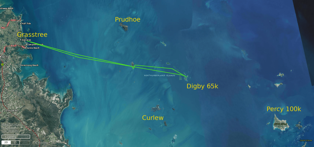
Underway about 0730 from Grasstree ramp at Cabbage Tree Ck ? Now there’s a thought I wonder if it was named after the Pissonia trees over at Bushy ? Cabbage Tree is one of their nicknames. Getting back and out onto the sea it was hazy as and we couldn’t see too many islands. I was mostly depending on using Prudhoe as a guide. Had a good idea of general direction but find yourself second guessing in a new area. I Haven’t mentioned that this was virgin sea for all of us. An island was visible to the south (maybe Cullen?)… our first leg we head out to find Cullen a little to the north… a minor adjustment.

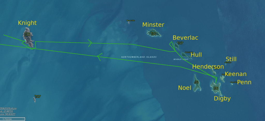
Next leg to Knight Island with visibility still ordinary we make for another island in the general direction and after a while we spot the real deal. Haze or muck starting to clear and islands starting to pop up all over the place, Including Prudhoe breaking out of a cloud of fog/mist. Conditions are a little lumpy without being harsh but enough to hinder speed. We arrive about 0845 at a bay at Knight Island for a stretch and photos.
Next leg takes us across to Minster island and a string of Islands running south. We slipped around the bottom of Knight and decide to give Minster Island a miss and head for Beverlac Island. On approach we spot whales tried for photos but unsuccessful. Sondra was quite excited after a close encounter with a smaller whale’s tail not far from her ski.
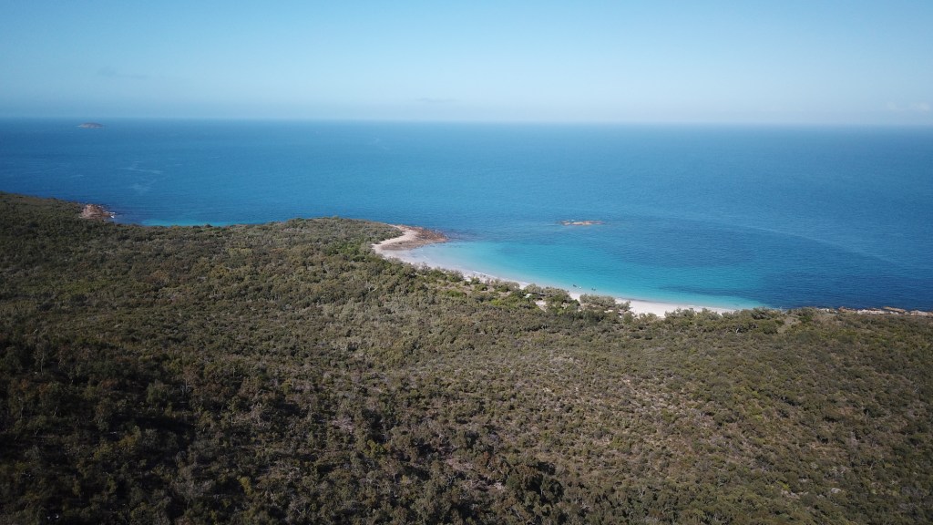
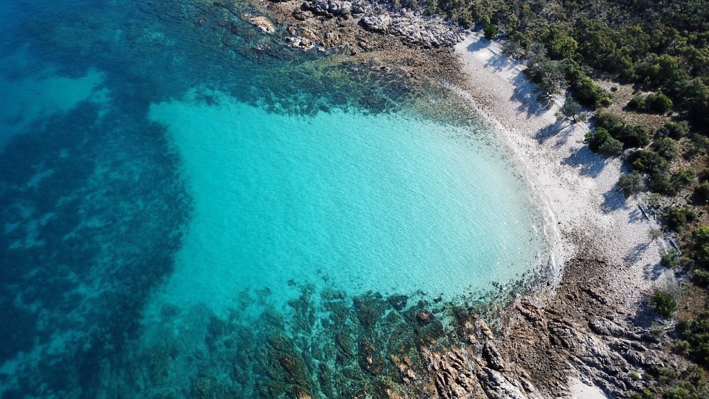
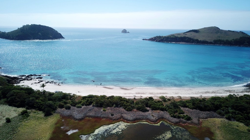
We are now heading for Digby Island coasting down the west side of Hull and Henderson Islands. With a southerly we find a nice big sheltered bay at the northern side. Its like you ride around a point of headland and your eyes and mind just gobble up the scenery. Mornê has supplied the best way to share this experience with his drone shots. They are a birds eye view of what we see but expresses the same. Stunning.
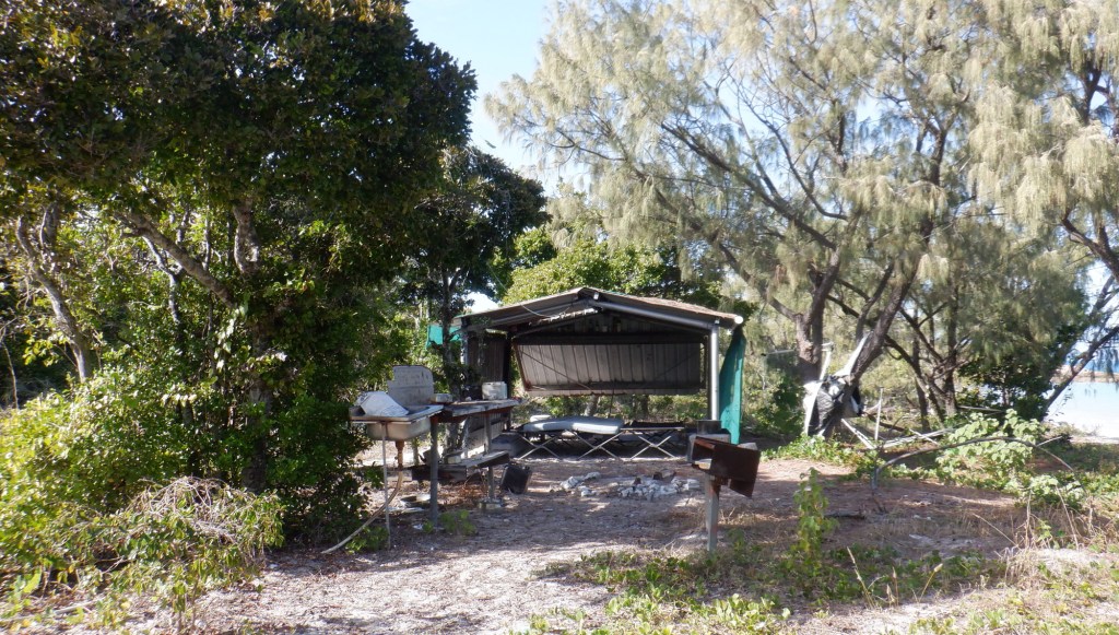
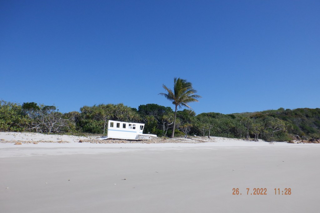
This bay is a pearler…you take in the large beach with a rocky headland to the north that has a portion of a large boat wreck that the sea has planted high and dry up on the rocks. Another portion of wreck parked up on the beach under a Coconut Palm.
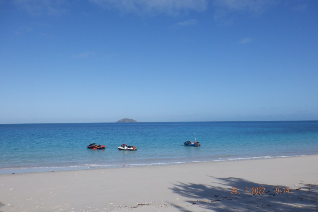
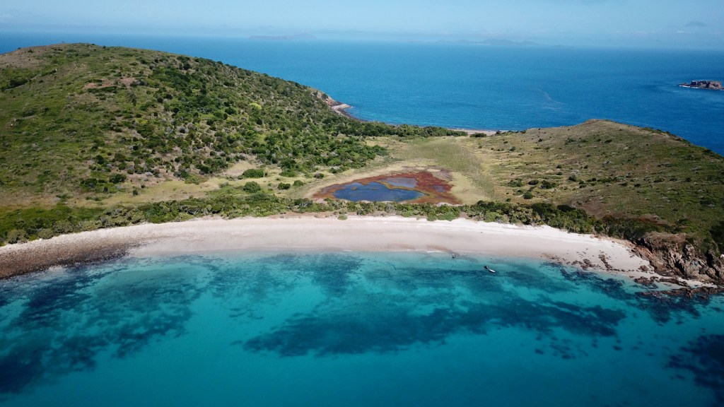
In the next photo I am convinced that Middle Island (Percy) is trying to show itself through that cloud of haze/fog ? Directly over the center of knobby headland ? That is the direction to Percy 37ks away.
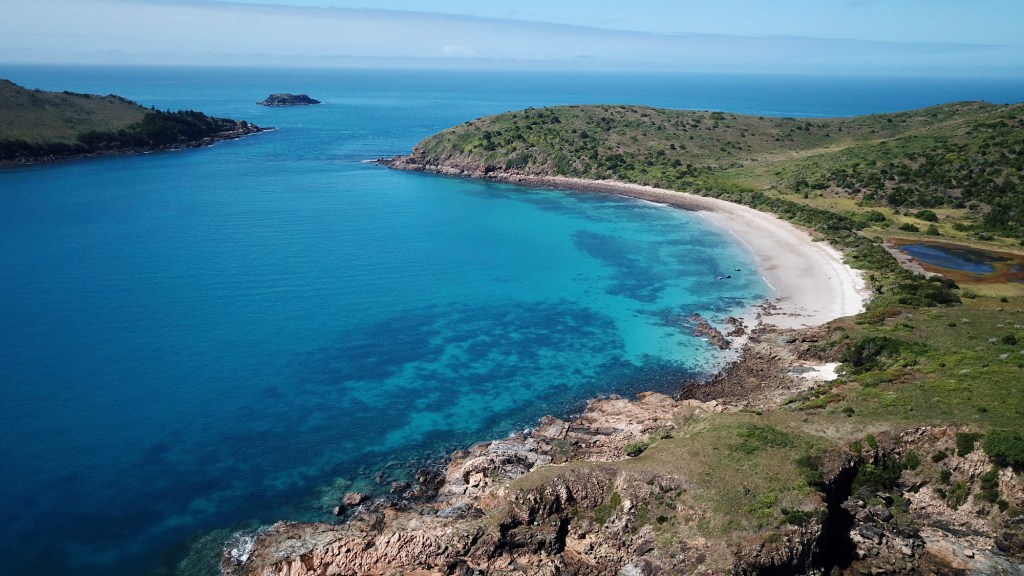
I am thinking this bay would take a hammering in a storm with a northerly, and at high tide it might overrun this section of island. The islands to the north acting like a funnel pouring through that gap and crashing over the beach and vegetation. If you go back over the photos it looks like it could spill out the bay south/opposite. Hence that ship wreck and stagnate water behind dune.
Run back to Grasstree is fairly flat sitting close to 60kph pretty much up to Cullen Island. Closer we got to the mainland the shittier it got. Not big, just short sharp stuff. Arrived back to creek entrance and the water had nearly gone. I bottomed out once and got to ramp and did it again…spitting out rocks and sludge. My bad. I have stayed away from tidal dependent ramps for this very reason, and my first trip out of one and I completely forgot to make allowances for it. Sorry guys it wont happen again. The others got through okay…I will check mine over and test before next run.
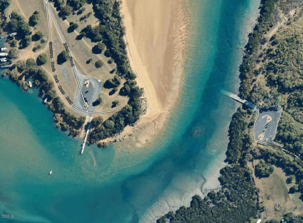
In future I would stay as close to the sand side as possible. The sand moves and this image is not quite the same as it was for us. There it is…another mission accomplished…thanks fellow explorers making this memorable journey with me.

Thanks for reading.

Testing comments