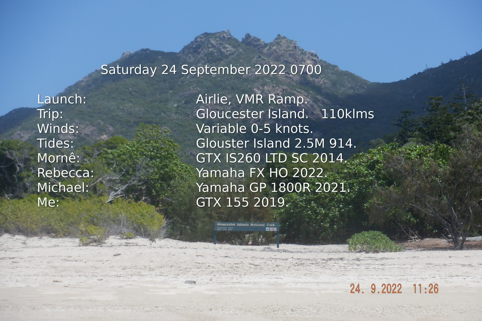
I was Not going but that was only until I woke up at 3am thinking should I go? at 318 decision made. Fueled up and text Mornê at 424 ” Am going to Airlie doing Gloucester maybe Bowen ” They including Rebecca & Michael were unsure of what they were doing. Arriving boat ramp 2 hours later the crew turn up and plan is made.
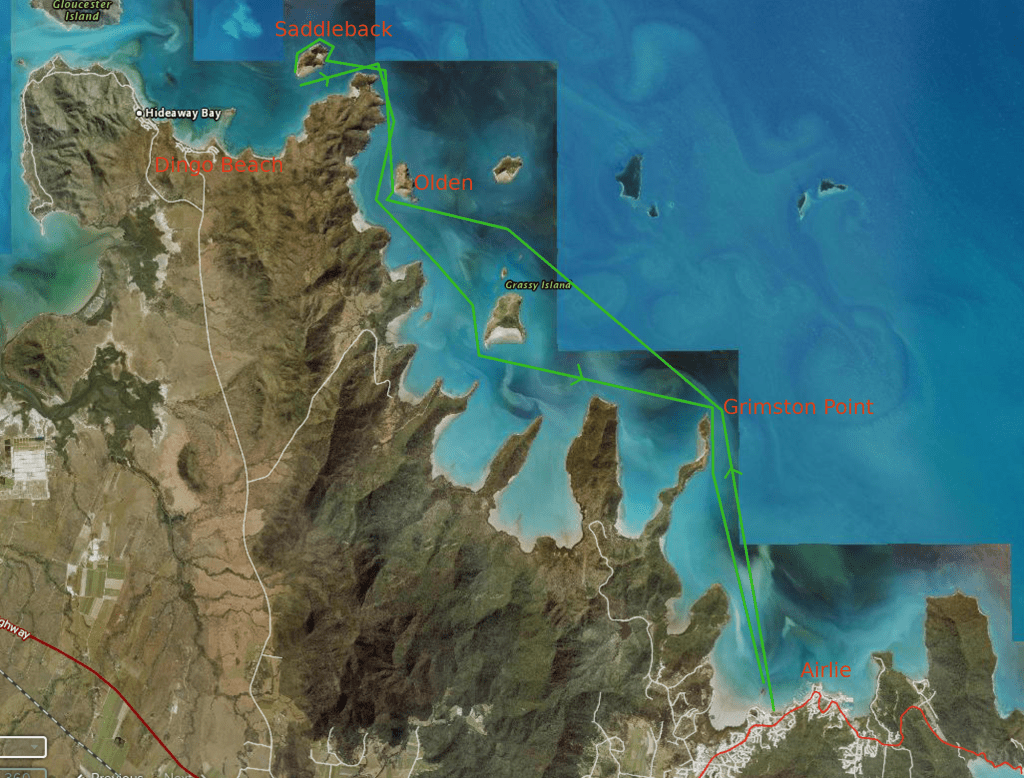
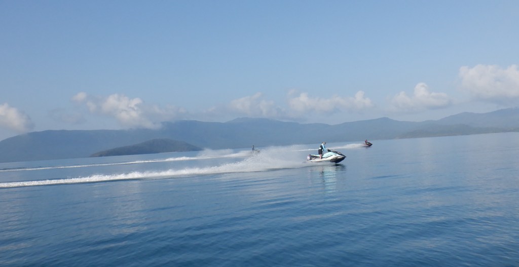
Michael & Rebecca having done Cape Gloucester before. This making them Admiral & Vice to lead the way. Conditions through Pioneer Bay were good and the further we went the better it got, like glass.
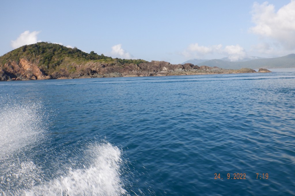
The trek basically takes us up along the coast passing several large bays with long peninsulas like Point Grimston.
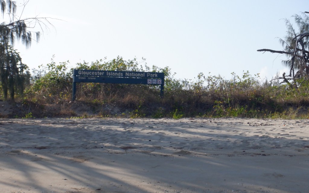
We arrive at our first stop over for drone exercise and a wander around at Olden Island.
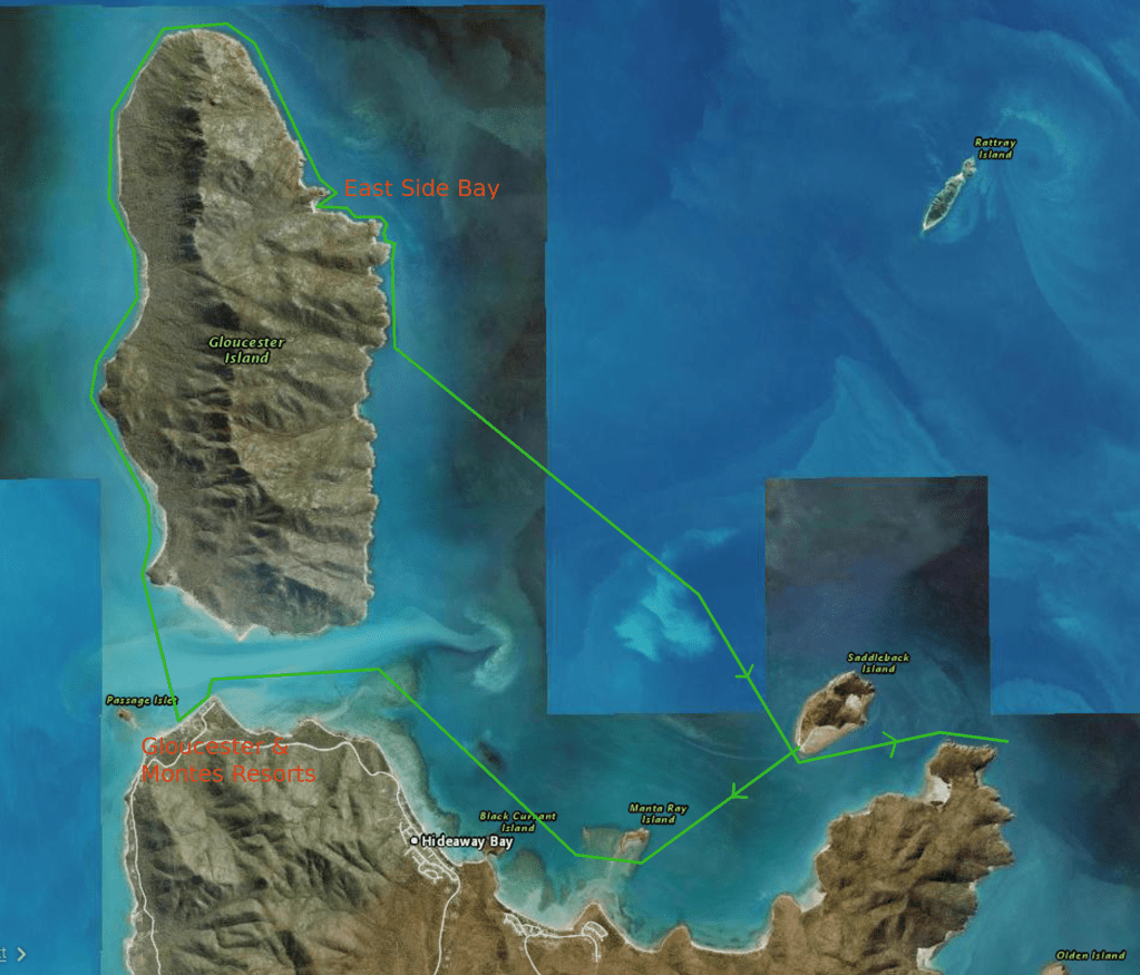
Up anchor heading for Saddleback Island just a short dash north around George Point.

Rounding Saddleback Island confronted with unusual rock formations that is characteristic to all our islands.
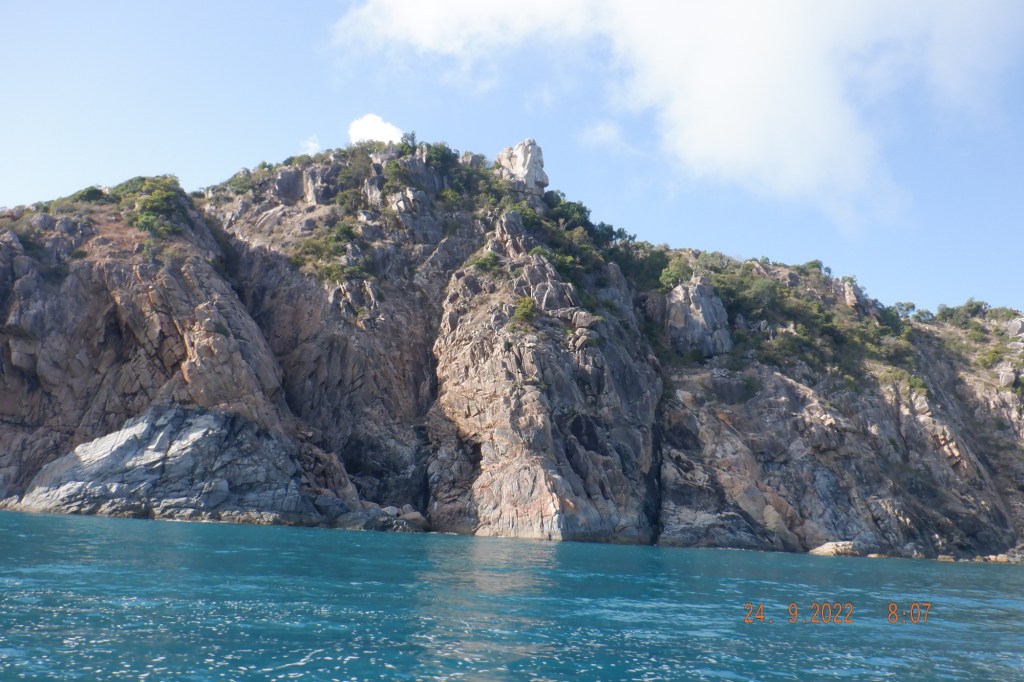
A little further around there is a nice part stony beach.

Anchoring off this beach for a spell and up drones the essential tools to express the vista of our discoveries. Looking at Dingo Beach and Holiday Bay. I believe there is fuel at Dingo Beach but you have to cart it, walk it and very tidal.

We spotted some thing out on the surface about 700M out that turned out be turtles romancing. Mornê & Rebecca soon had their drones over them for some great shots.

Saddleback island behind us we head towards Manta Ray Island and up along Hideaway Bay towards Cape Gloucester and in to Gloucester Passage.

Rounding Cape Gloucester we come across Montes Resort with no sign of coffee available we move on to Gloucester Resort that had some movement and waited a few minutes to open.
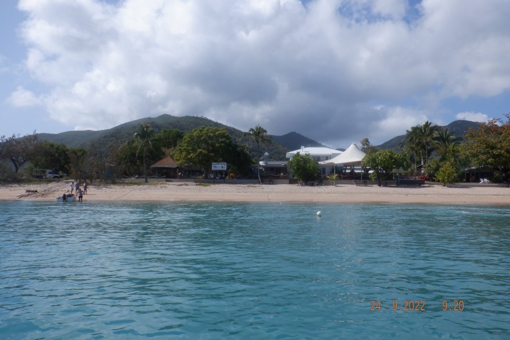

We sat at a table on the beach and enjoyed our coffee.
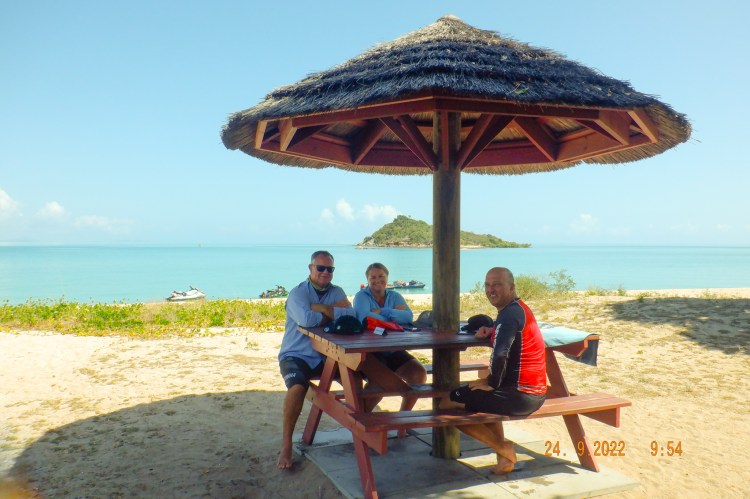
The thought to go back around the top of Gloucester was soon agreed. Preparing to leave I noticed a audience of holidaymakers seemed intrigued with these sea trekkers. They may of been disappointed at our sedate departure.
Traveling up the west side of Gloucester Island I took many photos to have a great droplet of water in the middle of lens. It was very picturesque with some nice beaches and very steep peaks.
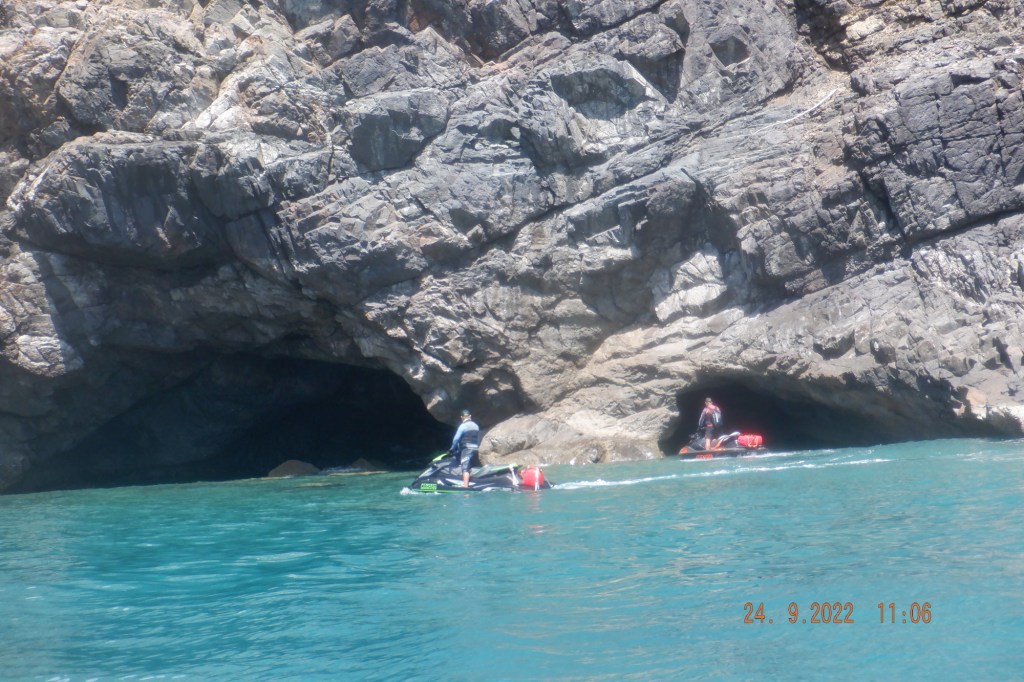
Around past Gloucester Head and heading down the eastern side we encounter a couple of small caves.
A Manta Ray crossed our path at this stage of the trip we also had an earlier encounter. This was my first Manta Ray experience and surprised at their size.

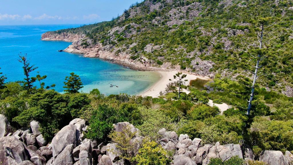
We came across this sandy bay embraced by a couple of decent peninsulas The feature photo was taken from this bay with its steep peaks watching over it. The drones needing another run we pull up for a while.
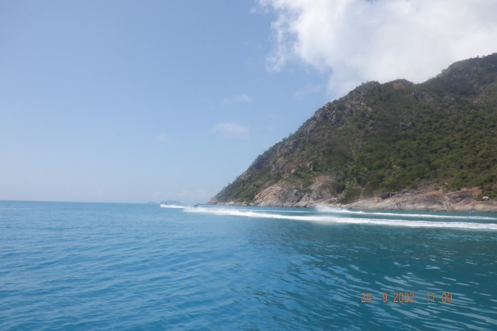
Moving on down the Island a bit further we depart back to Saddleback Island still on a flat surface. Stopping occasionally for turtles or a break we make for Airlie with a chop starting from around Olden Island and building a little and traveling with it. Out of the water by 1330. Mornê’s drone show below.
The following clip is Rebecca’s drone work from 2 of our trips combined with 1 of her and Michael’s day out. Bait Reef and Whitehaven Beach are included with some of Gloucester.
We have been so deprived of decent weather over several months and being able to get out 5 days in the last 2 weeks for a total of 620klms has been good for the soul. As always thank you for reading and to The Whit Crew for sharing the experience and your great Drone work.

Absolutely love the write up George, well done again 🙌🏻🙌🏻
Appreciate Mornê and thanks for your drone work that enhance the blog.
Love it George.
We should have stopped at George point!!
Thank you Rebecca and your drone/video work.
I loved all the pics George